Level 15 storm threatens to hit Central Vietnam
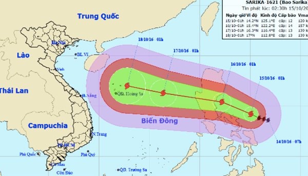
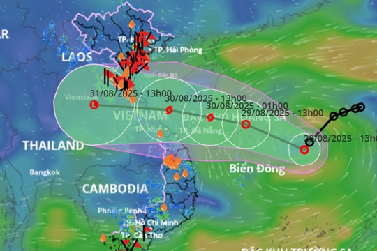
Storm Sakira is continuing to strengthen and may reach level 14-15 when it enters the East Sea of our country, with the risk of making landfall in the Central region.
At 1am this morning (October 15), typhoon Sakira was about 440km east-southeast of Luzon Island, Philippines. The strongest wind near the storm's center was level 12 (120-135km/h), gusting to level 13-14.
Forecast in the next 24 hours, the storm will move in the West Northwest direction, about 10-15km per hour and continue to strengthen.
 |
| Storm Sakira is likely to make landfall in central Vietnam. |
By dawn tomorrow, storm Sakira will be located right over the island area east of Lu Dong island. The strongest winds near the storm center will be level 13-14 (135-165km/h), gusting to level 15-16.
The storm will then move mainly to the West, traveling 20-25km per hour into the East Sea of our country, becoming storm number 7.
At 1:00 a.m. on October 17, the center of the storm was at approximately 16.3 degrees North latitude; 116.4 degrees East longitude, approximately 680 km east of the Paracel Islands. The strongest wind near the center of the storm was at level 13, gusting to level 14-15, and continued to move rapidly westward, with the risk of making landfall in the Central region before October 20.
Due to the storm's influence, from the morning of October 16, the northeastern sea area of the East Sea has gradually increased to level 11-12 winds, near the storm's center, level 13-14 winds, gusting to level 15-16. The sea is very rough.
Central region has record rain of nearly 1m of water
The Central region is suffering from a record-breaking rainstorm. Rainfall measured in the past 30 hours in Ha Tinh and Quang Binh provinces is generally between 250-600mm, some places are even larger such as Dong Hoi up to 820mm, Le Thuy 725mm.
It is forecasted that in the next 6 hours, Quang Binh and Ha Tinh will continue to have very heavy rain with total rainfall of about 50-150mm, some places over 150mm.
Extremely heavy rain has caused the flow to reservoirs in Ha Tinh and Quang Binh provinces to increase rapidly. It is necessary to take precautions against floods affecting the safety of reservoirs in the two provinces.
At the same time, there is a warning of the risk of landslides in mountainous areas; serious flooding continues to occur in Nghe An, Ha Tinh, Quang Binh provinces, focusing on Huong Khe, Huong Son, Vu Quang, Thach Ha, Cam Xuyen, Ky Anh districts, Ha Tinh city (Ha Tinh province); Tuyen Hoa, Minh Hoa, Quang Ninh, Le Thuy, Dong Hoi city (Quang Binh province).
Heavy rains have caused floods on the Ngan Sau and Ngan Pho rivers (Ha Tinh), Gianh and Kien Giang rivers (Quang Binh) to peak, exceeding alert levels 2 and 3.
According to Vietnamnet


