Storm No. 1 with level 11 gusts is moving northwest.
Storm No. 1 in the East Sea with wind speed of level 9, gusting to level 11, is moving northwest. The storm is forecast to weaken in the next 72 hours.
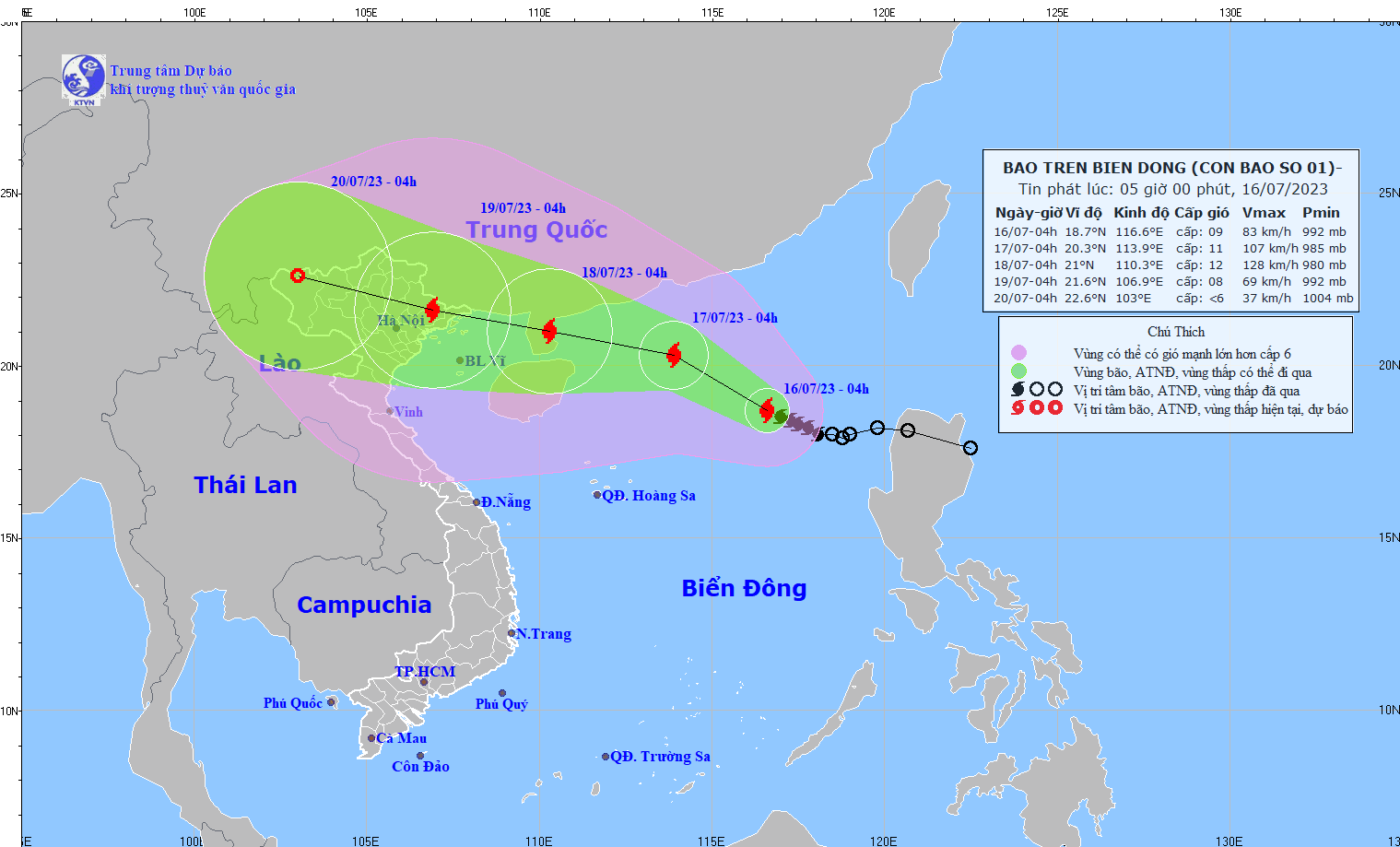
4:00 a.m. July 16, center positionstormat about 18.7 degrees North latitude; 116.6 degrees East longitude, about 710km East Southeast of Leizhou Peninsula (China). The strongest wind near the storm center is level 9 (75-88km/h), gusting to level 11.
2. Storm forecast (in the next 24 to 72 hours):
| Forecast time | Direction, speed | Location | Intensity | Danger zone | Disaster Risk Level (Affected Area) |
| 04h/17/7 | Northwest, 10-15 km/h. Storm likely to strengthen | 20.3N-113.9E; in the northern sea area of the North East Sea, about 380km East Southeast of Leizhou Peninsula (China) | level 10-11, jerk level 14 | 17.0-22.0N; East of longitude 112.0E | Level 3:North of the North East Sea area |
| 04h/18/7 | West Northwest, about 15 km/h | 21.0N-110.3E; in the sea east of Leizhou Peninsula (China) | level 12, jerk level 15 | North of latitude 18.0N; 108.5-117.5E | Level 3:North of the North East Sea area |
| 04h/19/7 | West Northwest at about 15 km/h and weakening | 21.6N-106.9E; in the Northeast region | level 8-9, jerk level 12 | North latitude 18.0N; West longitude 113.0E | Level 3:Northwest of the North East Sea and North Gulf of Tonkin |
3. Storm warning(from 72 to 120 hours)
From the next 72 to 96 hours, the storm will move mainly in the West Northwest direction, traveling 15km per hour and continue to weaken.
4. Forecast of storm impact in the next 24 hours
| Strong wind | |
| On the sea: The northern sea area of the North East Sea has strong winds of level 7, near the storm center they have strong winds of level 9, then increase to level 10-11, gusting to level 14. The sea is very rough. | |
| Rising water, big waves | |
| The sea area north of the North East Sea has waves 5.0-7.0m high. |


