Storm No. 8 will weaken into a low pressure area and enter the sea areas of Ha Tinh and Quang Binh.
(Baonghean.vn) - From tonight and tonight (October 24), in the Gulf of Tonkin, the wind will gradually increase to level 6-7, near the storm's eye, level 8, gusting to level 10.
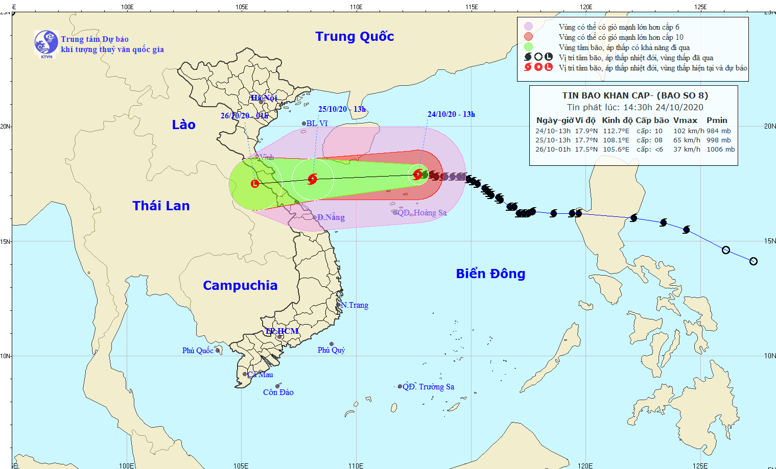
At 1:00 p.m. on October 24, the center of the storm was at about 17.9 degrees North latitude; 112.7 degrees East longitude, about 110 km north of Hoang Sa archipelago.
The strongest wind near the storm center is level 10 (90-100 km/h).level 12. Radius of strong winds from level 6, gusting from level 8 or higher is about 180 km from the center of the storm; radius of strong winds from level 10, gusting from level 12 or higher is about 60 km from the center of the storm.
Forecast in the next 24 hours, the storm moves west, traveling 15-20 km per hour.
At 1 p.m. on October 25, the storm center was located at approximately 17.7 degrees North latitude; 108.1 degrees East longitude, approximately 180 km east of the mainland from Ha Tinh to Quang Tri provinces. The strongest wind near the storm center was level 8 (60-75 km/h).level 10.
 |
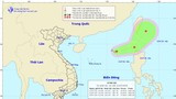
| Path of storm No. 8. Photo: National Center for Hydro-Meteorological Forecasting |
Dangerous areas due to storms in the East Sea in the next 24 hours (strong winds level 6 or higher,jerk from level 8and above): from latitude 15.5 to 20.0 degrees North; west of longitude 114.5 degrees East. All vessels operating in the danger zone are at high risk of being affected by strong gusts of wind.
Due to the influence of the storm, the western sea area of the North East Sea (including the sea area of Hoang Sa archipelago) has stormy rain, strong winds of level 9-10, gusts of level 12; waves from 5-6m high; very rough seas.
In the next 24 to 36 hours, the storm will move westward at a speed of 15-20 km per hour, making landfall in the provinces from Ha Tinh to Quang Tri, weakening into a tropical depression, then a low pressure area. At 01:00 on October 26, the center of the low pressure area was at about 17.5 degrees North latitude; 105.6 degrees East longitude, over central Laos. The strongest wind in the center of the low pressure area decreased to below level 6 (below 40 km/h).
 |
| Checking the work of preventing and fighting storm No. 7. Photo: Document |
Forecast of strong winds at sea: From tonight and tonight (October 24), in the Gulf of Tonkin, the wind will gradually increase to level 6-7, near the storm's eye it will increase to level 8, gusting to level 10; waves 2-4m high; rough seas. In the sea from Quang Tri to Thua Thien Hue, there will be strong winds of level 6-7, gusting to level 9; rough seas.
Rain forecast: From tonight (October 24) to the morning of October 26, in the provinces from Nghe An to Thua Thien Hue, there will be moderate to heavy rain with total rainfall of 50-150mm/period.
Disaster risk warning level: level 3.
Next news broadcast at 17:00 on October 24.

Nghe An: Floods in 5 days killed 2 people, damaged 74 houses, and submerged more than 1,000 hectares of crops
(Baonghean.vn) - The prolonged rain and floods from October 15 to 20 in Nghe An have caused serious consequences. Currently, the authorities and people at all levels are focusing on overcoming damage to houses, properties, constructions, and restoring crops and livestock to stabilize life.
New information: Tropical depression in the East Sea, Nghe An floods above alert level 2
(Baonghean.vn) - At 1:00 a.m. on July 21, the center of the tropical depression was about 560km east-northeast of Hoang Sa archipelago.
