Warning: Central region continues to have heavy rain, high risk of flash floods and landslides
(Baonghean.vn) - Early this morning, heavy to very heavy rain occurred in Quang Tri and Thua Thien Hue. Warning: In the next 6-12 hours, heavy to very heavy rain will continue in Quang Tri and Thua Thien Hue, with a very high risk of flash floods, landslides in mountainous areas and flooding in low-lying areas.
Last night and early this morning (November 20),In Quang Tri and Thua Thien Hue, there was heavy to very heavy rain such as Cam Chinh station (Quang Tri) 75mm, Ta Long (Quang Tri) 46mm, Cau Truoi (Thua Thien Hue) 105mm, Khe Ngang reservoir 73mm, Ta Luong 77mm.
Warning:In the next 6-12 hours, in Quang Tri and Thua Thien Hue, there will continue to be heavy to very heavy rain.
There is a very high risk of flash floods and landslides in mountainous areas and flooding in low-lying areas in Quang Tri and Thua Thien Hue. In particular: There is a high risk of flash floods and landslides in the following districts: Quang Tri: Huong Hoa, Dakrong; Thua Thien Hue: Phong Dien, Phu Loc, Huong Thuy, Nam Dong, A Luoi
High risk of localized flooding in the following districts: Quang Tri: Trieu Phong, Hai Lang, Dong Ha City; Thua Thien Hue: Huong Tra, Phu Vang, Hue City. Disaster risk level: Level 1.
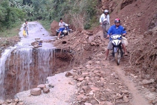 |
| Illustration photo. |
1. Flood developments
Currently, floods on Ky Lo River (Phu Yen), Ve River (Quang Ngai) have peaked and are receding; Tra Khuc River (Quang Ngai), Kon River (Binh Dinh), Bo River, Huong River (Thua Thien Hue) are fluctuating at peak levels; Vu Gia - Thu Bon River (Quang Nam), Dak Bla River (Kon Tum) are rising. Water levels at 4:00 a.m. on November 20 on the rivers are as follows:
- Bo River at Phu Oc 4.05m, below BĐ3 0.45m;
- Huong River at Kim Long 2.34m, on BĐ2 0.34m;
- Vu Gia River at Ai Nghia 7.76m, 0.24m below BĐ2;
- Tra Khuc River at Tra Khuc station 5.34m, on BĐ2 0.34m;
- Ve River at Ve River station 3.58m, at level 2;
- Kon River at Thanh Hoa station 7.08m, at level BĐ2;
- Ky Lo River at Ha Bang 9.13m, 0.37m below BĐ3.
2. Flood forecast
In the next 3-6 hours, flood on Vu Gia river at Ai Nghia will peak at 8.0m, at level 2; Tra Khuc river at Tra Khuc station will peak at 5.5m, 0.5m above level 2; Kon river at Thanh Hoa will peak at 7.2m, 0.2m above level 2, then decrease; Thu Bon river will continue to rise.
In the next 6-12 months, the flood on Thu Bon River at Cau Lau will peak at 2.3m, 0.3m above BĐ1, then decrease; Bo River and Huong River will fluctuate according to the regulation of the hydroelectric reservoir; other rivers will gradually decrease. Water levels on the rivers are as follows:
- Bo River at Phu Oc is at 3.5m, 0.5m above BĐ2;
- Huong River at Kim Long is at 1.6m, 0.4m below level 2;
- Vu Gia River at Ai Nghia down to 7.7m, 0.3m below BĐ2;
- Kon River at Thanh Hoa down to 6.7m, 0.3m below level 2;
- Ky Lo River at Ha Bang down to 7.5m, level BĐ1;
- Rivers in Quang Tri, Quang Ngai, Kon Tum fluctuate at level 1.
There is a high risk of flash floods and landslides in mountainous areas and localized flooding in low-lying areas in provinces from Quang Tri to northern Phu Yen and the northern Central Highlands.
Currently, in the Central and Central Highlands regions, there are many vulnerable reservoirs, many of which are full of water, and the flow to the reservoirs continues to be supplemented, posing a high risk of insecurity for reservoirs in this region. Disaster risk level: Level 2
Pear Flower
(Synthetic)
| RELATED NEWS |
|---|