The Ho Chi Minh Trail was a strategic military transportation network that transported troops, food, and weapons from the North to support the battlefields in the South. The Americans noted that this was "one of the great achievements of military engineering in the 20th century".
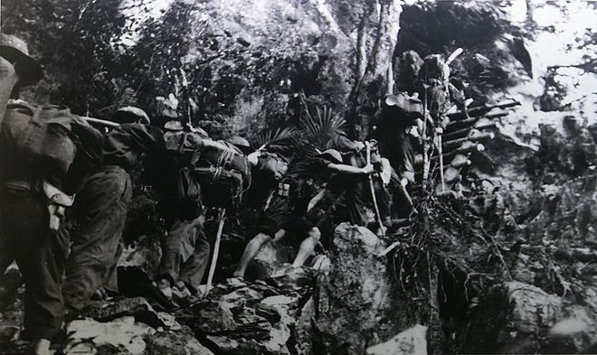 |
| On May 19, 1959, the Truong Son Corps (Group 559) was established, marking the beginning of the Truong Son route. This military transportation network ran along the Truong Son range, from the North through the Central region, lower Laos and Cambodia to support the Southern Liberation Army and the Vietnam People's Army. In the early years, the transportation of supplies was carried out on foot and by backpack. In the photo are soldiers of the 70th Regiment - the first unit of the Truong Son troops - carrying goods on the Western Truong Son route in September 1961. |
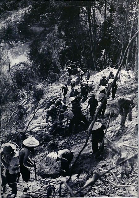 |
| Although kept secret, the primitive transportation method was ineffective due to the long distance of 2,000 km. After 2 years, the transportation began to be mechanized. In the photo, the 128th company of Thai Binh province workers cut the forest and opened a mechanized road. |
 |
| A network of motorized roads was gradually formed hidden among the Truong Son mountains and forests, creating conditions for military convoys to transport large quantities of troops, food and weapons from the North to the South. From here, the US military tried to destroy this transportation system with infantry and air force, the Truong Son road became a fire line - where fierce battles of courage and intelligence took place between the two sides. |
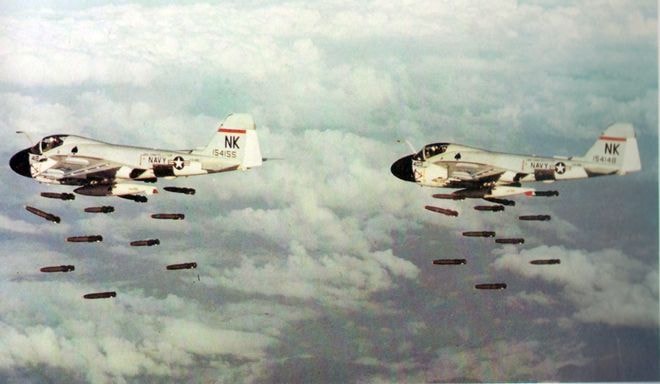 |
| To destroy this route, the US military set up an electronic system, commonly known as the McNamara electronic fence, to guide bombers. In addition, Agent Orange and some other herbicides were sprayed on many forest areas along the Truong Son road to defoliate trees, rain-making projects and sludge-forming chemicals were also used by the US to destroy the route. |
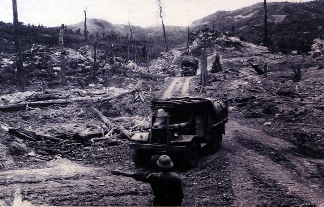 |
| Despite bombs and toxic chemicals, convoys continued to move south. In the photo, soldiers of the 25th Engineer Battalion, Station 31, Command 559, are leading military vehicles at the northern intersection of Sieng Phan to Sompeng. |
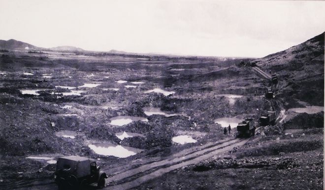 |
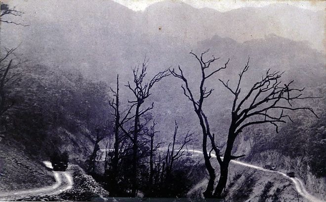
| For 16 years, the Truong Son battlefield suffered more than 4 million tons of bombs and mines dropped by the US Air Force. Along the entire route, there were up to 2,500 key targets. In the photo is the key point of Dong Loc intersection (Ha Tinh), the convoy moved through an area dense with bomb craters. |
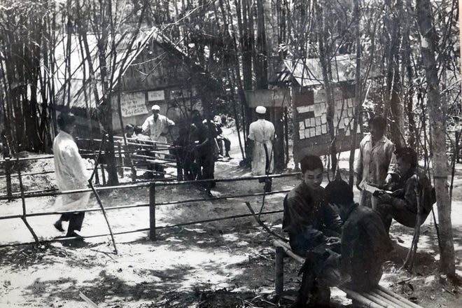 |
| Ensuring the smooth operation of the Truong Son road system were engineering, logistics, medical, infantry and air defense units, operating in the jungle right under the American bombs. Pictured is a medical station where military doctors are treating soldiers. |
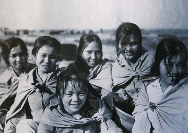 |
| The 20-year-old female youth volunteers on the Truong Son battlefield. The role of the youth volunteer force during this time was more evident than ever. |
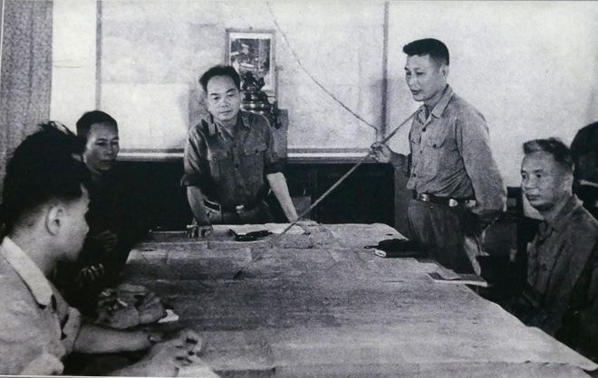 |
| General Vo Nguyen Giap (center) and Lieutenant General Dong Sy Nguyen (right) in the Route 9 Southern Laos campaign in 1971 - the campaign that brought complete ground control to the Vietnam People's Army on the Truong Son battlefield. With the development of an active defense strategy, Truong Son troops increasingly dominated the battlefield. With a total length of tens of thousands of kilometers spread over 5 vertical axes and 21 horizontal axes... transport convoys could easily cross the Truong Son range from North to South. |
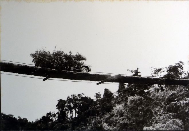 |
| The suspension bridge over the Tale River - Route 20, was built by the 33rd Engineer Battalion. When the US Air Force bombed the bridge, it was hidden on the river bank, and rebuilt when the war calmed down. The bridge existed for 6 years, helping thousands of vehicles safely cross the river to the front. |
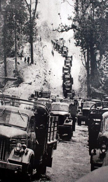 |
The mighty transport convoy of the Vietnam People's Army during the 1975 Ho Chi Minh campaign on the Truong Son road, the final campaign to unify the North and South.
On June 3, 1976, the Party and State's commendation of the Truong Son Troops' achievements stated: "From the beginning of its establishment, only carrying baskets and packs were used as the main means of transportation on small, narrow roads; from only operating seasonally, serving each campaign, the Truong Son Troops have brought sweat, blood, courage, intelligence and strategic talent to build a strategic route named after the great Uncle Ho."
According to the official history of the US National Security Agency, the Truong Son trail is considered "one of the great achievements of military engineering in the 20th century". |
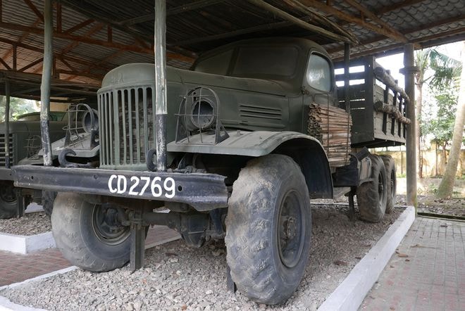 |
| Nowadays, the western Truong Son route (Laos territory) has been abandoned in many places, some places have been built to become historical relics. In 2000, the Ho Chi Minh trail, the second cross-Vietnam route after Highway 1, began construction on the eastern Truong Son route. The ZIL157 truck of the Truong Son troops transporting goods and soldiers in the past, along with thousands of documents and artifacts about the legendary route, are stored in the Ho Chi Minh Trail Museum at Km15 - Highway 6, Yen Nghia Ward, Ha Dong District, Hanoi. |
According to VnExpress
Photo: Ho Chi Minh Trail Museum


