Affirming role and operational capacity
(Baonghean) - 20 years of construction and development, the Center for Natural Resources and Environment Engineering has always affirmed its role, position and brand in the field of surveying, mapping - cadastral records, land use planning, administrative boundaries..., contributing to the overall development of the province.
Established under Decision No. 996/QD-UB, dated May 12, 1995 of the Provincial People's Committee, the Land Surveying and Planning Team is a public service unit under the Department of Land Administration (now the Department of Natural Resources and Environment). Many cadres, engineers, and employees still have vivid memories of the difficult period when the unit was first established. The process of surveying and mapping at that time had no standard procedures, regulations, semi-manual techniques, and methods of doing and gaining experience while doing. The surveying was directly measured on a wooden Mia using a photocopier, or pulling a steel ruler, or a cloth tape measure. The mapping tools at that time were also very rudimentary, using only an iron pen, a curved pen, a single rotation, a protractor, a set, a scale zoom ruler, etc.
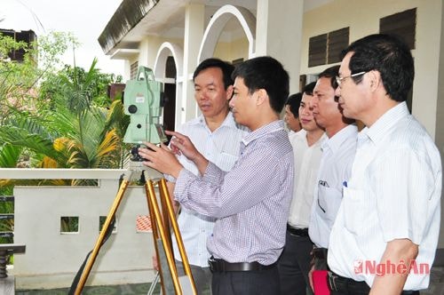 |
| Check the electronic total station. |
Overcoming difficulties, in the first 3 years, the delegation measured and made cadastral maps in 9 communes of 2 districts Dien Chau and Quynh Luu; agricultural land of 3 districts Ky Son, Tuong Duong, Que Phong; set up markers to serve land allocation for more than 20 areas with over 250 plots of land in Vinh City and towns of Thanh Chuong, Hung Nguyen, Cau Giat districts. The delegation also participated in making adjustments to the planning and land use plan (KHSD) of the province, period 1995 - 2000; and 19 communes of Nghia Dan, Quy Hop districts... Despite rudimentary equipment and lack of human resources, the products of cadastral mapping and land use planning are all of guaranteed quality.
Along with the development of science and technology and the requirements of the tasks, in the years 1998 - 2002, the delegation was supplemented with staff, strengthened in terms of organization and apparatus; equipped with more high-tech machinery and equipment; applied GPS technology and digital technology. The delegation's technical expertise has made new progress; especially in 2001, marking a turning point in technical technology when the delegation researched, tested and successfully implemented digital cadastral maps in Nghi Phu commune (Vinh city); followed by Nghia Dong commune (Tan Ky), Kim Son town (Que Phong); Quy Chau town....
During this period, the delegation was assigned a new task, which was to carry out land inventory of organizations according to Directive 245/TTg, dated April 22, 1996 of the Prime Minister; prepare dossiers for granting urban land use right certificates according to Decree 60/CP of the Government. The results of the implementation of a fairly large amount of work. Specifically, preparing dossiers for granting urban land use right certificates in 8 wards of Vinh City; 2,080 certificates for households and individuals using residential land and agricultural land in 2 communes of Hung Thinh and Hung Tien (Hung Nguyen); establishing land use planning until 2010 for 11 districts of Tan Ky, Do Luong, Nghi Loc, Quynh Luu, Anh Son, Con Cuong, Thanh Chuong, Quy Chau, Que Phong, Tuong Duong and Ky Son; establishing land use planning for 135 communes in the districts of Hung Nguyen, Nam Dan, Tan Ky, Do Luong, Nghi Loc, Quynh Luu. The delegation also conducted the land use planning of Nghe An province, period 2001 - 2010 and was approved by the Prime Minister.
In 2003, the Department of Land Administration developed into the Department of Natural Resources and Environment. Accordingly, the Land Surveying and Planning Group was also renamed the Center for Natural Resources and Environment Engineering and its functions and tasks were supplemented according to Decision No. 4816/QD.UB-TC, dated December 10, 2003 of the Provincial People's Committee. This was a time that marked a turning point when the center became a self-funded, financially autonomous public service unit, which truly "unleashed" and changed all activities of the center; instead of working according to policies, assigning and receiving work from superiors, the unit was proactive and autonomous in the process of implementing political tasks.
Currently, the center owns a fairly spacious headquarters with 32 staff, including many officers who are formally trained, specialized, and experienced in their work. Regarding machinery and equipment, it includes HP designeiet 5500 A0 laser printer; 5 TC 450 electronic total stations; 5 Hurace X20 single-frequency GPS coordinate measuring machines; using Villis and TMV software to create cadastral records to issue land use right certificates.
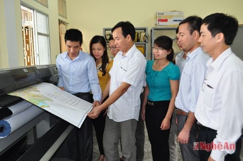 |
| Print maps using modern printing equipment at the Center. |
The center's current activities focus on the fields of surveying, mapping, cadastral records and building cadastral databases, granting land use right certificates, land use planning; land statistics, mapping the current land use status in the province; resolving land disputes, and establishing administrative boundary records. In the past 5 years, the center has carried out and completed a large amount of work. In surveying and mapping, the center has completed surveying and mapping 14 communes in the province; carried out measurements to serve land clearance and site clearance for a number of key projects such as Hua Na Hydropower Plant, Ban Mong Reservoir and many other projects and works...
In particular, the work of registering statistics, establishing land records, and granting land use right certificates for residential land, agricultural land, and forestry land has been carried out in large numbers with nearly 30,000 land use right certificates for organizations, individuals, and localities in the province. The products of establishing land records and granting land use right certificates in the areas implemented by the center are all evaluated by the Department of Natural Resources and Environment as the best among construction units in the province. Establishing land use planning until 2020 and the first 5-year land use planning for the period 2011 - 2015 of Nghi Loc, Quynh Luu, Hoang Mai town; planning new rural areas for 20 communes in 4 districts of Nghi Loc, Quynh Luu, Nghia Dan and Ky Son. The work of demarcating, planting landmarks, and establishing administrative boundary records according to the Government's decrees and resolutions, as well as resolving administrative boundary disputes, has been carried out with quality and has been highly appreciated by the Ministry of Home Affairs - the Government's standing agency on administrative boundary work. The products meet national technical standards.
Up to now, the center has developed quite comprehensively in terms of facilities, staff quality, organizational structure, technical expertise, and improved competitiveness in surveying, documenting, cadastral mapping, granting land use right certificates, and land planning. The lives of cadres, civil servants, and laborers have been constantly improved. The Party cell has continuously achieved clean and strong status, and in 2014 was recognized as exemplary clean and strong.
Every year, the center is ranked by the Department of Natural Resources and Environment as having excellently completed its tasks, and has received many Certificates of Merit from the Provincial People's Committee. The Center's Trade Union and Youth Union are ranked excellent every year, and have received many certificates of merit from all levels. These results create great motivation and spirit, encouraging the staff, civil servants, and employees to continue to make greater efforts and strive to meet the requirements of the new period, contributing to the state management of the land sector, serving the overall development of the province.
Minh Chi


