Malaysia receives radar data to help search for MH370
However, Malaysia said it was not allowed to independently publish information provided by other countries.
Malaysia's acting Transport Minister Hishammuddin Hussein said on March 19 that the country's investigation team had just received some radar data related to the Boeing 777-200 aircraft with flight number MH370 that went missing with 239 passengers and crew on March 8. However, Malaysia is not allowed to independently release information provided by other countries.
 |
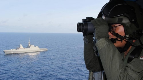
| The search for the missing Malaysian plane continues (Photo: themalaysiainside) |
The search for the missing plane continues in two directions, the first is an arc going north from Laos to the Caspian Sea; the second is considered more likely is an arc going south through the southern Indian Ocean from the west of Indonesia's Sumatra island to the west of Australia.
“We are prioritizing the southern Indian Ocean. I have spoken with Admiral Samuel Locklear, Commander of the US Pacific Command, to identify equipment that can help us locate the black box of the plane. Focusing on this direction, I have also spoken with French experts who have experience in finding the plane that went missing two years ago in the Atlantic Ocean to find out what equipment they used,” said Malaysian Acting Transport Minister Hussein.
Mr. Hussein also called on all partners to continue to support and provide any information that could help the investigation and search for the missing plane.
Meanwhile, the police of this country searched the homes of the pilot and co-pilot of flight MH370 and found a flight simulator belonging to 53-year-old pilot Zaharie Ahmad Shah. The data of this simulator was deleted on February 3, more than a month before flight MH370 went missing. Malaysian and international experts are restoring data from this simulator to serve the investigation.
By piecing together data from military radar and communications satellites, investigators believe the plane suddenly veered westward while en route from Kuala Lumpur to Beijing. A weak signal from a commercial satellite suggests it continued flying for at least six hours before losing contact.
The systematic shutdown of communications and signs that the plane was following a pre-planned route after the diversion are two factors that point to the possibility of a hijacking attempt rather than a mechanical failure. However, US government sources said intelligence agencies have analyzed the profiles of those on board the flight and have not found any links to criminal activity.
The search area for the missing plane has been expanded to cover an area of 7.7 million square kilometers, equivalent to the area of the United States. Although it has been narrowed down after analyzing satellite and weather data, the search area is still up to 600,000 square kilometers./.
According to VOV


