Vinh should be named a coastal city.
(Baonghean) - On July 30, 2013, the Politburo issued Resolution 26/TW on the development of Nghe An, which reiterated: "Building Vinh City into the North Central region's center of finance, trade, science - technology, information technology, high-tech industry, health, culture, sports, education - training; together with Cua Lo Town, developing into an economic growth pole and spearhead of the province's growth" (Decision 239 of the Government has stipulated).
Currently, the province has been organizing research and adjusting the general planning of Vinh City until 2030, with a vision to 2050. The planning project is being implemented by Niken Sekkei, a Japanese consulting company.
Up to now, through a research process, consultants have proposed a general goal and 6 specific goals. Of which, 6 specific goals are important development orientations of Vinh, including the fifth goal: Urban symbiosis with the environment based on the advantages of forests and water. This goal is specifically explained as follows: "Considering the harsh natural conditions of the region and the heat island phenomenon due to urbanization to form a cool island for the city with forests - trees - lakes. Creating a water - forest network to create a fresh, cool and relaxing feeling towards an urban symbiosis with the environment".
It can be seen that the consultants have respected the current infrastructure status and existing urban functional zones of Vinh City, Cua Lo Town, as well as the related areas of Hung Nguyen and Nghi Loc districts. The new planning project is also based on the existing planning, and at the same time follows the development ideas of Vinh and Cua Lo that have been expressed in other planning documents. Therefore, when approaching this planning project, people feel familiar and easy to accept, because it is still possible to develop without having to destroy or disrupt many existing values.
However, that is also the weakness that makes this project lack creativity, breakthrough, and a clear, decisive "idea" for the "poem" of Vinh city in the near future.
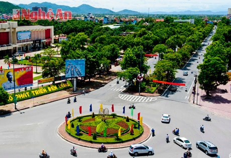 |
| Five-way intersection - Vinh City. Photo: Sy Minh |
In the current urban research from the perspective of the Urban Strategy (CDS), the United Nations recommends that each city needs to find its own definition, which must be briefly described in a clause. Through that clause, people know the identity of that city, or know the goal that the city is aiming for. Unfortunately, most of the cities in Vietnam today have not found their own definition. The same is true for Vinh City, even this planning project has not been able to identify Vinh in a very specific and concise way.
In the fifth goal, the consultants mentioned the forest and water factors, as an advantageous and differentiating factor of Vinh in the future. However, unfortunately, while talking a lot about the lakes that have existed or have not existed, the consultants have not exploited the rivers that have, are and will create the appearance of Vinh, such as Lam River, Vinh River, Cam River, etc. In particular, in just 7 years, Vinh City will include Cua Lo Town, but people almost forget about the East Sea! In my opinion, it is necessary to affirm with great certainty that Vinh is a coastal city! Currently, we can say that, if we temporarily forget about the administrative boundary (a boundary that does not have much meaning in modern urban space).
Currently, the distance from the farthest point of Vinh to Cua Lo is less than 20 kilometers, with convenient and fast transportation, it is not wrong to say that Vinh has a sea. Moreover, in just 7 years, all administrative boundaries will no longer exist, Vinh will be a coastal city, of course. But, more importantly, determining Vinh as a coastal city is extremely important for current planners. Accordingly, the whole Vinh City will take the sea as its facade, develop towards the sea. Accordingly, from not thinking about the sea, people now have to take the sea as the center, as the destination to aim for, take the sea as inspiration, as poetry for creative architectural styles, landscape, construction...
In particular, when Vinh is identified as a coastal city, there will be a clear orientation in defining the functions of urban subdivisions. Accordingly, it can be seen that Vinh in the future will have three major functional subdivisions: Vinh City area is currently the administrative - political, financial, cultural, commercial center; Cua Lo is the center of tourism, services, entertainment activities; Quan Hanh, associated with the Southeast Economic Zone, is the industrial center. Accordingly, cultural, physical training, sports, entertainment centers... will mainly be planned in Cua Lo Town. The future university city should also be planned on the Vinh - Cua Lo road axis (currently Highway 46) towards Cua Lo. This is also the best way to overcome the current "one-season" situation of Cua Lo beach tourism.
Also on the basis of identifying Vinh as a coastal city, it is necessary and advisable to reconsider the urban structure selection. The current urban development trend in the world is following the Nuclear - Satellite model. However, this trend is mainly to reduce the load on megacities, while creating environmentally friendly urban areas, preserving natural landscapes. With Vinh City, the planning area is about 250 km2, the distance between the two farthest poles is only about 20 km, the estimated maximum population is 900 thousand people, should we raise the issue of multipolar - nuclear? Will that selection option fragment the city's planning? In fact, like many other urban areas, in the development process, Vinh has also formed and will form "centers" and "highlights" due to uneven development. However, they should only be considered as transitional steps, creating the rhythm of urban development over time, not as "poles", shaped from the beginning in the planning.
In my opinion, towards becoming a coastal city, Vinh needs to be planned according to the model of two poles, one axis. The two poles are Vinh (currently) and Cua Lo (currently), with the functions as mentioned above. These two poles are connected by the Vinh - Cua Lo axis. On the current basis, it is possible to deploy the Vinh - Cua Lo axis along five main routes, including: Lam River Road, Vinh - Cua Hoi Road, Vinh - Cua Lo Road, Road 46, Nam Cam - Cua Lo Road. In which, the new Vinh - Cua Lo route, with a cross-section of 160 meters, is the route that plays a symbolic role for the new Vinh City, facing the sea.
In fact, the development orientation of Vinh City, including Cua Lo, has been affirmed since Decision 239 of the Government, approving the Development Project of Vinh City, in 2005. However, in the implementation of planning, as well as the implementation of many specific projects in Cua Lo and Vinh, there has been no consistency in this orientation, especially not thinking about turning Vinh into a coastal city. That is also one of the reasons that negatively affects the speed and direction of development of Vinh, Cua Lo and surrounding areas.
I think it is ripe for Vinh to be named a coastal city. With that new orientation and designation, the consultants will certainly have a clearer and more decisive goal, ideology, thinking, and “poetry” for the urban poem Vinh in the near future.
Pham Xuan Can


