Nghe An proactively responds to tropical depression that is likely to strengthen into a storm
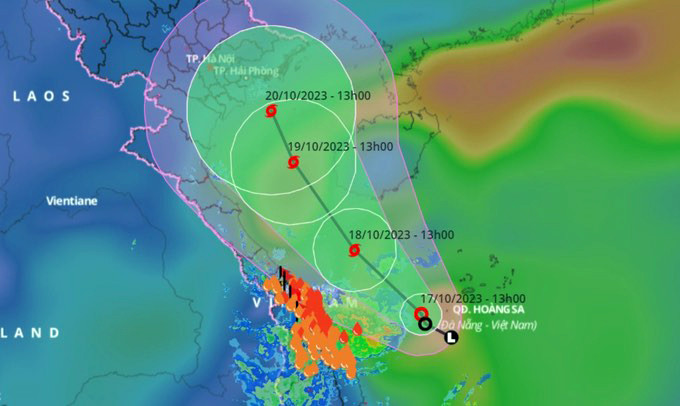
(Baonghean.vn) - On the morning of October 17, the tropical depression in the Hoang Sa archipelago intensified into a tropical depression. It is forecasted that by 10:00 a.m. on October 18, the tropical depression will likely intensify into a storm with winds of level 8, gusts of level 10.
From October 19, the Northeast and North Central regions are likely to experience heavy rain.
To proactively respond to the near-shore tropical depression and heavy rain, this afternoon (October 17), the Steering Committee for Natural Disaster Prevention, Search and Rescue and Civil Defense of Nghe An province issued Official Dispatch 11/CD-BCH directing the implementation of necessary measures.
The dispatch stated: According to the bulletin of the North Central Region Hydrometeorological Station, on the morning of October 17, 2023, the tropical depression in the sea of Hoang Sa archipelago strengthened into a tropical depression; at 10:00 a.m. on October 17, the center of the tropical depression was at about 15.5 degrees North latitude; 110.7 degrees East longitude, about 150km southwest of Hoang Sa archipelago with strong winds of level 6, gusting to level 8.
It is forecast that by 10:00 a.m. on October 18, the tropical depression is likely to strengthen into a storm with wind speed of level 8, gusting to level 10.
To proactively respond to the near-shore tropical depression and heavy rain, the Provincial Steering Committee for Natural Disaster Prevention, Search and Rescue and Civil Defense requests the Steering Committee for Natural Disaster Prevention, Search and Rescue and Civil Defense of districts, towns and Vinh city; departments, branches and sectors to immediately implement a number of contents:
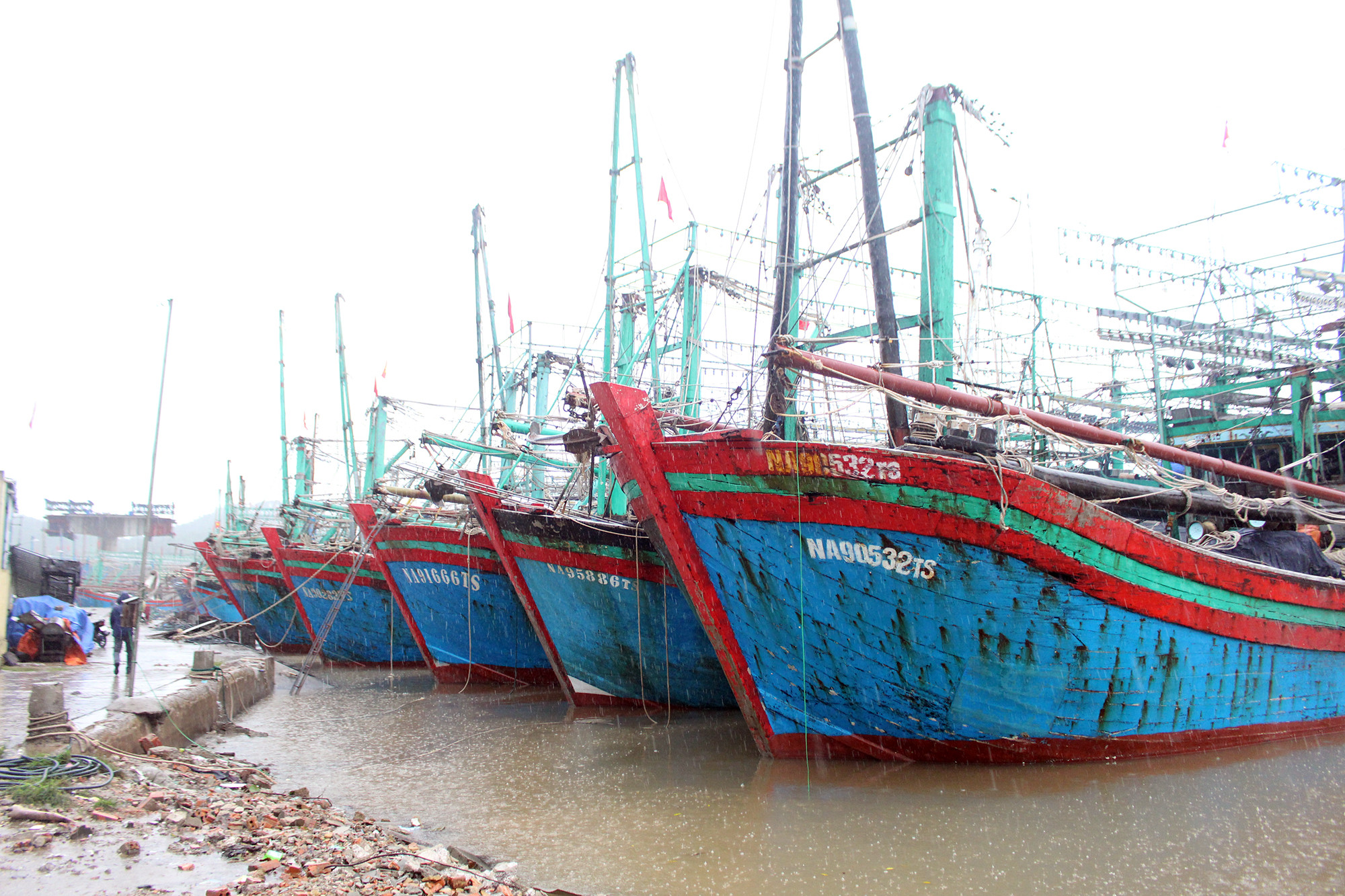
For sea routes:Closely monitor the development of the tropical depression that may strengthen into a storm, continue to organize the counting of vessels, and use all measures to notify owners of vehicles and captains of vessels operating at sea of the location, direction of movement and development of the tropical depression so that they can proactively avoid, escape or not move into dangerous areas, and not be subjective and cause damage to people and vessels due to tropical depressions and storms near shore.
(Danger zone in the East Sea in the next 24 hours: from 14.5 - 18.5 degrees North latitude; West of longitude 111.5; in the next 48 hours: from 15.0 - 21.0 degrees North latitude, West of longitude 110.5 and adjusted in forecast bulletins).
Organize strict management of vehicles and boats going out to sea; check and guide boats at anchorage. Proactively deploy measures to ensure safety for people, cages, and aquaculture areas at sea and along the coast. Depending on the development of tropical depressions and storms, the Border Guard Command proactively advises on sea bans.
Ready rescue forces and vehicles to promptly handle situations.
For mainland areas:It is necessary to closely monitor developments of heavy rain, floods, inundation, flash floods, and landslides, and provide timely and complete information to authorities at all levels and people so that they can proactively prevent, respond, and minimize damage.
Along with that, deploy shock forces to inspect and review residential areas along rivers, streams, and low-lying areas to proactively organize the relocation and evacuation of people in areas at high risk of deep flooding, flash floods, and landslides.
Organize forces to be ready to control and guide traffic, put up warning signs, especially at culverts, spillways, deep flooded areas, and fast-flowing water; proactively arrange forces, materials, and means to handle incidents, ensuring smooth traffic on main traffic routes when heavy rain occurs.
At the same time, direct the work of ensuring the safety of vulnerable sea dykes or those under construction. Implement measures to drain and prevent flooding in urban areas and industrial zones.
Inspect, review, and ensure the safety of reservoirs and downstream areas, especially small hydroelectric reservoirs and important irrigation reservoirs; arrange permanent forces to be ready to handle possible situations.
North Central Region Hydrometeorological Station:Closely monitor, strengthen forecasts, warnings and timely information on developments of tropical depressions, storms, floods, flash floods and landslides to proactively deploy response measures.
Department of Agriculture and Rural DevelopmentDirect the work of ensuring safety of fishing vessels and aquaculture; safety of dikes, irrigation dams, especially key works under construction; protect agricultural production.
Department of Industry and TradeDirect the work of ensuring the safety of hydroelectric dams and downstream areas, especially small hydroelectric plants; be ready to promptly restore the power system in case of an incident.
Department of TransportDirect the work of ensuring safety for transport vessels; direct timely handling of incidents, ensuring traffic on main routes.
Departments, branches and sectorsAccording to assigned functions and tasks, direct response measures when bad situations occur. Prepare forces and means for rescue when requested.
Units: Provincial Radio and Television Station, Nghe An Newspaper, Ben Thuy Coastal Information Station and mass mediaIncrease the time and promptly report on the developments of tropical depressions and heavy rains to authorities at all levels, owners of vehicles operating at sea and people to proactively prevent and respond.
Organize on-duty seriously, regularly report to the Provincial Steering Committee for Natural Disaster Prevention, Search and Rescue and Civil Defense.


