Nghe An: Displaying 150 maps and documents proving sovereignty over Hoang Sa and Truong Sa
(Baonghean.vn) - On the afternoon of May 11, the Department of Information and Communications held a meeting to deploy the plan to organize the exhibition of maps and display documents "Hoang Sa, Truong Sa of Vietnam - Historical and legal evidence".
Attending were representatives of relevant sectors, units and People's Committee of Cua Lo Town.
 |
| Overview of the meeting. |
According to the Organizing Committee, the Exhibition will open on June 2 at Binh Minh Square (Cua Lo Town). During 3 days (from June 2-4), the exhibition will display 150 maps, documents, and images related to the process of establishing and implementing Vietnam's sovereignty over its seas and islands from the 17th to the 20th century, affirming Vietnam's sovereignty over the Hoang Sa and Truong Sa archipelagos.
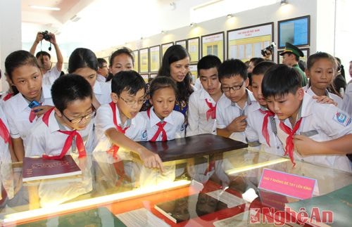 |
| Students visit the Exhibition "Hoang Sa, Truong Sa of Vietnam - Historical and legal evidence" in 2015 at Nghe An Provincial Cultural Center. |
The exhibition is one of the important information activities, contributing to raising awareness among all classes of people about Vietnam's sovereignty over the two archipelagos of Truong Sa and Hoang Sa; arousing patriotism, solidarity and sense of responsibility of each citizen towards the sacred sovereignty of the sea and islands of the Fatherland.
Minh Quan
: Khoảng 14.5 độ Vĩ Bắc; 114.9 độ Kinh Đông, cách đặc khu Hoàng Sa khoảng 370km về phía Đông Đông Nam")
: Hồi 7 giờ ngày 27/9, vị trí tâm bão ở khoảng 14,1°N; 115,8°E, cách đặc khu Hoàng Sa khoảng 480km về phía Đông Đông Nam")
: Hồi 4 giờ ngày 27/9 vị trí tâm bão cách đặc khu Hoàng Sa khoảng 580km")


