Footsteps on the top of Puxailaileng
(Baonghean.vn) -Located at an altitude of 2,711 meters above sea level, Puxailaileng is the highest peak of the Northern Truong Son range running from the Ca River to Quang Ngai.
During the days traveling with them, looking up at the mountains, stepping on rapids, sharing each rare piece of dry food, shedding tears when losing teammates, green leeches biting blood from one shoulder, some people could not say a word for 3 days... only then could we understand somewhat the hardships upstream of those who go to beautify the country. The long journey of 4 years to plant markers is also an immeasurable journey in terms of geography. Each sacred national border marker is erected with countless stories that will last forever.
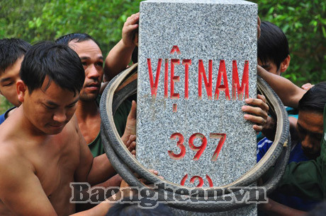
From border post 527 (My Ly commune - Ky Son), the thin motorboat went upstream of Nam Non, towards Laos, where there was the thick 3-point marker 597. To reach the marker, we had to cross 3 famous waterfalls: Canh Trap, Canh Mai and Canh Xo. It is said that after passing these 3 waterfalls, boat capsizing and loss of belongings happened frequently. Marker 397 is located at the junction of the Nam Non source bordering Muong Duong (Muong Quan - Hua Phan district - Laos). To erect the marker, countless efforts of the Marker Setting Team 1 (DCM1) cadres were poured down, as much as the water of Nam Non.
Lieutenant Colonel Phan Van Hong, the leader of the DCM1 team, said that each monolithic granite marker placed from Binh Dinh was not light at all. The large marker in Nam Can weighed 1 ton, the medium marker (for restoration) weighed 4.5 quintals, and the small marker weighed about 2.6 quintals. From the bottom of the boat, which was heavily filled with the sound of the engine, looking up at the deep green forest above, we could hardly imagine how that monolithic marker could travel thousands of kilometers, through so many stages, to reach this remote place, and then proudly stand forever as an immortal symbol of our ancestors' land. Perhaps, only the courage and the thousand-year-old pride ingrained in each person who planted the markers could do it.
Tomorrow, next month, they will continue to set out towards the vast jungle and deep mountains. When the Vietnam-Laos border is completed, the governments and people of the two countries will travel back and forth to do business and visit each other in friendship. Surely no one will forget the efforts of those who planted the border markers today. Because the border was created by humans to be crossed, not to separate.
Below are some images captured by Nghe An Newspaper reporters during a trip into the forest with Marker Planting Team No. 1:
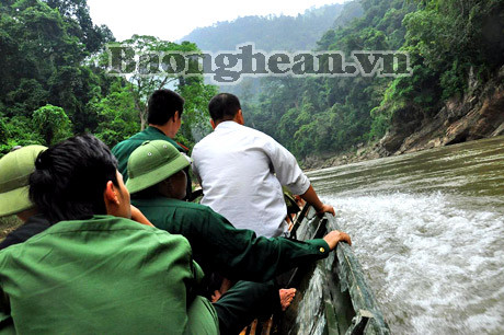
From BP 527 station, the boat goes up Nam Non to marker 397, passing 3 fierce waterfalls.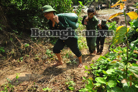
Each bag of sand and cement must go through many stages to reach the marker. The cement bag must be divided into two or three parts according to the shoulders of the person setting the marker at the gathering point.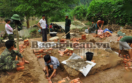
Base of milestone 397 (2) on Vietnamese side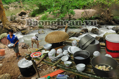
The kitchen by the stream reminds us of the old kitchens in the military stations in the middle of the forest on the way to the front line.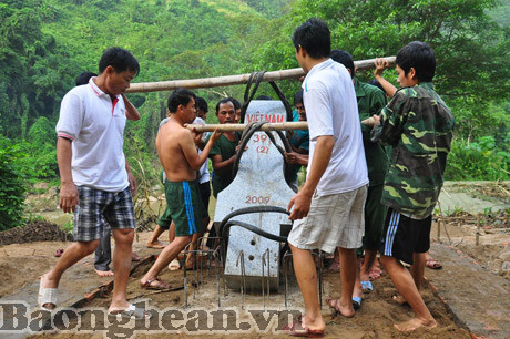
Milestone 397 is being brought in and erected on the national border landmark.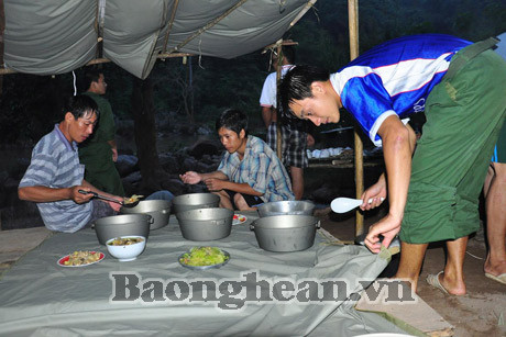
Dinner was served right on the sleeping platform.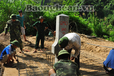
Milestone 397 (1) on the Laos side has been erected by us to help you.
Tran Hai


