A rock slab has been discovered revealing an image of the map of Vietnam.
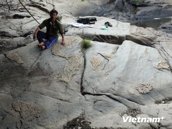
While foraging in the forest, Mr. Dang Quoc Ai (Quang Chau commune, Quang Trach district, Quang Binh province) discovered a rock slab eroded over time, revealing an image of a map of Vietnam with the Hoang Sa and Truong Sa archipelagos, as well as images of countries in the East Sea region.
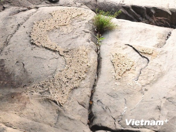 |
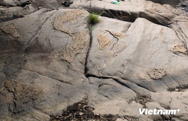
| Map of Vietnam on a rock. (Photo: Nguyen Duc Tho/Vietnam+) |
The image and description provided by Mr. Ai are located at Khe Da Bang Con, in Quang Hop commune, Quang Trach district, Quang Binh province.
According to Mr. Ai and many others who discovered the image, they all believe that this rock formation was created by nature over hundreds of years, eroded by the stream, leaving behind a whole that, when viewed by anyone, resembles a map of Vietnam.
Mr. Ai explained: These images are all protruding from a large rock in the middle of the stream, consisting of raised S-shaped sections representing the map of Vietnam, two smaller blocks to the east of the S-shaped section representing the Hoang Sa and Truong Sa archipelagos of Vietnam, and further east are several raised blocks representing countries in the South China Sea region. To the west of the S-shaped section are two large blocks representing Laos and Thailand...
After discovering this fascinating image, Mr. Ai brought many people to see it, and everyone agreed that it closely resembled the map of Vietnam.
People believe that nature itself created this wonder and also affirms that the Hoang Sa and Truong Sa archipelagos belong to Vietnam, a fact that cannot be denied. Even nature itself acknowledges this.
Reportedly, a few months ago, during a fishing trip in the stream, on a hot afternoon, Mr. Ai lay resting on a rock and discovered this fascinating thing. At first, the rock was covered with leaves, but seeing this, Mr. Ai cleaned it up, and the image of the map of Vietnam became even clearer before his eyes.
Mr. Ai said that they might interpret these images as a map of Vietnam, although they cannot confirm this is accurate. However, for them, these images are a natural creation, and they consider them a map of Vietnam, including the Hoang Sa and Truong Sa archipelagos.
Currently, every few days Mr. Ai goes to the stream area to sweep up dry leaves and clean the area. He wants visitors to see these images in a beautiful and dignified manner.
 |
 |
According to VNA

