Super typhoon Goni makes landfall in the Philippines
According to the National Center for Hydro-Meteorological Forecasting, tropical storm Goni moved through the area near the northern Philippines this afternoon, August 21, causing heavy rain in the area.
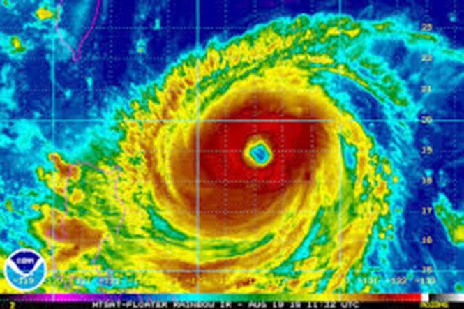 |
| Imagesatellite of super typhoon Goni - Photo: Accuweather |
Weather.com reported that at 2 p.m. on August 21, the storm, with winds near the center of the storm reaching level 15, gusting to level 17, passed through the northeastern part of Luzon Island in the Philippines. The strongest winds near the center of the storm reached level 15 (165-185 km/h), gusting to level 17.
The storm is expected to bring heavy rains along northern and northwestern Luzon, with authorities fearing it could trigger flash floods and landslides in parts of the region.
The impact of the storm is expected to affect the Philippines for weeks to come, with the capital Manila not being spared.
After passing the Philippines, Typhoon Goni will make landfall in northern and eastern Taiwan over the weekend. While it is expected to pose less of a threat than the Philippines, the storm still threatens to bring heavy rains and landslides.It is forecasted that in the next 24 hours, the storm will move mainly north, traveling about 5-10km per hour. In the next 24-48 hours, the storm will move north-northeast, traveling about 15km per hour.
From Sunday to Monday, the typhoon will sweep across northern Taiwan and Japan's Ryukyu Islands. While northern Taiwan is not expected to be deeply affected, the typhoon is expected to have a negative impact on the Japanese archipelago.
In addition, due to the influence of strong southwest winds, the southern area of the East Sea, including the Truong Sa archipelago and the sea area from Binh Thuan to Ca Mau, will be subject to strong southwest winds of level 5, sometimes level 6, gusting to level 7-8, causing scattered thunderstorms.
According to TTO
| RELATED NEWS |
|---|


