Weather forecast September 6: Warning of thunderstorms, tornadoes, lightning and heavy rain due to cold air
(Baonghean.vn) - According to the National Center for Hydro-Meteorological Forecasting, currently (September 6), the cold air mass in the North is continuing to move south.
Forecast:Tomorrow day and night (September 7), this cold air mass will affect the North, then affect the North Central region and some places in the Central Central region.
From tomorrow, the wind will shift to the northeast in the inland provinces of the Northeast, level 2-3, coastal areas level 3-4. During this northeast monsoon (September 7-9), the lowest temperature in the Northern and North Central provinces will generally be 21-24 degrees Celsius, in the Northern mountainous areas 19-22 degrees Celsius.
 |
| In the Gulf of Tonkin from tomorrow night, the sea will be rough. Illustrative photo |
In the Gulf of Tonkin from tomorrow night, the wind will change direction to northeast and gradually increase to level 6-7, gusting to level 8-9; rough seas. Disaster risk level due to strong winds in the Gulf of Tonkin: level 1.
Thunderstorm, tornado, lightning and heavy rain warning:Due to the influence of cold air compressing the low pressure trough, from tonight (September 6) to tomorrow morning, in the mountainous and midland areas of the North, there will be showers and heavy thunderstorms; during thunderstorms there is a possibility of tornadoes, lightning, hail and strong gusts of wind.
From tomorrow afternoon and night, in the North and the provinces of Thanh Hoa, Nghe An, Ha Tinh, there will be moderate rain, heavy rain, and in some places very heavy rain (common rainfall 50-100mm/24 hours). During September 8-9, heavy to very heavy rain is likely to spread to the South and concentrate in the provinces of Ha Tinh, Quang Binh, Quang Tri.
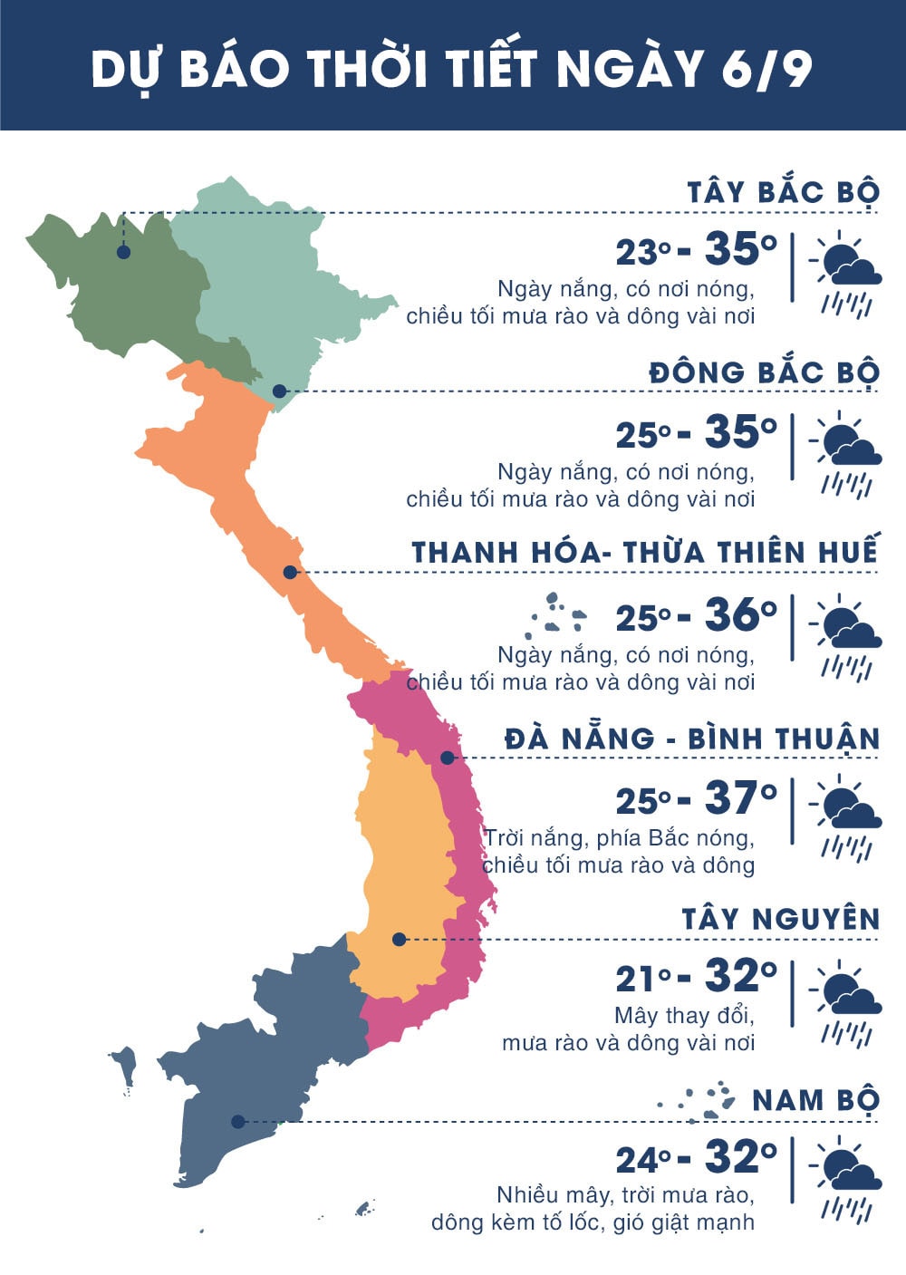 |
| Temperature on September 6 in regions across the country. Photo: news.zing.vn |


