Agree to resolve administrative boundary dispute between two communes of Luu Kien and Nam Can
(Baonghean.vn)-Resolutely and thoroughly resolve conflicts and disputes in land use between Luu Kien commune (Tuong Duong) and Nam Can commune (Ky Son) to ensure stability in people's lives and production and create favorable conditions for the unified and effective management of administrative boundaries by all levels of government - That is the directive of the leader of the Standing Office of the Provincial Steering Committee for Project 513 at the Consultation Conference to resolve administrative boundary disputes held on the afternoon of September 25.
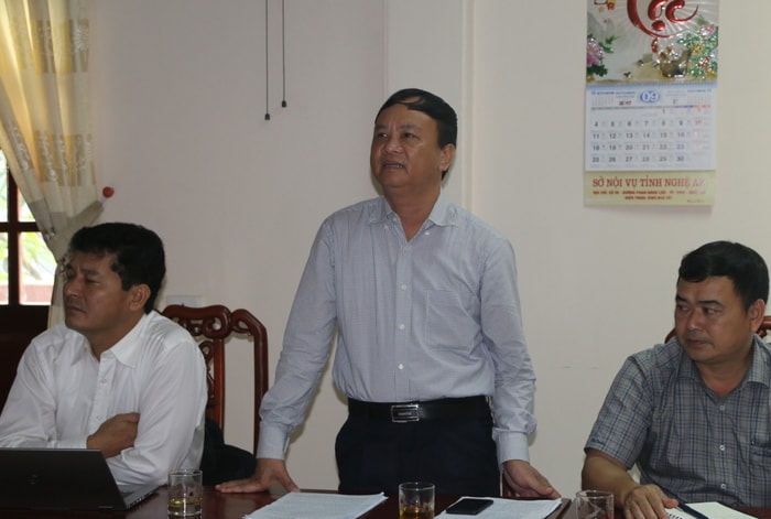
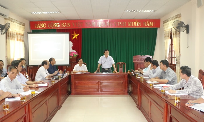 |
| Overview of the consultation conference. Photo: KL |
On the afternoon of September 25, in Vinh city, the Standing Office of the Provincial Steering Committee for Project 513 held a meeting to negotiate and resolve conflicts and land disputes related to administrative boundaries between Nam Can commune (Ky Son) and Luu Kien (Tuong Duong). Comrades: Dau Van Thanh - Director; Le Dinh Ly - Deputy Director of the Department of Home Affairs chaired the meeting. Also attending were representatives of the Party Committee, government, departments of the two districts of Ky Son and Tuong Duong, relevant sectors and communes. |
According to the report, the two districts of Ky Son and Tuong Duong have 5 points of dispute, of which the authorities of both sides have proactively negotiated and successfully resolved 4 points. Currently, there is still a point between Nam Can commune (Ky Son) and Luu Kien (Tuong Duong) that has been in dispute for many years. And twoThe two sides have held negotiations and resolved the issue many times but have not yet reached an agreement.
Luu Kien commune (Tuong Duong) proposed that the boundary line between the two communes remain the same according to map 364 because up to now, Luu Kien commune has twice adjusted the administrative boundary line for Nam Can commune.
 |
| Fields produced by Mong people living in Nam Khien village, Nam Can commune, Ky Son district. Photo courtesy |
Specifically, there were 2 times before that Luu Kien commune had 6 km of border with Laos. In 1989, when the administrative division of Nam Can commune was adjusted, Luu Kien became a commune without a border with Laos.
In 1990, implementing Directive 364/CT of the Council of Ministers (now the Prime Minister), the DHHC road from Pa Niec stream was continued to be adjusted down to follow the Suoi Niec waterway shown in map 364/CT. The natural area of Luu Kien commune was narrowed to 13,973.34 hectares, with 934 households and 4,019 people. Meanwhile, Nam Can commune (Ky Son) has 14,000 hectares but a population of only 2,000 people.
Also according to the leader of Tuong Duong district, since 2012, due to the opening of Pha Lom road, Tam Hop commune - Nam Can (Ky Son), some households from Pha Lom village, Tam Hop commune and Nam Khien village (Nam Can commune) have encroached and damaged the forest managed by the Forest Protection Management Board.
| Specifically, the total number of detected encroached fields is 30 with an area of 24.70 hectares, including a forested area of 2.9 hectares, a non-forested area of 21.8 hectares, belonging to lots 11, 13, section 6, lots 4, 8, section 7, lot 9, section 11, sub-area 618; lot 19, section 1, lot 5, section 2, lot 2, section 3, sub-area 617 and lot 17, section 16, sub-area 625.Of which, within the protective forest managed by Tuong Duong district are 27 patches with an area of 22.80 hectares. |
On the side of Nam Can commune (Ky Son), it is proposed to adjust the boundary line between the two communes according to the actual production situation for a long time due to the huge difference between the production and business situation of the people of Nam Can village compared to map 364 (the difference in area is 3,120 hectares according to data of the General Department of Vietnam Maps) and currently there are about 55 households producing on the disputed area with Luu Kien commune (Tuong Duong).
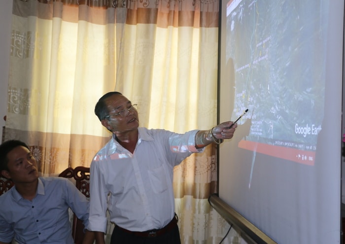 |
| Leaders of Nam Can commune (Ky Son) presented the people's production land on the map. Photo: KL |
Implementing the direction of the Department of Home Affairs at the working session between the two districts, relevant sectors and communes on June 1, 2017, the two districts of Ky Son - Tuong Duong and the two communes of Luu Kien and Nam Can coordinated to conduct field inspections but have not yet reached an agreement on how to handle the situation.
At the consultation conference, after listening to the representative of the consulting agency report on the results of the measurement on the DHHC map according to 364, the leaders of Nam Can commune (Ky Son) maintained their viewpoint of adjusting the boundary between the two communes according to the actual production status of more than 3,000 hectares for Nam Can to manage. Because the wish of Nam Can people is to keep the production land intact to serve their lives, because in fact, for a long time now, people have been producing normally, without any problems related to security and order.
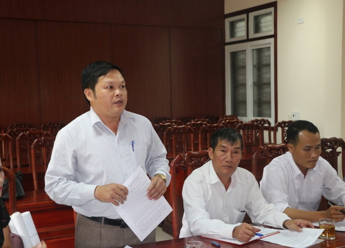 |
| Leaders of Luu Kien commune (Tuong Duong) proposed to keep the administrative boundaries according to map 364. Photo: KL |
The leaders of Luu Kien commune (Tuong Duong) reserved their opinion to keep the administrative boundary line according to 364 because they believed that "the commune had ceded land to Nam Can many times and the encroachment of Nam Can households on Luu Kien's land area affected the local management work".
The representative of the Department of Natural Resources and Environment suggested that the administrative boundary line according to map 364 should be kept intact and only the area of 55 Nam Can households cultivating on Tuong Duong protective forest land should be handled and adjusted. Because the adjustment would be very costly and in fact, the land that people have been cultivating has not been in dispute for a long time.
Based on the top priority of stabilizing people's lives and production and facilitating the unified and effective management of administrative boundaries by all levels of government, the leaders of the Department of Home Affairs proposed that the two sides maintain the current status of administrative boundary management of the two sides according to map 364. Accordingly, focusing on the direction of resolving the production land area to stabilize the lives of 55 households in Nam Can (Ky Son) who have long been cultivating on a part of the area managed by Luu Kien commune and the Protective Forest Management Board, Tuong Duong Forest Ranger Department.
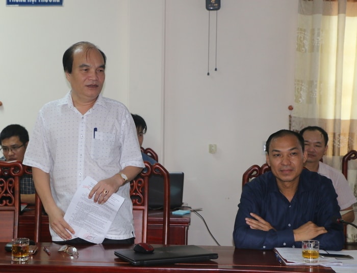 |
| Mr. Nguyen Thanh Hoang - Chairman of the People's Committee of Ky Son district agreed with the solution that puts the interests of the people first. Photo: KL |
The leaders of Ky Son district said that: Map 364 is not suitable for reality, land dispute resolution should be based on suitability for reality and from the interests of the people. The leaders also agreed with the way the leaders of the Department of Home Affairs raised the issue that we should focus on solving the problem of 55 households in Nam Can that are producing to ensure long-term stability.
"We propose to enclose the area where 55 households are producing for long-term stability, commit to stabilizing and not creating additional areas and especially not allowing people to enter the protective forest for cultivation" - Mr. Nguyen Thanh Hoang - Chairman of the People's Committee of Ky Son district expressed his opinion.
On the side of the leaders of Tuong Duong district: agree with the viewpoint of putting the interests of the people of the two communes in the two districts first, and the focus is on resolving the land area for 55 households in Nam Can. However, the legality of map 364 must be respected and the average production land/household of the two sides must be recalculated. And consider whether letting local people go to cultivate in another locality, especially digging deep into the area of protected forests and special-use forests, is in accordance with the law and ensuring national security or not?
In fact, it is very difficult to adjust the areas of cultivation that are deeply encroached on the administrative boundary line according to map 364. So should we switch to a production location that does not deeply encroach on the administrative boundary line according to map 364 to ensure convenience for administrative management? - Mr. Nguyen Thanh Hai - Chairman of the People's Committee of Tuong Duong district raised the question.
 |
| Mr. Nguyen Thanh Hai - Chairman of Tuong Duong District People's Committee expressed his opinion that the legality of map 364 should be respected. Photo: KL |
Based on the viewpoints of the parties and functional sectors, Mr. Le Dinh Ly - Deputy Director of the Department of Home Affairs, Deputy Head of the Steering Committee of Project 513 of the province acknowledged the efforts of the Party Committee and authorities of the two districts of Ky Son and Tuong Duong in resolving conflicts and disputes on administrative boundaries within and outside the district, including the Nam Can and Luu Kien lines.
The leaders of the Department of Home Affairs also proposed that the authorities of the two communes and two districts agree on a plan to adjust the area of 02 hectares of agricultural land belonging to Luu Kien commune, which Nam Can people have been producing for a long time, to Nam Can commune (Ky Son) for management. The remaining administrative boundary line must comply with the current map 364.
Regarding the 24.7 ha of cultivated land that 55 households in Nam Can commune have been cultivating for a long time in the administrative boundary under the management of Luu Kien commune and Tuong Duong protective forest management board, the two sides agreed to maintain the current status, measure, and establish records to hand over to the people for long-term production.
The authorities of Luu Kien commune and Tuong Duong district are responsible for strictly managing according to land law to prevent people from expanding cultivation into the area of protective forests and special-use forests under their management authority.
On the part of Nam Can authorities, Ky Son district must also be responsible for propagating and supervising people to comply with regulations on land management, not allowing more people to cultivate and encroach on the protective forest area under the administrative management of Luu Kien and the Tuong Duong Protective Forest Management Board.
It is recommended that the leaders of the two districts and two communes develop regulations and thoroughly educate officials, civil servants in the political system and the people to respect the content of the consultation; properly implement the regulations on management according to the land law and the law on residence; avoid affecting the solidarity of the two districts and two communes and ensure the stability of the socio-economic situation, national security and defense of the locality. At the same time, ensure the progress of completing the common project 513 of the whole province as committed to the Government./.
Project 513 was implemented to completely resolve land disputes related to administrative boundaries left over from history, and new ones arising from errors in the process of preparing records and maps of administrative boundaries at all levels, which were implemented according to Directive No. 364-CT of the Chairman of the Council of Ministers, now the Prime Minister. From there, build and complete the dossier, administrative boundary maps and databases at all levels in the province in accordance with the national border, ensuring scientific, complete and accurate nature as a legal basis for state management of administrative boundaries and building strategies and plans for socio-economic development, national defense and security in Nghe An province. |
Gia Huy


