News of low pressure near the coast: Nghe An has heavy rain, beware of flash floods, floods and landslides
(Baonghean.vn) - Due to the influence of the tropical depression, during the day and tonight (September 4), in the provinces and cities from Nghe An to Quang Ngai and the Central Highlands, there will be heavy rain (common rainfall 50-100mm/24 hours); in particular, the provinces and cities from Ha Tinh to Da Nang will have heavy to very heavy rain. Beware of flooding and landslides.
At 4:00 a.m. on September 4, the center of the tropical depression is located at about 17.0 degrees North latitude; 109.7 degrees East longitude, about 180 km East Northeast of the mainland of Quang Tri - Quang Ngai provinces. The strongest wind near the center of the tropical depression is level 6 (40-50 km/hour),level 8 jerk. Radius of strong winds level 6, gusting to level 8 about 60 km from the center of the tropical depression.
Forecast for the next 24 hours:The tropical depression is moving in the Northeast direction, traveling 5-10 km per hour. At 04:00 on September 5, the center of the tropical depression was at about 18.3 degrees North latitude; 111.3 degrees East longitude, about 120 km southeast of Hainan Island. The strongest wind near the center of the tropical depression is level 6 (40-50 km/hour).level 8 jerk.
Forecast:
Floods on Thach Han River, upper Ngan Sau River, Gianh River, Kien Giang River continue to rise.
This afternoon (September 4), water levels on rivers are likely to be as follows:
On Ngan Sau River at Chu Le, the water level changes slowly at 13.3m, 0.2m below BĐ3; at Hoa Duyet, it rises to 8.3m, 0.7m below BĐ2;
La River at Linh Cam under BĐ1;
Gianh River at Mai Hoa rose to 6.0m, 0.5m below BĐ3;
Kien Giang River at Le Thuy rose to 2.2m, at level BĐ2;
Thach Han River at Thach Han rose to 5.4m, 0.1m below BĐ3;
Rivers in Kon Tum and Gia Lai fluctuate above level 1.
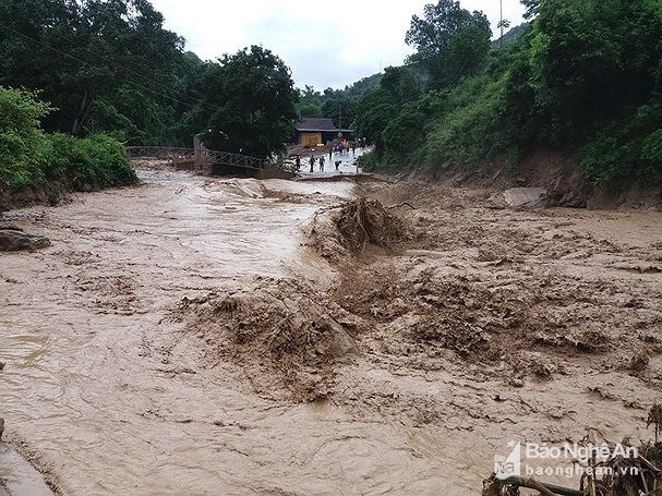 |
| Beware of possible flash floods. Illustrative photo |
Warning
Due to the influence of the tropical depression, during the day and tonight (September 4), in provinces and cities from Nghe An to Quang Ngai and the Central Highlands, there will be moderate to heavy rain (common rainfall 50-100mm/24 hours); in particular, in provinces and cities from Ha Tinh to Da Nang, there will be heavy to very heavy rain (rainfall 70-120mm/24 hours, in some places over 150mm/24 hours).
From now until September 5, provinces from Nghe An to Quang Ngai will have heavy to very heavy rain (total rainfall is common 100-200mm, especially provinces from Ha Tinh to Thua Thien Hue 150-300mm); the Central Highlands will have heavy to very heavy rain (70-150mm). From September 6, heavy rain will decrease rapidly in the Central region.
High risk of flash floods and landslides in the district:
- Thanh Hoa Province:Muong Lat, Quan Hoa, Quan Son, Lang Chanh,Ngoc Lac, Ba Thuoc, Ivy, Nhu Xuan
- Nghe An Province:Ky Son, Tuong Duong, Con Cuong,Que Phong, Quy Chau
- Ha Tinh province:Huong Khe, Huong Son, Vu Quang
- Quang Binh Province:Tuyen Hoa, Minh Hoa, Bo Trach
- Quang Tri Province: Huong Hoa, Dakrong
- Thua Thien Hue:A Luoi, Nam Dong
- Kon Tum Province: Dak Glei, Dak To, Sa Thay, Tu Mo Rong, IaH'Drai
- Gia Lai Province: K'Bang, Chu Pah, Ia Grai, Duc Co, Chu Prong
High risk of flooding in the district:
- Nghe An Province: Nghi Loc, Hung Nguyen, Vinh City
- Ha Tinh Province: Can Loc, Thach Ha, Ha Tinh City, Cam Xuyen
- Quang Binh Province: Tuyen Hoa, Minh Hoa, Quang Trach, Le Thuy
- Quang Tri Province: Hai Lang, Dong Ha City, Quang Tri Town
- Thua Thien Hue: Hue City
Disaster risk warning level: Level 1
Disaster risk level: level 3.
