STORM NEWS NO. 7: Storms, whirlwinds and strong gusts of wind appear in the eastern coastal area of the North.
At 4:00 a.m. on September 8, the center of the storm was located at about 21.3 degrees North latitude; 112.9 degrees East longitude, in the northwest sea area of the North East Sea. The strongest wind near the center of the storm was level 10-11 (89-117 km/h), gusting to level 13. Moving in the North Northwest direction, 20-25 km/h.
2. Storm forecast (in the next 12 to 24 hours)
| Forecast time | Direction, speed | Location | Strong degree | Danger zone | Disaster risk level (Affected area) enjoy) |
| 16 hours September 8 | Northwest, 20-25km/h | 23.2N-111.4E; on land Quang Nam province East (Central) (Country) | Level 8, level 10 | North parallel 19.5N; 110.5- longitude 115.0E | Level 3:region Northwest Sea area North East Sea |
| 04 hours September 9 | West West North, 20- 25km/h | 23.7N-108.8E; on land Guangxi Province (China) |
Forecasting the impact of storms:
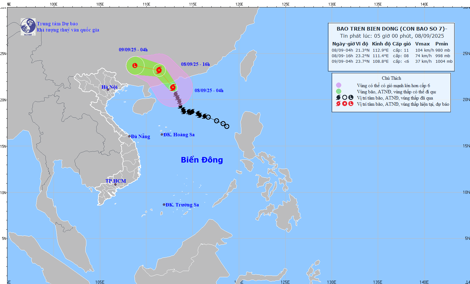
Strong winds and big wavesat sea: The northern sea area of the North East Sea has strong winds of level 7-8, near the storm center strong winds of level 9-10, gusts of level 13; waves 4.0-6.0m high, very rough seas. Ships operating in the above-mentioned dangerous areas are likely to be affected by storms, whirlwinds, strong winds, and large waves.
Note:Although not directly affected by the storm circulation, areas on the far edge of the storm circulation such as the Gulf of Tonkin and the eastern coastal areas of the North may experience thunderstorms, tornadoes and strong gusts of wind.


.jpg "Nghệ An: Lễ khai giảng đặc biệt ở xã biên giới bị thiệt hại nặng nề nhất sau bão số 3")
