Latest news on tropical depression
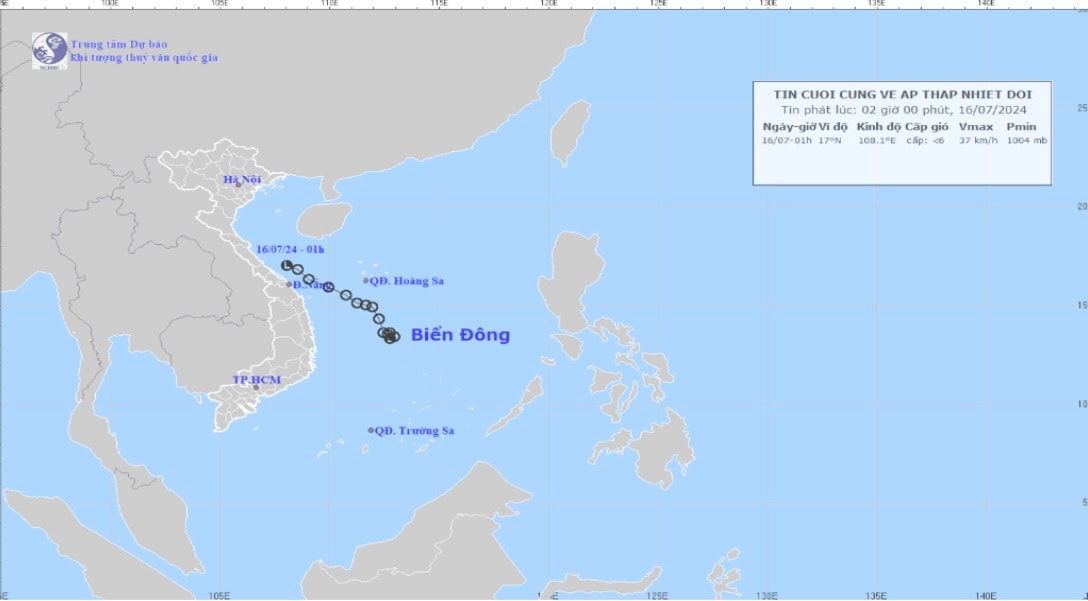
Early this morning (July 16), the tropical depression weakened into a low pressure area over the sea from Quang Tri to Da Nang.
At 01:00, the center of the low pressure area was at about 16.5-17.5 degrees North latitude; 107.6 - 108.6 degrees East longitude. The strongest wind in the center of the low pressure area decreased to below level 6 (below 39km/h).
Forecast of tropical depression (in the next 12 hours):The low pressure area moves mainly in the West Northwest direction, about 15km per hour, and continues to weaken.
Forecast impact of tropical depression:
Today (July 16), the sea area of Nghe An province has heavy rain and thunderstorms, strong winds of level 4 - level 5, sometimes level 6, slightly rough seas. The sea area of Nghe An province has waves 1.0-2.0m high.
From now (July 16) to the end of July 17, Nghe An province will have moderate rain, heavy rain, and some places will have very heavy rain and thunderstorms. The rainfall is forecast to be generally 60-120mm in coastal plains, with over 150mm in some places such as Vinh City, Hung Nguyen, Nam Dan, etc.; in midland and mountainous areas, it is generally 50-100mm, with over 120mm in some places such as Thanh Chuong, Do Luong, Anh Son, etc.
This is the last news about this tropical depression./.
.jpg "Thời tiết Nghệ An ngày 16/7: Có mưa to đến rất to và dông")


