Exhibition of maps and documents "Hoang Sa and Truong Sa of Vietnam - Historical and legal evidence"
On March 17, the Ministry of Information and Communications coordinated with the People's Committee of Gia Lai province to organize an exhibition of maps and documents "Hoang Sa and Truong Sa of Vietnam - Historical and legal evidence".
The exhibition contributes to raising awareness, solidarity and sense of responsibility of the people in the country in general and Gia Lai in particular in protecting and affirming Vietnam's sovereignty over the Hoang Sa and Truong Sa archipelagos.
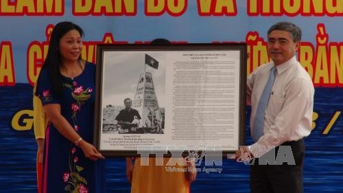 |
| Representative of the Ministry of Information and Communications (right) presented the items and documents "Hoang Sa, Truong Sa of Vietnam - Historical and legal evidence" to Gia Lai province. |
The exhibition displays many documents, artifacts, publications and nearly 100 maps collected from previously published sources of domestic and international researchers and scholars such as: Versions of Han - Nom documents, Vietnamese and French documents issued by the Vietnamese feudal court and the French government in Indochina from the 17th century to the early 20th century; versions of administrative documents of the government of the Republic of Vietnam...
Some documents and publications compiled and published by Western countries from the 18th to the 19th century announced Vietnam's sovereignty over these two archipelagos. In particular, the exhibition displays 4 atlases and 30 maps published and officially released by Chinese states throughout historical periods, showing that China did not manage the two archipelagos of Truong Sa and Hoang Sa... The exhibition also displays a number of images and documents on the economic, cultural and social development activities of Truong Sa island district during the period of industrialization and modernization of the country.
The maps and documents displayed at the exhibition are part of the historical evidence and legal basis proving Vietnam's sovereignty over the Hoang Sa and Truong Sa archipelagos. The documents show that Vietnamese states from the feudal period to the present socialist period have explored, established, enforced and protected national sovereignty over the two archipelagos and many other sea and island areas belonging to Vietnam's territory.
Previously, Gia Lai province also organized training and updated information on sea and island sovereignty for officials throughout the province.
The exhibition is open until March 21./.
According to the Communist Party of Vietnam

.jpg "Chiếc túi “Độc lập” - Hành trình từ đất liền ra đảo xa")


.jpg "37 năm sự kiện Gạc Ma: 'Thấy bóng hình cha giữa biển trời Trường Sa'")