Exhibition of maps and documents on Hoang Sa and Truong Sa in Hanoi
Maps and documents displayed at the exhibition are historical and legal evidence proving Vietnam's sovereignty.
·
On the morning of July 9, at the Vietnam Military History Museum
Mr. Le Van Nghiem, Director of the Department of External Information (Ministry of Information and Communications), Head of the Organizing Committee, said that based on the results of the exhibitions held in Da Nang and Ha Tinh, the exhibition in Hanoi has expanded content, more complete annotations, especially with annotations in English and Chinese, aiming to provide sources of documents on Vietnam's sovereignty over the Hoang Sa and Truong Sa archipelagos in a systematic and accurate manner, contributing to raising the spirit of solidarity and sense of responsibility of all people, especially the youth in the cause of protecting sovereignty over seas and islands.
Nearly 150 maps and many documents, texts, artifacts and publications on display are a collection of previously published sources of information by domestic and international researchers and scholars, serving as historical and legal evidence proving Vietnam's sovereignty over the Hoang Sa and Truong Sa archipelagos in the East Sea.
The exhibition includes main groups of documents: Versions of Han Nom texts, Vietnamese and French texts by the Vietnamese feudal court.
95 maps proving Vietnam's sovereignty
Three atlases (official maps) published by Chinese governments include: China Atlas (in English in 1908), China Postal Atlas (published by the General Post Office of the Ministry of Communications of the Republic of China in Nanjing in 1919 in three languages: Chinese, English, and French), and China Postal Atlas reprinted in 1933.
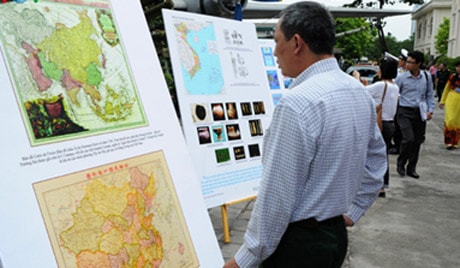
Maps and documents are also displayed outdoors in the grounds of the Vietnam Military History Museum.
The exhibition also introduces a number of documents, texts and publications of Western countries from the 18th to the 19th century, documents on the Hoang Sa archipelago during the French colonial period and the old regime on the issue of Vietnam's sovereignty over the Hoang Sa and Truong Sa archipelagos; a number of images and documents on the economic, cultural and social development activities of Hoang Sa and Truong Sa in recent times.
Mr. Le Van Nghiem, Head of the Organizing Committee, also said that the next exhibition is expected to be held in Ho Chi Minh City next August./.
According to (VOV) - LC


