Exhibition "Vietnam's sovereignty over the East Sea and Hoang Sa - Truong Sa"
(Baonghean.vn) - On the afternoon of July 22, 2014, the opening ceremony of the exhibition "Vietnam's sovereignty over the East Sea and Hoang Sa - Truong Sa" took place at the Provincial Library. Attending the event were comrade Dinh Thi Le Thanh - Member of the Provincial Party Committee, Vice Chairman of the Provincial People's Committee, representatives of the Provincial Military Command, Provincial Border Guard, leaders of the Department of Culture, Sports and Tourism, and a large number of students and people in the province.
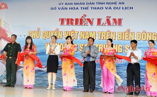 |
| Comrade Dinh Thi Le Thanh - Vice Chairman of the Provincial People's Committee, leaders of the Provincial Military Command, Department of Culture, Sports and Tourism, Provincial Library cut the ribbon to open the exhibition. |
With the aim of helping people of all walks of life better understand the sovereignty of the Hoang Sa - Truong Sa archipelago through many documents, the Exhibition "Vietnam's sovereignty over the East Sea and Hoang Sa - Truong Sa" has displayed various books, documents, historical materials, maps, films, etc. to affirm Vietnam's sovereignty over the sea and islands. This is a necessary information and propaganda work to help people fully understand the situation in the East Sea. Thereby, mobilizing the combined strength of the entire political system and the entire population to participate in protecting, fighting and condemning acts of violating the sovereignty of the territory, sea and islands of the Fatherland.
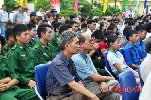 |
| Many people from all walks of life attended the opening of the exhibition. |
The exhibition content includes: Topic 1: Maps of Vietnam through historical periods, the earliest is the Hong Duc map (1490) of King Le Thanh Tong's reign, followed by maps of the Le - Trinh dynasties to the Nguyen dynasty such as Thien Nam tu chi do lo thu; Binh Nam do; maps of Portuguese navigators; French priests; Dai Nam nhat thong toan do of the Minh Mang dynasty (1838); Topic 2: 17 world maps from the end of the 15th to the 18th century; Topic 3: Maps of Vietnam and Hoang Sa - Truong Sa archipelagos with 16 maps from the 16th to the 20th century; Topic 4: Maps of the East Sea of Vietnam and Hoang Sa - Truong Sa archipelagos with more than 50 maps of Vietnam in the early 20th century arranged according to the coastal position of Vietnam from North to South, from river mouths, estuaries to archipelagos; Topic 5: Nghe An with Vietnam's sovereignty over the East Sea and Hoang Sa - Truong Sa, but the contribution of Nghe An people in creating maps with Hoang Sa - Truong Sa...
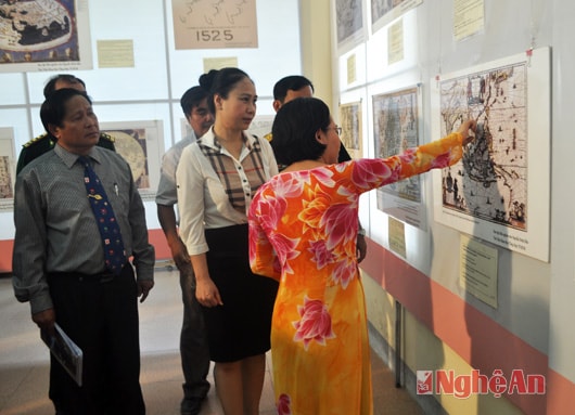 |
| Delegates listen to a presentation on the sovereignty of Hoang Sa and Truong Sa islands. |
In particular, the exhibition received help from the Ho Chi Minh City General Library, which lent 90 rare ancient maps on sea and island sovereignty (approved by the Ministry of Foreign Affairs and exhibited in Ho Chi Minh City).
The exhibition runs from July 22 to July 24, 2014.
Thanh Thuy


