Vietnam deposits at the United Nations nautical charts and baseline coordinates of the Gulf of Tonkin
The United Nations Secretary-General announced that Vietnam has completed the procedures for depositing nautical charts and lists of geographical coordinates related to baselines used to calculate the breadth of territorial waters in the Gulf of Tonkin.
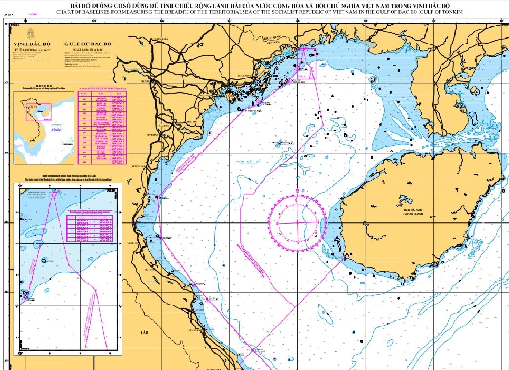
The March 12 announcement of the United Nations Secretary-General to member countries stated that on March 7, in accordance with Clause 2, Article 16 of the 1982 Convention on the Law of the Sea, the Vietnamese Government deposited at the United Nations a nautical chart along with a list of geographical coordinates of points determining straight baselines for the mainland territory in the Gulf of Tonkin and the outer boundary of the territorial sea in this area.
On March 14, the United Nations website posted detailed information about the deposit content.
The announcement also stated that the Vietnamese Government's Declaration dated February 21, 2025, on the baselines for calculating the breadth of territorial waters in the Gulf of Tonkin will be published in the upcoming official publication of the United Nations entitled "Bullet on the Law of the Sea".
>> Declaration on baselines used to calculate the width of Vietnam's territorial waters in the Gulf of Tonkin:HERE

.jpg "37 năm sự kiện Gạc Ma: 'Thấy bóng hình cha giữa biển trời Trường Sa'")

