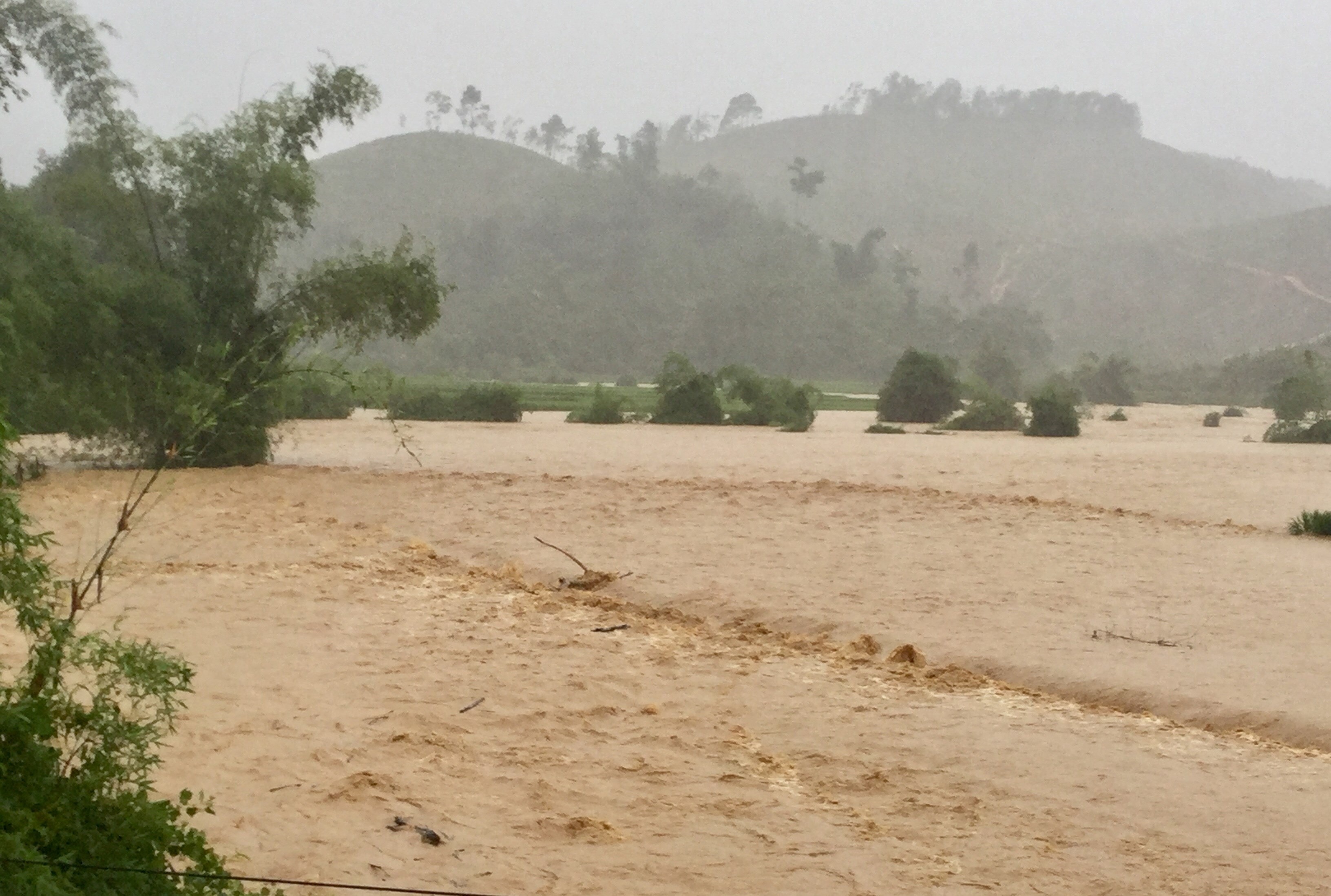
Western Nghe An province is severely flooded due to the impact of Typhoon No. 4.
(Baonghean.vn) - Due to the influence of the circulation of typhoon No. 4, since last night (August 16), many localities in western Nghe An have been severely affected by heavy rain. Water levels in streams and rivers have risen, causing flooding in many places, especially cutting off many roads and isolating residential areas.
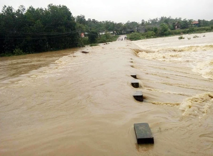 |
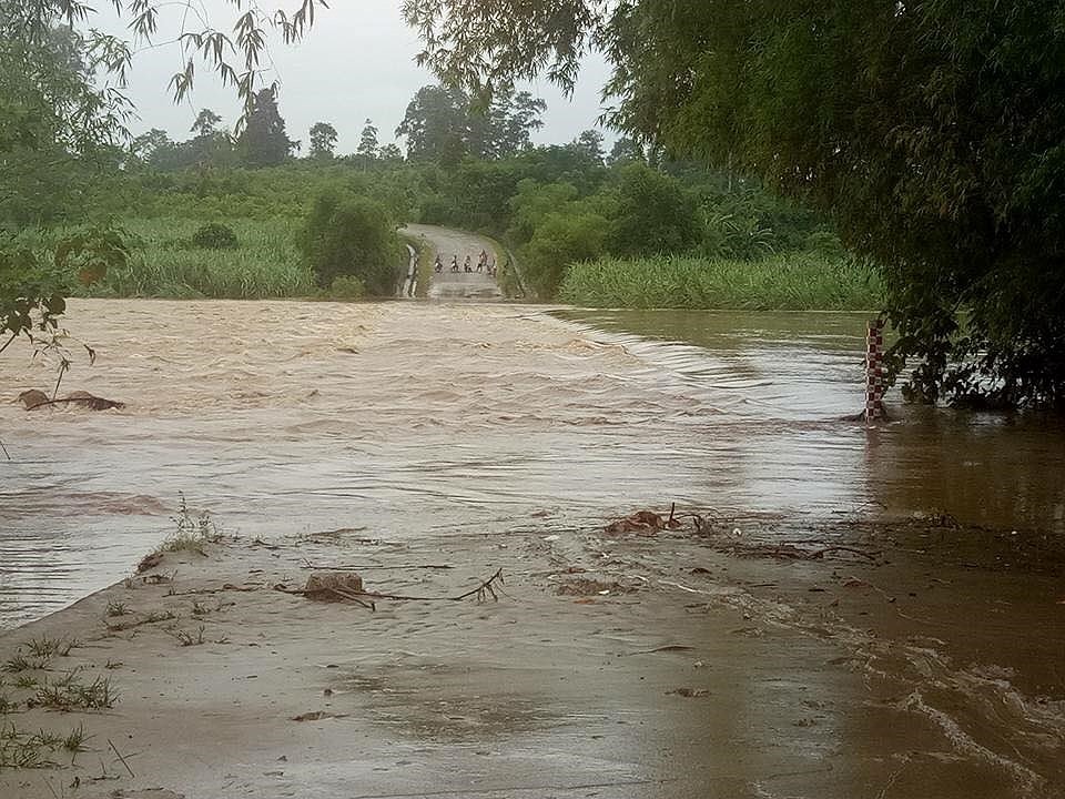
| Rising floodwaters have divided Thach Ngan commune (Con Cuong district) into four areas. Photo: CTV |
According to information from the People's Committee of Thach Ngan commune (Con Cuong district), heavy rain fell in the area from last night until this morning, causing a large volume of water to flow from upstream, resulting in rapidly rising water levels in streams and creeks. The rising water levels have caused traffic congestion and isolated villages in the commune, dividing them into four separate areas. Damage statistics are not yet available.
 |
| Leaders of Thach Ngan commune have been assigned to be on duty at critical points. Photo: Contributor. |
To minimize damage, since yesterday afternoon, the People's Committee of the commune has organized the evacuation of households at risk of flooding and landslides to safe areas, and the commune's Search and Rescue Command is on duty 24/7. At overflow bridges and vulnerable points, commune leaders have been stationed to prevent people and vehicles from passing through.
Reportedly, heavy rain is still falling in Thach Ngan, and floodwaters are continuing to rise.
Cong Kien
Not only Thach Ngan commune, a remote area, but many other localities in Con Cuong district have also been severely affected.
 |
| A resident in Chi Khe commune tries to prevent floodwater from entering his house on the morning of August 17. Photo: Huu Vi. |
| Road collapse in Mau Duc - Con Cuong. Video: Ba Hau |
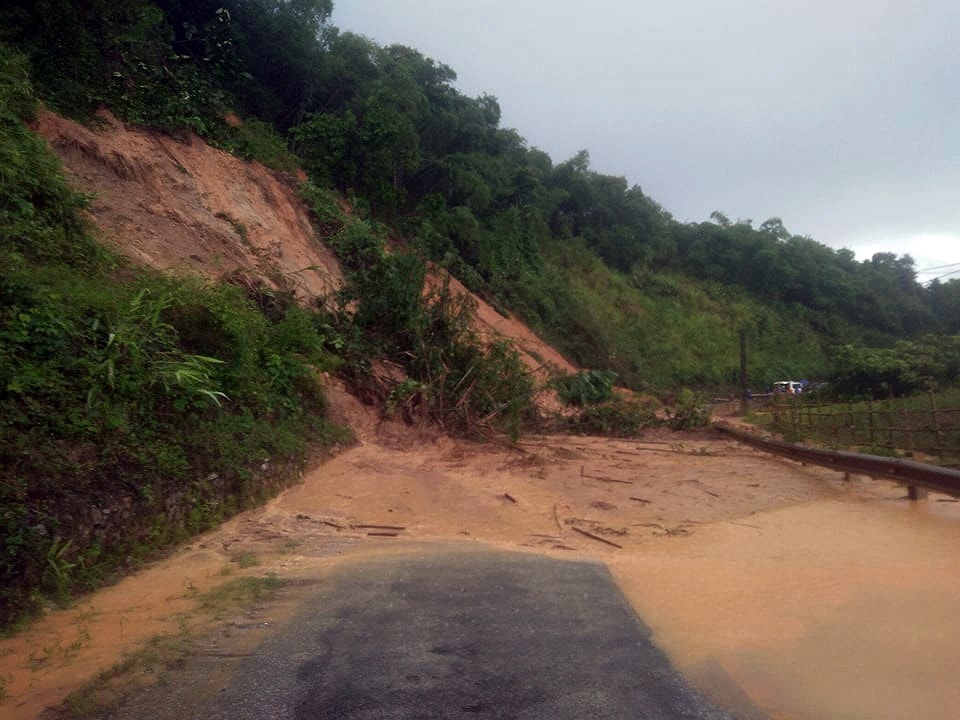
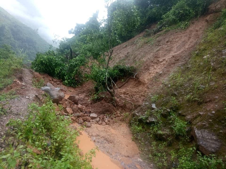
According to information from the Mau Duc commune authorities, the road under construction in the area, already affected by Typhoon No. 3, has now suffered further landslides. Hundreds of cubic meters of soil and rocks from the mountain section passing through Ke Sung village in Mau Duc commune have spilled onto the road, causing traffic congestion. Currently, motorized vehicles cannot pass through. In Ke Sung village, local authorities have had to evacuate two households due to the risk of their houses being buried by landslides.
 |
| A section of National Highway 7 passing through Cho Hill in Lang Khe commune was affected by a landslide on the morning of August 17. Photo: Ba Hau |
The heavy rains and floods have also caused frequent landslides at Cho Slope in Lang Khe commune to recur. In Thach Ngan commune, several villages such as Dong Tam, Thanh Binh, Ke Trai, Ke Tat, and Ba Ha are currently isolated due to flooded bridges. Six power poles in Dong Tam have collapsed, and two houses in Ke Tat and Ba Ha villages have been inundated with mud and rocks.
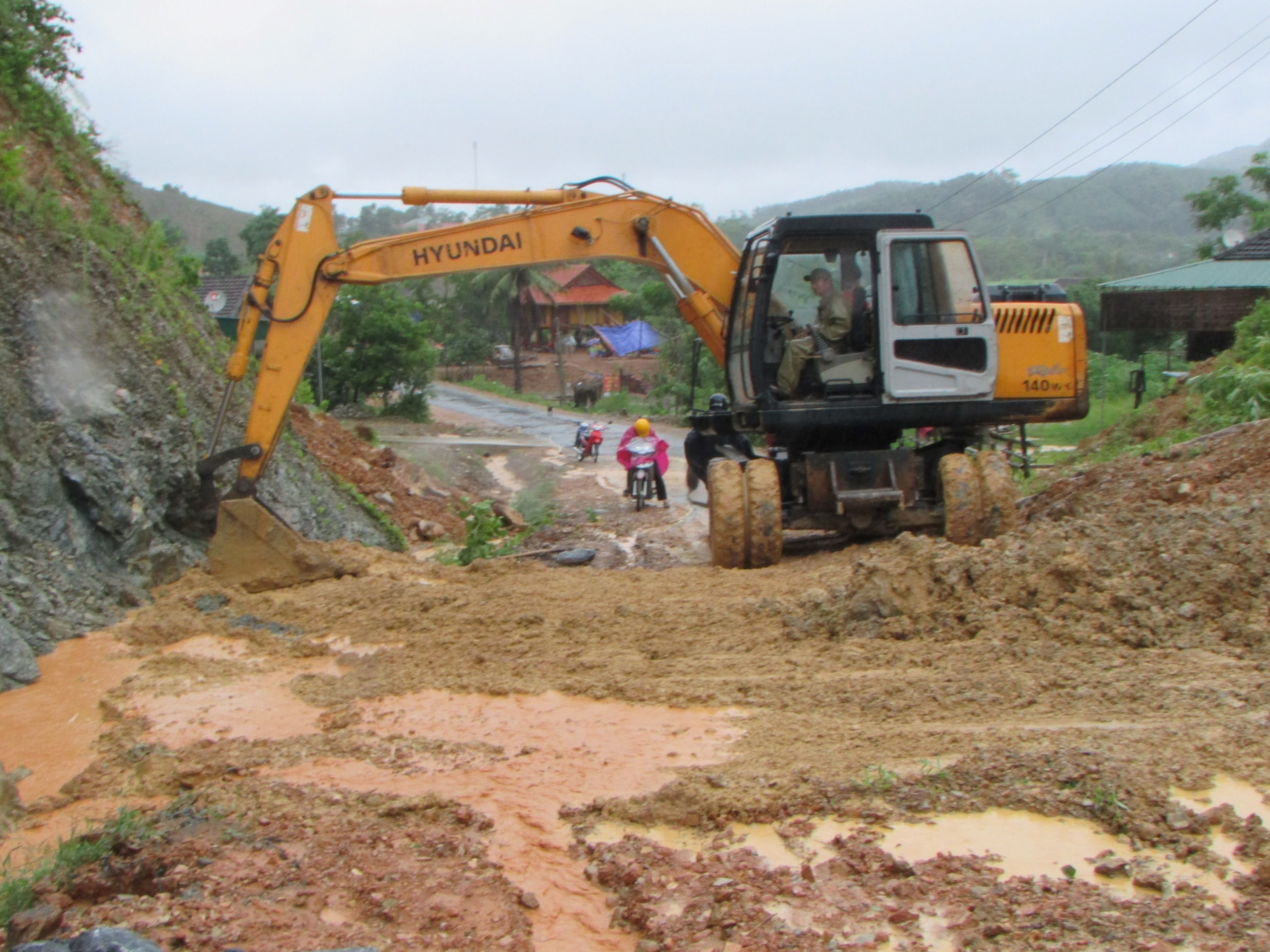 |
| Local authorities mobilized machinery to clear the landslide site in Mau Duc. Photo: Ba Hau. |
In Luc Da, the overpass bridge on the road to Mon Son continues to be flooded. Ms. Luong Thi Hien, Vice Chairman of the People's Committee of Luc Da commune, said: Currently, the local authorities have assigned people to guard both ends of the bridge to prevent people from risking their lives crossing the floodwaters.
Currently, there are no statistics on the extent of the damage. The Con Cuong district authorities are mobilizing manpower and machinery to clear traffic congestion on the roads and help people overcome the damage.
Huu Vi - Ba Hau
Quy Hop District: Heavy rains cause widespread flooding and landslides.
 |
| Due to the influence of the circulation of typhoon No. 4, heavy rain caused flooding and landslides in Chau Ly commune (Quy Hop district). Photo: Cao Duy Thai |
From last night to this morning, due to the influence of the circulation of typhoon No. 4, heavy rain caused widespread flooding and landslides in Chau Ly, Chau Thanh, Chau Hong communes and the town... All overflow bridges in Chau Ly commune were deeply submerged, completely cutting off and isolating the villages in the commune, including: Bung, Vuc, Tham, Xet, Bang, Lau, and Xao villages.
Many rice paddies that were in the heading stage were submerged by floodwaters and mud, and many fish ponds were swept away. Several roads leading to Bung and Xao villages in Chau Ly were affected by landslides... Some houses were damaged by mud and rocks.
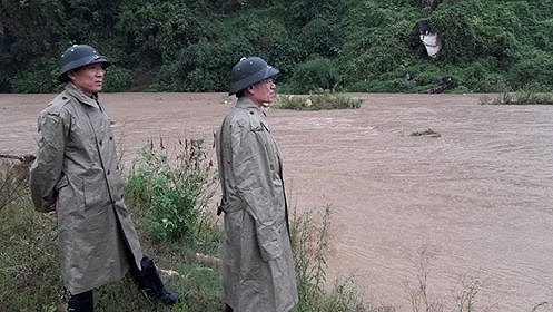 |
| Leaders of Quy Hop district inspect Chau Hong commune. Photo: Phan Giang |
Proactively responding to the flood situation, leaders of communes in Quy Hop district and the District Flood Control Committee are patrolling and setting up checkpoints at vulnerable points to ensure the safety of people's lives and property.
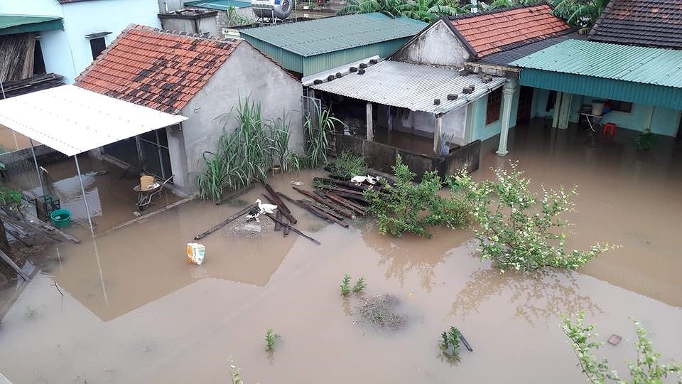 |
| In many communes of Quy Hop district, water has penetrated deep into people's homes. Photo: Minh Nguyet. |
| Video: Heavy rains cause flooding in Quy Hop. Cao Duy Thai |
Duy Thai - Phan Giang
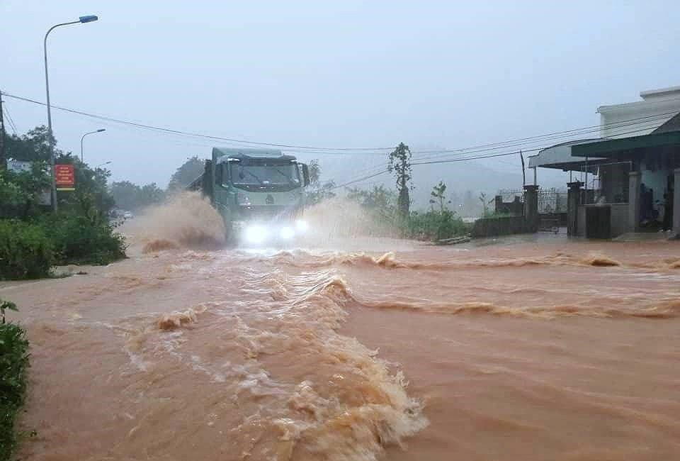
Nghia Dan: Many communes are cut off.
Currently, there is heavy rain in Nghia Dan district, and some bridges are deeply submerged, posing a danger to people using them.
Specifically, the Dinh Bridge at Km97+850, connecting Nghia Hung commune in Nghia Dan district and Nghia Xuan commune in Quy Hop district, was submerged to a depth of 2 meters above the bridge surface; other spillways in the district, such as Nghia Dan town and Nghia Binh, were submerged to a depth of 0.5 - 0.7 meters...
 |
| Floodwaters have swept through Nghia Hung commune, isolating it. Photo: Minh Thai |
In Nghia Hung commune, access roads to 11 hamlets with over 1,000 households have been cut off and isolated. At the spillway in Gang village, Nghia Hung commune, all four hamlets are completely isolated. Water from upstream has created a strong, fast-flowing current, submerging the spillway to a depth of 1.5 - 2 meters.
Mr. Tran Van Long, Vice Chairman of the Nghia Hung Commune People's Committee, said: "The Commune People's Committee has continuously issued notices and directives to hamlets, schools, and residents to raise awareness and be prepared for the low-pressure system before and after the storm."
In Nghia Thinh commune, a locality with complex terrain, the Hieu River runs through it and there are three large reservoirs and dams, including the 8/3 dam in Hamlet 10; the Tan Dong dam in Hamlet 4; and the Khe Thai dam in Hamlets 5 and 6. Currently, the dams are at high water levels and floodwaters have been released to drain the area; approximately 10 households in Hamlet 4, located downstream of the dams, have been relocated.
 |
| Large areas of rice and sugarcane fields in Nghia Thinh commune were deeply flooded. Photo: Minh Thai |
According to Mr. Pham Van Tan, Vice Chairman of the People's Committee of Nghia Thinh commune, at the Hieu spillway bridge, section KM92+B50, National Highway 48E connecting Nghia Thinh with Nghia Hung, the water level is 2.2m deep, posing a danger to people and vehicles crossing. In response to this situation, the People's Committee of Nghia Thinh commune has erected barriers and warning signs to prevent people from crossing the flooded spillway.
To warn people when crossing spillways, the District People's Committee has directed communes to place warning signs; and assigned officials to stand guard and prevent people and vehicles from crossing the spillways during rainy and flood days. However, with the large number of spillways and the unpredictable weather, each citizen also needs to be proactive, avoid complacency, and refrain from crossing rivers and streams when warnings of danger have been issued by authorities.
 |
| In Thai Hoa, heavy rain caused flooding on the roads. Photo: Quang Huy. |
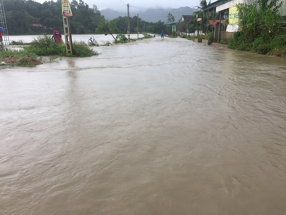
In Thai Hoa town, heavy rain also caused some roads to be cut off, making transportation difficult.
Minh Thai - Quang Huy
My Ly Border Guard Station mobilizes forces to evacuate due to flooding.
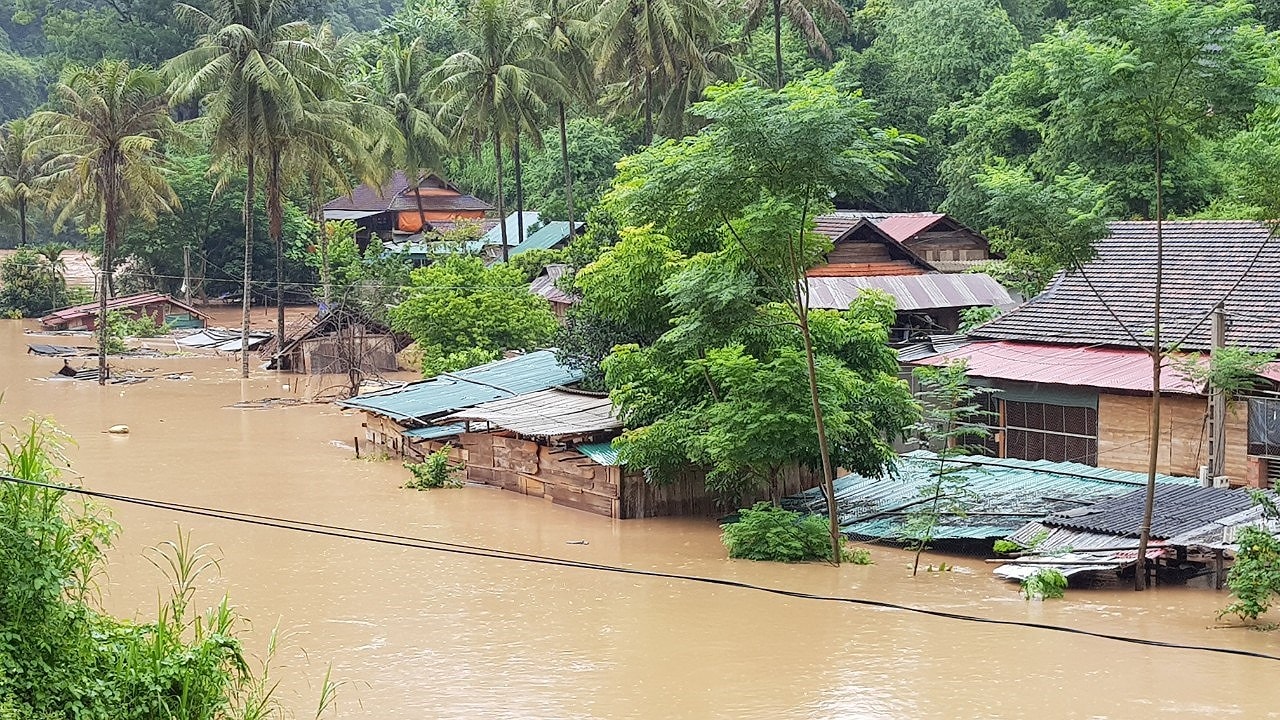 |
| Xop Tu village, My Ly commune, is currently severely flooded. Photo: Hai Thuong |
Heavy rains caused by Typhoon No. 4 have severely flooded My Ly commune, Ky Son district. The worst affected areas are Xop Tu village with 7 families, Xieng Tam village with 3 families, and Xieng Tren village with 4 households.
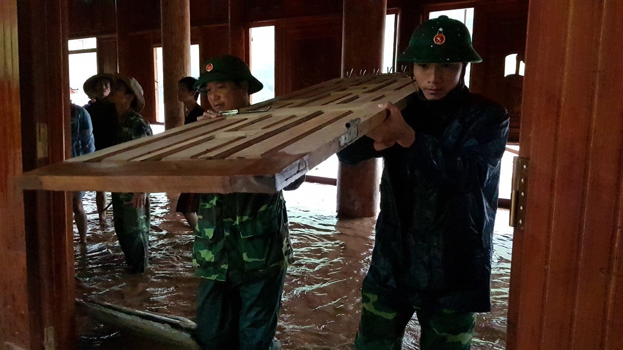
In order to promptly assist people in preventing and mitigating the effects of floods, the My Ly Border Guard Station mobilized its forces to coordinate with the local authorities of the commune to directly visit households and move their belongings to safe places.
In Xop Tu village, the house of Mr. Kha Hong Thuy's family was flooded to a depth of about 30cm and is at risk of collapsing due to its proximity to the riverbank. The My Ly Border Guard Post mobilized forces to help the family move people and property to a safe place.
 |
| Border guards at My Ly Border Post are urgently relocating people's belongings. Photo: Hai Thuong. |
Currently, a section of National Highway 16 at kilometer 353, passing through Xop Tu village in My Ly commune, is flooded to a depth of about 1.5 meters, cutting off traffic for local residents. People have to use boats to get around.
Hai Thuong
Heavy rains caused by Typhoon No. 4 have severely affected the area.Muong Ai and Muong Tip communesAccording to Mr. Lau Ba Nu, Head of the Muong Ai Commune Police, from last night (August 16th) until this morning, many roads in the area have been cut off due to landslides.
Specifically, sections of road through Xop Xang, Nha Nang, Huoi Khe, and Pung villages were completely isolated by landslides from the embankment. In particular, the section from Xop Lau to Pung village, which had only been reopened a little over a week ago, was cut off again this morning.
 |
| Many villages have been cut off due to landslides. Photo: Moong Van Binh |
Currently, heavy rain continues in the Muong Ai area, and coupled with water flowing from upstream, the Nam Tip River is rising rapidly, posing a risk of flash floods, landslides, and mudslides.
"Since last night, the teachers at the school have been preparing their belongings and are always ready to move at any time," said Mr. Le Quynh Luu, Principal of Muong Ai Primary School.
 |
| The Youth Union of Muong Ai commune puts up warning signs about landslides. Photo: Moong Van Binh |
Currently, local authorities have assigned personnel to be on constant alert and placed warning signs at landslide-prone areas to prevent any unfortunate damage from occurring.
Thanh Cuong
Due to prolonged heavy rain, on the morning of August 17th, floodwaters from upstream caused inundation and cut off access to many localities.Tan Ky.
| Floodwaters overflow the Bac Son spillway in Nghia Phuc commune. Video: Truong Thanh |
In Nghia Phuc commune, floodwaters have cut off many sections of the inter-communal road from Nghia Phuc to Dong Van. Floodwaters are rising and flowing rapidly at the Ke Nang and Bac Son spillways.
In Dong Van commune, since this morning, Tan Dong and Nha Tra hamlets have been cut off by floodwaters. Several other highland communes such as Giai Xuan and Tan Hop... have also experienced localized flooding. Many households living in low-lying areas of these communes have been submerged, forcing residents to move food supplies and relocate their homes.
 |
| The road from Nghia Phuc commune to Dong Van commune has been cut off in many sections. Photo: Huy Thu |
In Tien Ky commune, rising water levels in the Than stream are cutting off hamlets 6, 7, 8, and 12 from other hamlets. Many hamlets have been flooded, with five households in hamlet 5 experiencing flooding. Local forces are coordinating with families to move belongings and property, while also monitoring dams in hamlets 1, 2, 4, and 9 to prevent potential dam breaches. Heavy rain is currently falling in the area, causing strong floodwaters.
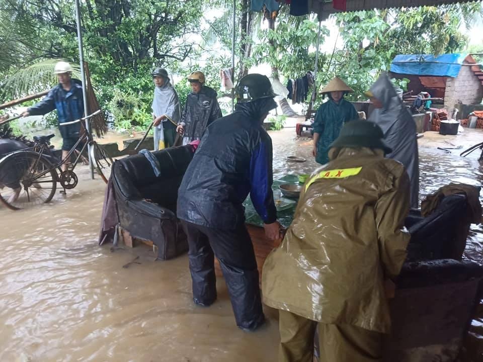 |
| Moving furniture for Mrs. Nguyen Thi Loan's family in Hamlet 1, Tien Ky Commune (Tan Ky District). Photo: Van Tuong |
In the flood-affected communes, local authorities have deployed forces to coordinate with residents in moving belongings. They are also monitoring the situation, setting up warning signs at key traffic points, and urging residents to be vigilant and take precautions against accidents and risks.

