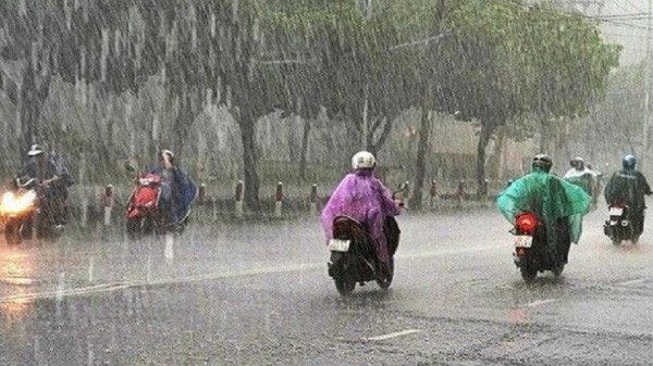
On September 26, Nghe An province had heavy rain, some places over 350 mm.
(Baonghean.vn) - According to the forecast of the North Central Region Hydrometeorological Station, due to the influence of a tropical depression, today (September 26), Nghe An will have heavy to very heavy rain.
NEWS ON TROPICAL LOW PRESSURE ON LAND
1. Current status of tropical depression
Due to the influence of the tropical depression, there has been heavy rain in the North and Central Central regions, some places have had very heavy rain. The rainfall from 7pm on September 25 to 2am on September 26 was over 100mm in some places, such as: Huong Trach (Ha Tinh) 195.4mm...
At Con Co island station (Quang Tri), there are strong winds of level 6, gusting to level 8. Cu Lao Cham (Da Nang) has strong winds of level 7, gusting to level 8. Bach Long Vy island (Hai Phong) and Ly Son (Quang Ngai) have strong gusts of level 7. Coastal areas from Quang Binh to Da Nang have strong gusts of level 6...
At 4:00 a.m. on September 26, the center of the tropical depression was at about 16.6 degrees North latitude; 107.2 degrees East longitude on the mainland of Quang Tri-Thua Thien Hue provinces. The strongest wind near the center of the tropical depression was level 6 (39-49 km/h), gusting to level 7-8. Moving in the West Northwest direction at a speed of about 15 km/h.
2. Forecast of tropical depression (in the next 6 hours):
| Forecast time | Direction, speed | Location | Intensity | Danger zone | Disaster Risk Level (Affected Area) |
| 06h/26/9 | West Northwest, 15 km/h | 16.9N- 106.0E; over Laos. | < level 6 | 16.0-17.5N; West of 108E meridian | Level 3: sea and coastal areas from Quang Binh to Da Nang |
3. Forecast of impacts of natural disasters:
- The sea area from Quang Binh to Da Nang (including Con Co and Cu Lao Cham island districts) and the Gulf of Tonkin has strong winds of level 6, gusts of level 7-8, rough seas.
- The South East Sea area (including the Truong Sa archipelago), the sea area from Binh Thuan to Ca Mau has strong southwest wind level 6, gust level 7-8, rough sea.
- On the morning of September 26, coastal areas from Quang Binh to Da Nang have strong winds of level 6, gusting to level 7; further inland there are gusts of level 6.
- The sea area from Quang Tri to Da Nang (including Con Co and Cu Lao Cham island districts), the sea area of Bac Bo Gulf has waves 2.0-3.0m high.
- South East Sea area (including Truong Sa archipelago waters), sea area from Binh Thuan to Ca Mau, waves are 2.0-4.0m high.
* Weather in North Central region:
- Strong wind:On land there are strong winds of level 2 - level 3, coastal areas have winds of level 3 - level 4, gusts of level 5 - level 6, rough seas.
- Heavy rain:From now until September 28, in the North Central region, there will be heavy to very heavy rain and thunderstorms. Rainfall is likely to reach:
+ Thanh Hoa: 100 - 250 mm, coastal and midland areas have places over 250 mm
+ Nghe An: Mountainous areas 70 -150 mm, some places over 180 mm; Midlands and coastal plains: 100 - 300 mm, some places over 350 mm
+ Ha Tinh: 100 - 300 mm, some places over 350 mm
FORECASTWEATHER ON LAND IN NGHE AN PROVINCE ON SEPTEMBER 26, 2023
* Coastal plain area
Cloudy with heavy to very heavy rain and thunderstorms. Northeast wind level 3-4, gusting to level 5-6.
- Temperature: 25 – 28oC
- Humidity: 85 – 95%
* Midland and mountainous areas
Cloudy with moderate rain. Heavy rain and scattered thunderstorms. Northeast wind level 2.
- Temperature: 24 – 29oC.
- Humidity: 80 – 90%
* Vinh City Area
- Cloudy with heavy to very heavy rain and thunderstorms. Northeast wind force 3.
- Temperature: 25 – 28oC.
- Humidity: 85 – 95%
* Cua Lo and Ngu Island area
Cloudy with heavy to very heavy rain and thunderstorms. Northeast wind level 3 – 4, gusting to level 5.
- Temperature: 25 – 27oC.
- Humidity: 85 – 95%
*Next 48 hours:The tropical convergence zone with its axis through the Central Central region connects with the center of the tropical depression, lifting its axis to the North and gradually strengthening its activity, so Nghe An province has cloudy weather, mountainous areas have moderate to heavy rain, while coastal plains and midlands have heavy to very heavy rain and thunderstorms. East to northeast wind level 2-3, coastal areas have some places level 4.
* During thunderstorms there is a possibility of tornadoes, lightning, hail and strong gusts of wind.

