Cua Lo Town seeks opinions on the planning project for the forest park area east of Binh Minh Street
(Baonghean.vn) - The People's Committee of Cua Lo town has just issued Document No. 580/UBND-DT on collecting opinions from the people and key officials for the detailed construction planning project at a scale of 1/500 for the forest park area east of Binh Minh Street.
According to the planning project just announced by the People's Committee of Cua Lo town, the areaEast park of Binh Minh streetLocated in the area of 4 wards Thu Thuy, Nghi Thu, Nghi Huong and Nghi Hoa, east of Cua Lo town, facing the sea, stretching about 4.4km along the coastline.
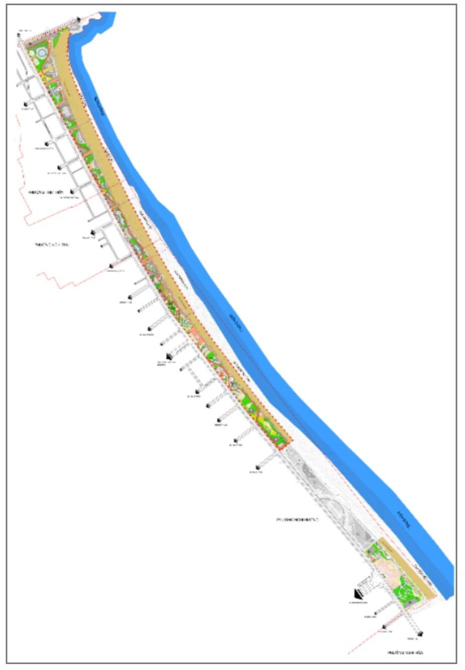 |
Architectural landscape organization diagram of the park area east of Binh Minh Street. Photo: Hiep Cuong |
The park area east of Binh Minh Street has a total area of 735,850m22(about 73.6ha), including two main areas: Area 1 has an area of 60.8ha with a coastline of 3.73km, stretching from Lan Chau island to the coastal park area of Cua Lo Golf Resort project; Area 2 has an area of 12.8ha with a coastline of 0.64km, stretching from the coastal park area of Cua Lo Golf Resort project to the border of Vinpearl Discovery Cua Hoi project.
The North of the park borders crossroad No. 1; the South borders Cua Lo Golf Course Project; the East borders the East Sea; the West borders Binh Minh Street.
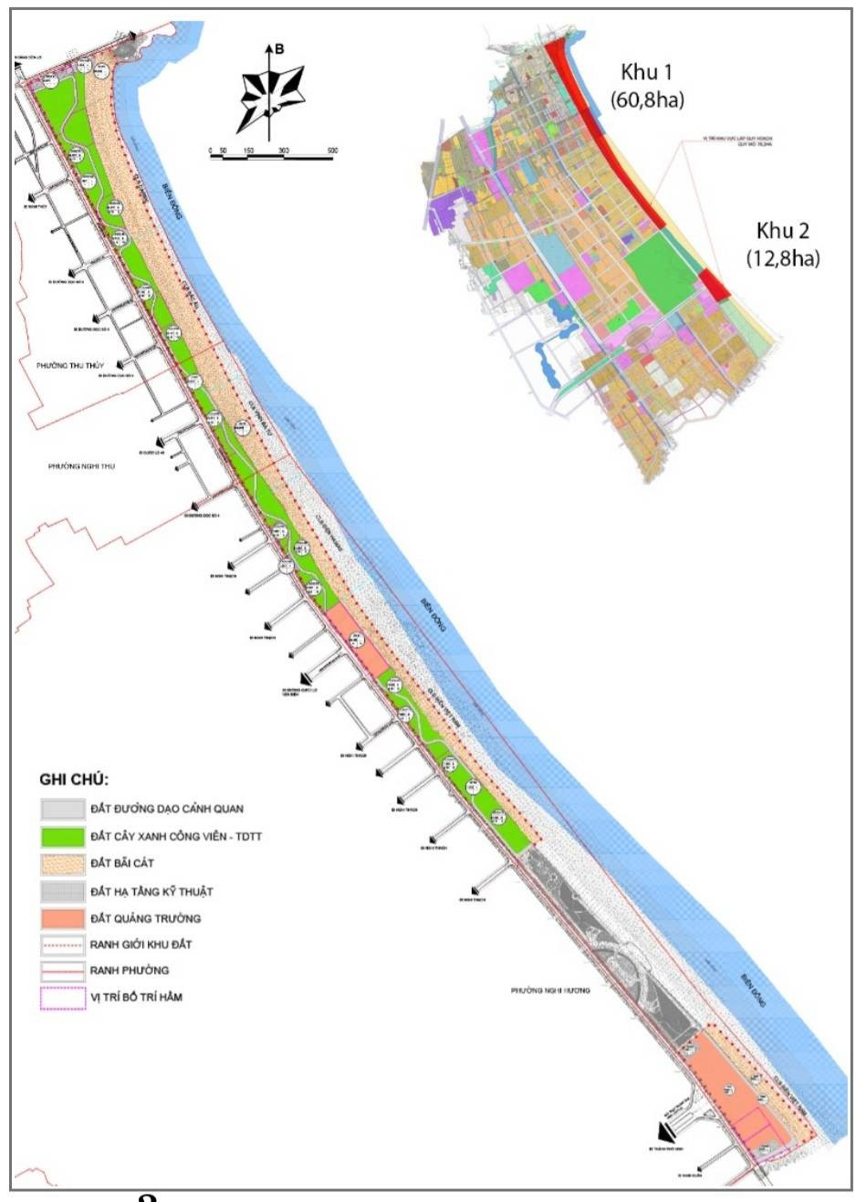 |
Land use planning board of the forest park area east of Binh Minh Street. Photo: Hiep Cuong |
The project clearly states that the planned area will become a coastal park, a beach area, sea tourism services, entertainment, recreation, and cuisine that will be fully invested and built to serve tourists in Nghe An province and visitors from all over.
The objective of the planning project is toxBuild Cua Lo beach to meet the requirements of "Modern, unique, identity, friendly and highly economically efficient", becoming one of the beautiful beaches of the North Central region, to attract tourists to visit, travel, entertain and work, contributing to promoting the socio-economic development of Cua Lo town and Nghe An province.
Serve as a basis for detailed planning, investment projects, construction management, promotion and investment attraction.
 |
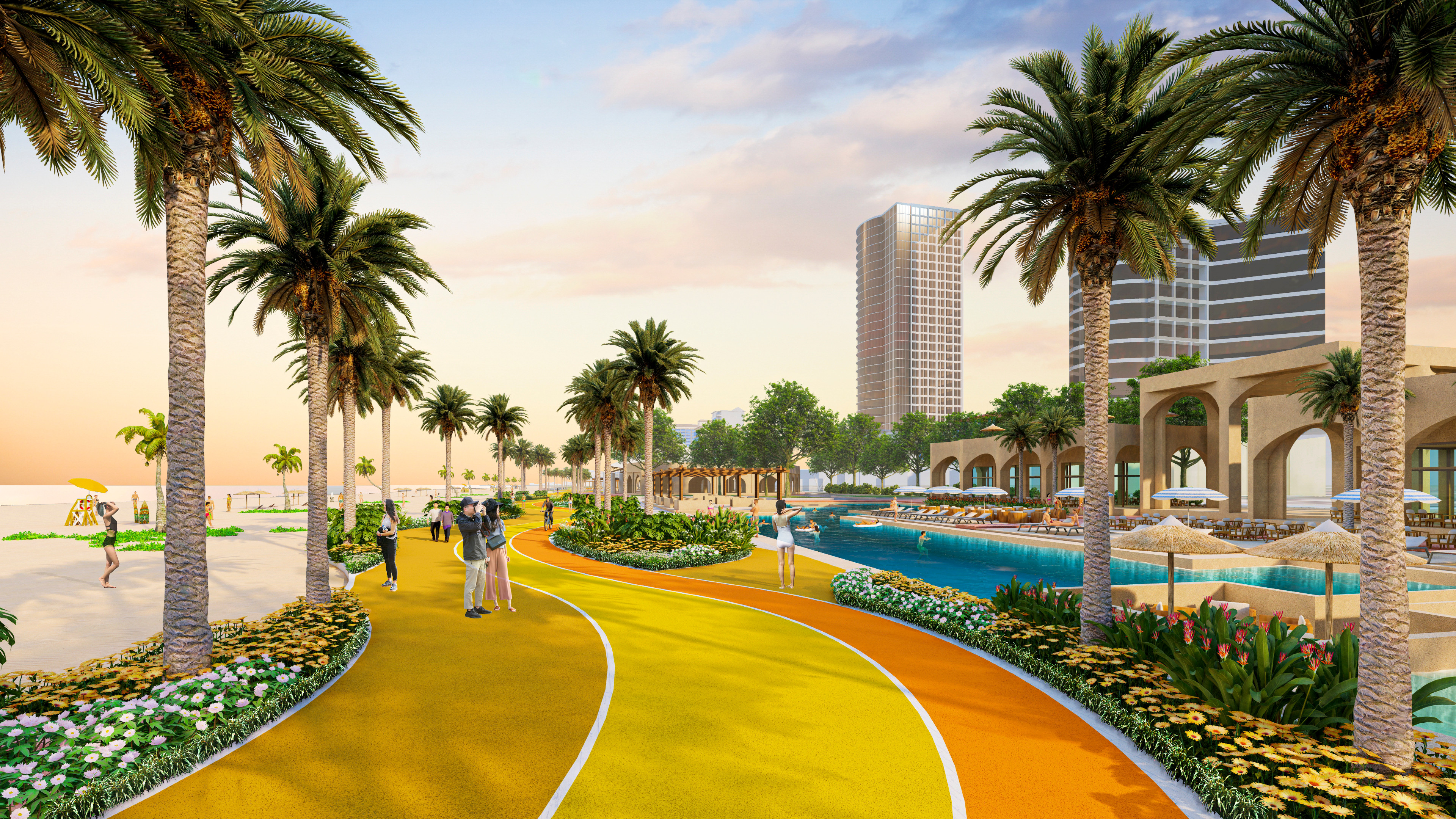
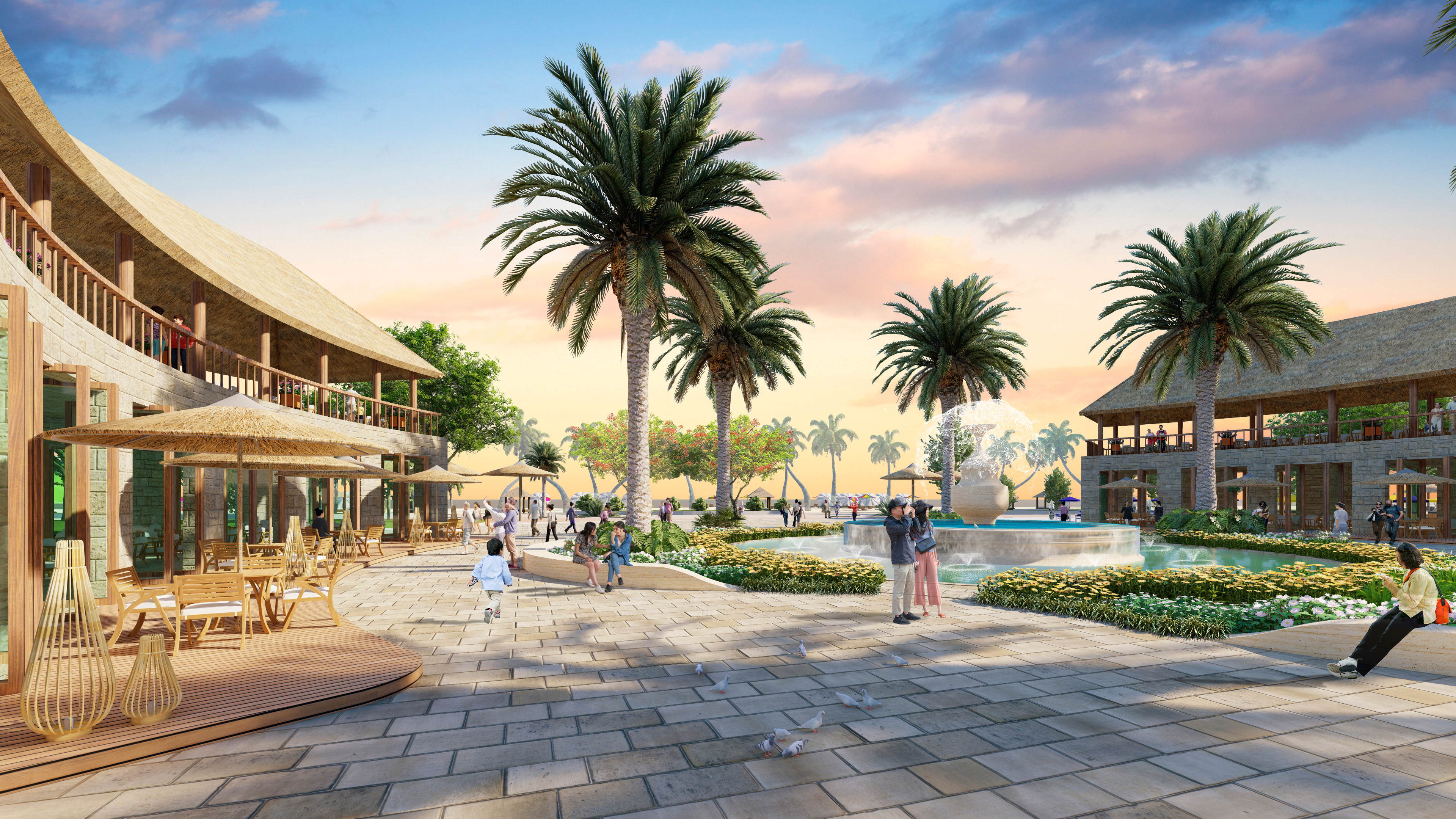
Perspective drawing of Vietnam Sea Club area. Photo: Hiep Cuong |
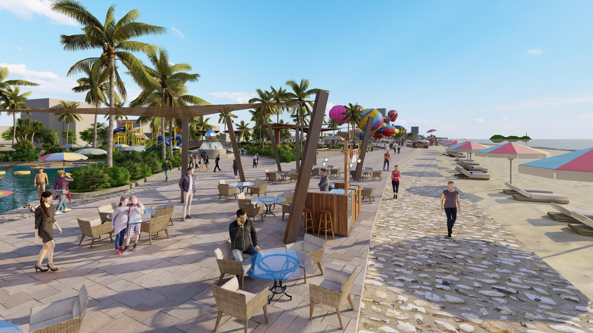
The content of planning istReorganize the public space - mixed services more lively, through the arrangement of alternating green spaces, soft walking paths. Propose the main walking route, connecting the entire length of the coast, soft arrangement interspersed in functional areas.
Add more access, direct connection to the sea squares from the main traffic axes of the urban area. Form a central square, the highlight of the new urban area, welcoming the Vinh - Cua Lo boulevard axis.
Increase public facilities to serve the entertainment needs of the community such as beach club, green park - sports area, parking lot, services in the semi-basement area are built in connection with functional areas above ground.
 |
Perspective drawing of Persian Sea Club area. Photo: Hiep Cuong |
 |
Perspective drawing of the Caribbean Sea Club. Photo: Hiep Cuong |
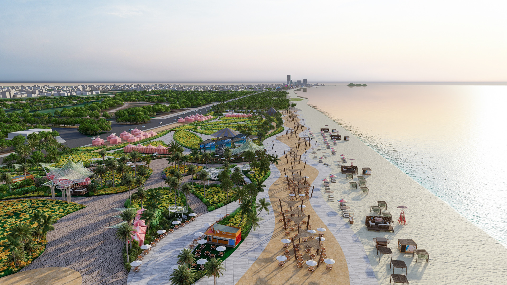
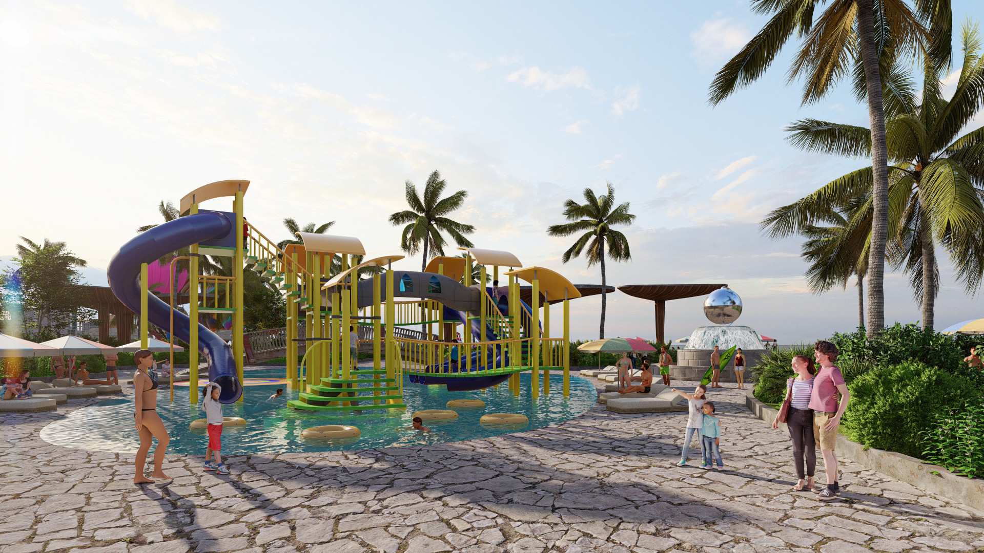
The Planning Project clearly states that the park area east of Binh Minh Street is divided into 5 functional sub-areas, which are 5 beach club areas with diverse landscape architectural styles and themes, in order from North to South as follows: Caribbean Beach Club Area (Beach Club, service complex, water music space, ...); Northern Europe Beach Club Area (Beach Club, service complex, children's play area, ...); Persian Beach Club Area (Beach Club, service complex, saltwater swimming pool, ...); Hawaii Beach Club Area (Beach Club, culinary festival area, coastal sports, ...); Vietnam Beach Club Area (Beach Club, service complex, square, stage, ...).
 |
Perspective drawing of the Nordic Sea Club area. Photo: Hiep Cuong |
 |
Perspective drawing of Hawaii Beach Club area. Photo: Hiep Cuong |
In total land area of 735,850m2, the square land has an area of 101,320m22(ratio 13.8%); land for green trees, parks and sports 249,707m2(ratio 33.93%); Technical infrastructure land 20,302m2(2.67% ratio); Landscape walking land 50,035m2(ratio 6.8%); Sandbank land 314,304m2(rate 42.71%).
Regarding architectural planning criteria, the maximum height in the entire park is 2 floors; construction density is about 2.6% (maximum 3%); construction floor area: about 34,500m2.
Information in Document No. 580/UBND-DT, implementing the tasks assigned by the Provincial People's Committee in Decision 362/QD-UBND dated February 12, 2020, Cua Lo Town People's Committee has taken steps to select a consulting unit to prepare a detailed planning project at a scale of 1/500 for the forest park area east of Binh Minh Street.
The planning project has been publicly announced for comments at the headquarters of the People's Committees of the wards, Binh Minh Square and Sea Daisy Park. Pursuant to the Construction Law, the People's Committee of Cua Lo town coordinated with the consulting unit to continue to publicly announce the planning project (by sending drawings to the wards and blocks) so that the People's Committees of Nghi Huong, Nghi Thu and Thu Thuy wards could publicly announce and collect comments from key staff of the wards, and send them to the blocks to collect comments from the people.
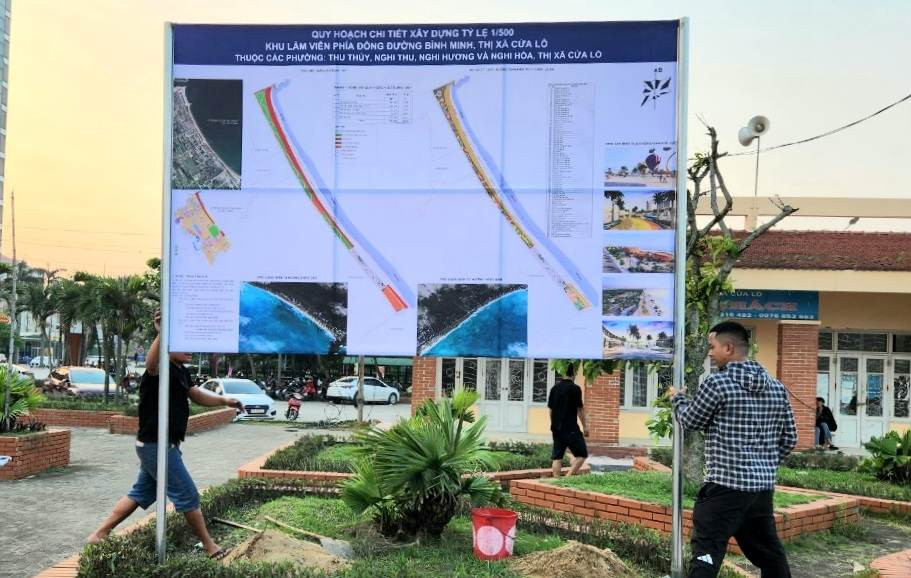 |
Currently, the detailed construction planning project at a scale of 1/500 for the forest park area east of Binh Minh Street has been publicly announced by the People's Committee of Cua Lo town on large boards in public spaces to collect public comments. Photo: Hiep Cuong |
The People's Committee of Cua Lo town also assigned the People's Committees of Nghi Huong, Nghi Thu and Thu Thuy wards to synthesize the opinions of the people and the opinions of key officials in the wards by collecting opinions before May 13, 2023 to synthesize and edit the planning project before asking for opinions from the Provincial People's Committee, submitting to relevant departments, branches and sectors for appraisal and approval according to regulations./.