Low pressure area appears in the northern region of Bac Bo Gulf
(Baonghean.vn) - According to the National Center for Hydro-Meteorological Forecasting, due to the influence of low pressure circulation in the Gulf of Tonkin, there will be showers and thunderstorms. During thunderstorms, it is necessary to be on guard against strong gusts of wind of level 7. In the North and North Central provinces, there will be heavy to very heavy rain. Disaster risk level: level 1.
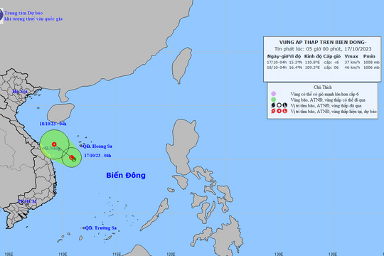
Currently (August 30), there is a low pressure area on the low pressure trough with an axis of 20-23 degrees North latitude. The center of the low pressure area (at 05:00) is at about 20.5-21.5 degrees North latitude; 106.5-107.5 degrees East longitude, right on the sea area north of the Gulf of Tonkin.
Forecast for the next 24 hours,The low pressure area tends to move slowly to the west.
 |
| Ky Son district (Nghe An) established inspection teams and directed functional forces to help people evacuate their houses and properties to avoid landslides. Photo: Lu Phu |
FLASH FLOOD AND LANDSLIDE WARNING
Last night in the North and North Central regions, there was moderate rain, heavy rain, and in some places very heavy rain with common rainfall ranging from 50-100mm, in some places higher such as Viet Tri (Phu Tho) 107mm, in Huu Lung (Lang Son) 142mm, Cau Son (Bac Giang) 202mm, Luc Nam (Bac Giang) 133mm Quang Ha (Quang Ninh) 166mm,...
Water levels on Luc Nam River at Luc Nam and Thuong River at Phu Lang Thuong are rising. At 3:00 a.m. on August 30, water levels at Luc Nam: 4.95m (above BĐ1: 0.65m); water levels at Phu Lang Thuong: 4.76m (above BĐ1: 0.46m).
Forecast:Water levels at Luc Nam and Phu Lang Thuong will continue to rise and are likely to reach 5.3m (level BĐ2) on the afternoon of August 30. Disaster risk warning level: Level 1.
Warning:From August 30 to September 1, in the North and North Central regions, there will be a flood, with flood levels on the following rivers: Central and upper reaches of Ma River, Ca River, Thai Binh River from 3-6m; upper reaches of Thao River, Da River, Lo River, Hoang Long River and lower reaches of Ma River, Ca River, Thao River and Thai Binh River from 2-4m, Hoang Long River and Lo River from 1-3m.
During this flood, the flood peak on Buoi River reached level BĐ3; Thao River reached level BĐ2; Da River, Hoang Long River, Ca River and the upper Ma River reached levels BĐ1-BĐ2; other rivers were at level BĐ1 and below BĐ1.
High risk of landslides and flash floods in mountainous areas of the North and North Central regions, especially in provinces such as:Hoa Binh, Phu Tho, Yen Bai, Lao Cai, Lai Chau, Dien Bien, Son La, Ha Giang, Tuyen Quang, Lang Son, Cao Bang, Bac Kan, Thanh Hoa and Nghe An. Flooding in low-lying areas, especially in the Northeast and Northern Delta.
Warning level of natural disaster risk due to floods, flash floods, landslides in mountainous areas of the North and North Central regions:level 1, for provinces onlyHoa Binh, Phu Tho, Yen Bai, Lao Cai, Lai Chau, Dien Bien and Son La:level 2.


