Typhoon No. 13 has just dissipated, but the East Sea is at risk of facing an extremely powerful Typhoon No. 14.
Typhoon No. 13 has just weakened, but the South China Sea may be hit by Typhoon No. 14, Fung Wong, with super-strong winds and a complex trajectory.
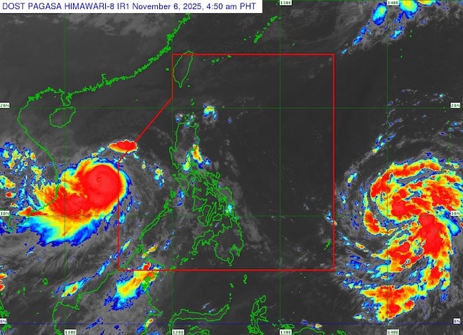
After Typhoon No. 13 dissipated, international forecasting models showed that the tropical depression off the coast of the Philippines had strengthened into Typhoon Fung Wong – the 26th typhoon in the Western Pacific in 2025.
According to the Japan Meteorological Agency (JMA), Typhoon Fung Wong is moving northwest and is likely to enter the northern South China Sea around November 11th, becoming the 14th typhoon to affect Vietnam.
Although Typhoon No. 13 has weakened, the weather situation in the South China Sea remains very unstable. Experts predict that Fung Wong could rapidly intensify, affecting the northern part of the South China Sea by mid-November.
According to the latest forecasts, Typhoon Fung Wong is expected to move slowly, changing direction to the west-northwest under the influence of a subtropical high-pressure system.
Although the likelihood of a direct landfall in Vietnam is not high, the recent Typhoon No. 13 has already caused considerable instability in the sea area. If Fung Wong enters the South China Sea, the northern and central parts of the South China Sea could experience strong winds, heavy rain, and rough seas.
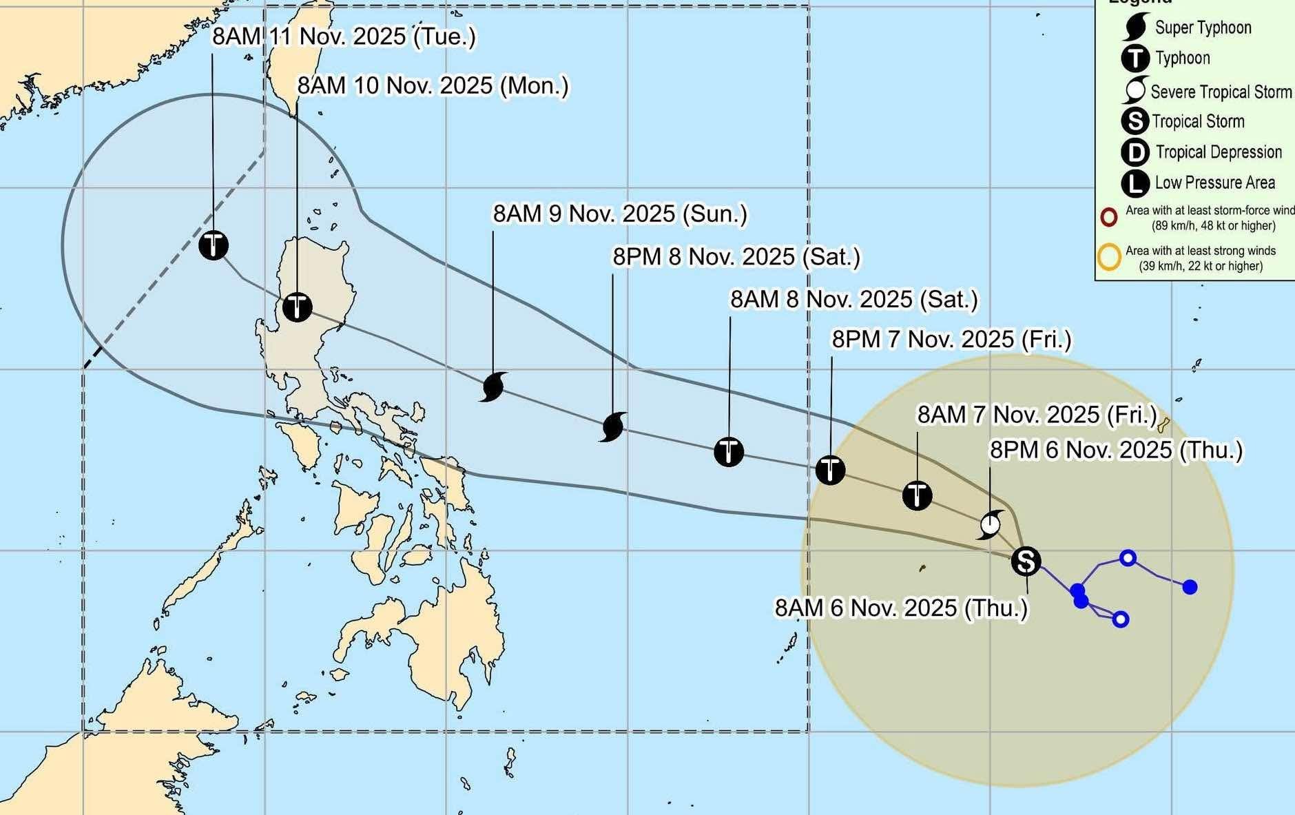
Data from the Joint Typhoon Warning Center (JTWC) indicates that, at the time of its initial landfall, Fung Wong could reach wind speeds of up to 215 km/h – a super typhoon. While its intensity would decrease as it passed over the mountainous terrain of Luzon (Philippines), the typhoon would maintain considerable strength upon returning to the South China Sea.
According to expert Le Thi Xuan Lan, climate change is occurring very strongly in 2025, which may be the reason for the frequent occurrence of typhoons number 13 and 14.
She stated that solar radiation is fluctuating unusually, contributing to increased storms in the Asian region, especially in Vietnam, which is directly affected by the tropical monsoon.
The sudden change in radiation is causing the climate to become erratic, potentially extending the 2025 rainy and typhoon season and resulting in more frequent typhoons (Typhoon No. 13 and No. 14) with more complex trajectories than in previous years.
The National Center for Meteorological and Hydrological Forecasting is closely monitoring the developments of Typhoon Fung Wong. The agency stated that it is highly likely to be the 14th typhoon to form in the East Sea this year. However, current models do not indicate the possibility of the typhoon making landfall in Vietnam.
Nevertheless, following the recent Typhoon No. 13 which caused widespread heavy rain, coastal provinces in Northern and North Central Vietnam are advised to proactively update information, maintain contact with fishermen operating offshore, and prepare response plans should Typhoon No. 14 enter the East Sea.

