Storm No. 3 - Son Tinh weakens and then dissipates on the mainland of Nghe An
(Baonghean.vn)- At around 0:00 on July 19, Storm No. 3 - Son Tinh made landfall in Thanh Hoa - Nghe An provinces, then weakened into a tropical depression. Nghe An area continued to have heavy rain.
|
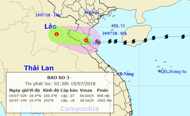
| Storm No. 3 - Son Tinh loses intensity and gradually dissipates over land. Photo:NCHMF. |
On the night of July 18, the storm made landfall in Nghe An and gradually dissipated. Thanh Hoa, Nghe An and Ha Tinh had heavy rain (70-130 mm). Coastal areas from Thai Binh to Ha Tinh had strong winds of level 6, gusting to level 7-8; Hon Ngu island had gusts of level 9; Tinh Gia and Ngoc Tra (Thanh Hoa) had gusts of level 9.
Due to the impact of the storm, the provinces in the Northern Delta and midlands, from Thanh Hoa to Quang Binh provinces will have very heavy rain that will last until about July 20. The average rainfall is 100-300 mm/period, in some places over 350 mm.
 |
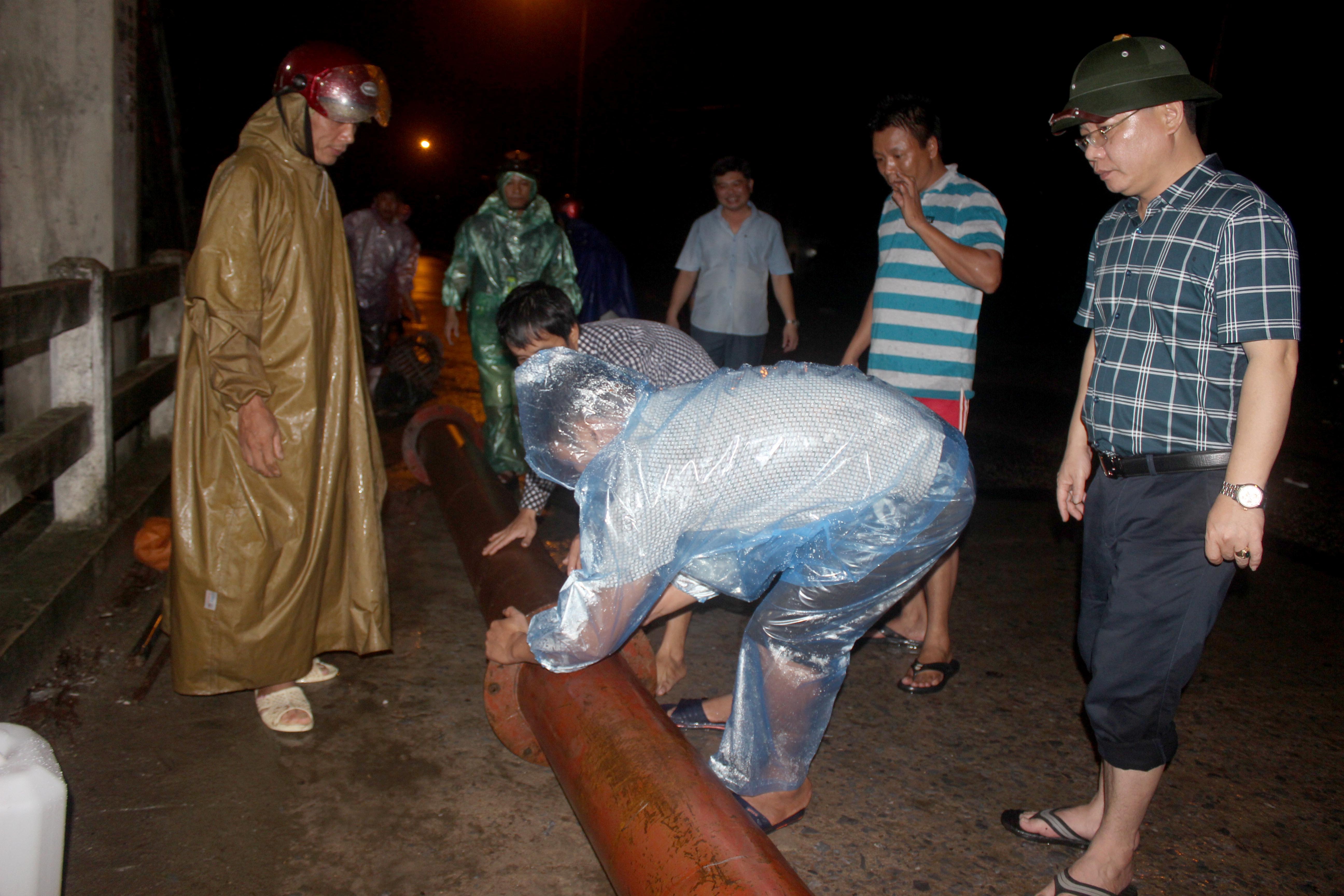
| Provincial Party Secretary Nguyen Dac Vinh inspected storm prevention in Quynh Luu district and asked people to absolutely not take shelter on ships or boats when the storm hits. Photo: Thu Huyen. |
Before storm No. 3 made landfall, Nghe An province's leaders and relevant agencies directed local people to proactively respond to the storm. Secretary of the Provincial Party Committee Nguyen Dac Vinh directly inspected vulnerable areas in Quynh Luu and Dien Chau. Standing Deputy Secretary of the Provincial Party Committee Nguyen Xuan Son was directly present at Nghi Loc sea area to direct storm prevention; Chairman of the Provincial People's Committee Nguyen Xuan Duong directly inspected storm response in Vinh city and Hung Nguyen district; Vice Chairman of the Provincial People's Committee Dinh Viet Hong directed storm prevention and control in Hoang Mai town.
 |
| Standing Deputy Secretary of the Provincial Party Committee Nguyen Xuan Son inspected storm prevention work No. 3 at the DKC Petroleum Depot. Photo: Nhat Tuan |
On the afternoon of July 18, the Chairman of the Provincial People's Committee issued two urgent dispatches directing localities and units to proactively prepare on-site plans to prevent and combat storm No. 3.
 |
| Chairman of the Provincial People's Committee Nguyen Xuan Duong inspects Hung Nguyen district. Photo: Quang An. |
Before the storm made landfall, coastal localities including Hoang Mai, Quynh Luu, Dien Chau, Nghi Loc, and Cua Lo Town had completed the evacuation of nearly 3,500 households with more than 15,000 people to safety; more than 3,800 ships and boats with more than 18,000 marine workers of the province had sought safe shelter from the storm.
 |
| The storm made landfall directly in Quynh Luu, causing many trees to fall. Photo: Thanh Toan. |
 |
Fishing boats of fishermen in Quang Binh province are supported to move to a safe storm shelter. Photo: Hai Thuong. |
Authorities such as the army, police, border guards and localities have proactively developed plans to help people prevent and fight the storm. Notably, right before the storm made landfall, Nghe An border guards successfully towed a fishing boat with license plate number QB 93532 TS of fishermen from Quang Binh province that had a broken engine and could not move to avoid the storm at Cua Hoi beach...
 |
| Installing field pumps at night to drain water for Vinh market area. Photo: Quang An. |
On the night of July 18, authorities also installed many field pumps around Vinh market area to be ready to drain water if flooding occurs due to heavy rain before and after the storm makes landfall.
According to records, on the morning of July 19, there was heavy rain in Nghe An, many areas were flooded. The North Central Hydrometeorological Center reported that storm No. 3 had weakened into a tropical depression.At 4:00 a.m. on July 19, the center of the tropical depression is located at about 19.0 degrees North latitude; 105.2 degrees East longitude, on the mainland of Nghe An and Thanh Hoa provinces. The strongest wind near the center of the tropical depression is level 6-7 (40-60km/hour),level 8-9
Forecast for the next 12 hours, the tropical depression moved westward, traveling 20-25km per hour, moving deep into the mainland and gradually weakening into a low pressure area. By 4:00 p.m. on July 19, the center of the low pressure area was at about 19.5 degrees North latitude; 102.0 degrees East longitude, on the mainland of Central Laos. The strongest wind in the center of the low pressure area decreased to below level 6 (below 40km/hour).
Due to the influence of low pressure, early this morning in the Gulf of Tonkin there are strong winds of level 6-7,level 8-9, waves 2-4m high; rough sea.
Formed from a tropical depression off the coast of Luzon Island (Philippines) on July 16 and moving rapidly into the East Sea, storm No. 3 (international name Son Tinh) moved almost straight west. The storm crossed Hainan Island (China) and aimed at the North Central region with the strongest wind reaching level 9, gusting to level 11.


.jpg "Nghệ An: Lễ khai giảng đặc biệt ở xã biên giới bị thiệt hại nặng nề nhất sau bão số 3")


: cách Nghệ An khoảng 185km về phía Đông Đông Nam")
.jpg "Gần 5 tỷ đồng hỗ trợ học sinh Nghệ An bị ảnh hưởng bão số 3")