Coastal localities of Nghe An respond to storm Conson
(Baonghean.vn) - Before the development of storm Conson that may make landfall in the area, coastal localities of Nghe An are focusing on response plans.
According to the forecast of the National Center for Hydro-Meteorological Forecasting,Typhoon Consonis forecast to hit the North Central provinces in the coming days, with strong winds and heavy rain. Currently, coastal localities in Nghe An are proactively developing response plans, including identifying areas that may be most affected.
* In order to respond and minimize the impact of storm Conson,Quynh Phuong Border Guard Station (Nghe An Border Guard)Coordinate with local authorities and functional forces to actively inform, propagate, count, and call on vehicles of Hoang Mai town operating in dangerous areas to return to safe storm shelters.
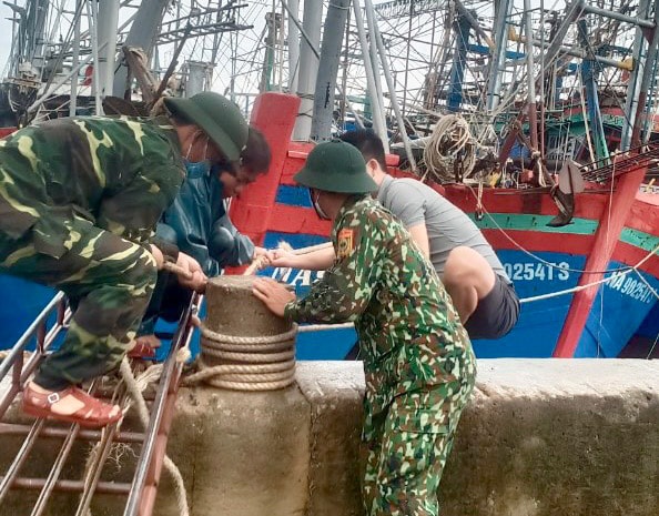 |
| Officers of Quynh Phuong Border Guard Station help vehicle owners anchor ships and boats at wharves and beaches to avoid storm Conson. Photo: Hung Phong |
According to statistics up to 10:00 a.m. on September 9, in Hoang Mai town, there were a total of 1,039 vehicles with 6,280 workers. Of which, the total number of ships and boats anchored at the port was 910 vehicles/5,541 workers (2 vehicles/17 local workers anchored at Binh Chau Gate - Vung Tau City, Ba Ria - Vung Tau Province).
There are 39 remaining vehicles with 290 workers operating in the Gulf of Tonkin; 5 vehicles with 12 workers operating along the coast of Nghe An province and 85 vehicles with 437 workers operating in the sea areas of Quang Tri, Da Nang, Quang Nam, Quang Ngai, Binh Dinh provinces...
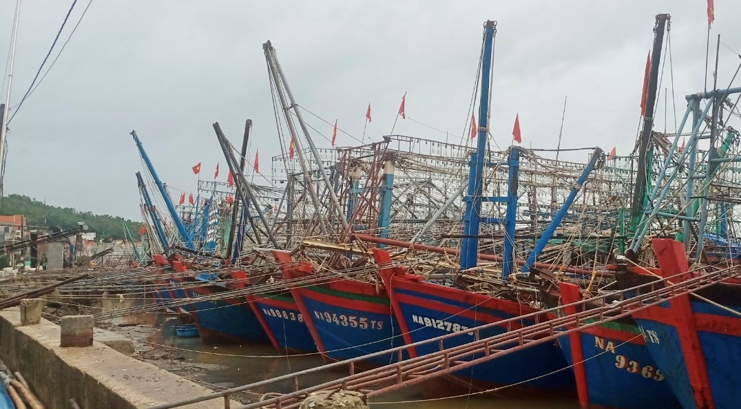 |
| Vehicles have safely anchored to avoid the storm at wharves in Hoang Mai town. Photo: Hung Phong |
All vehicles that have not yet anchored are not in the danger zone and have received information about the storm's path and affected area and have plans to move to avoid the storm safely.
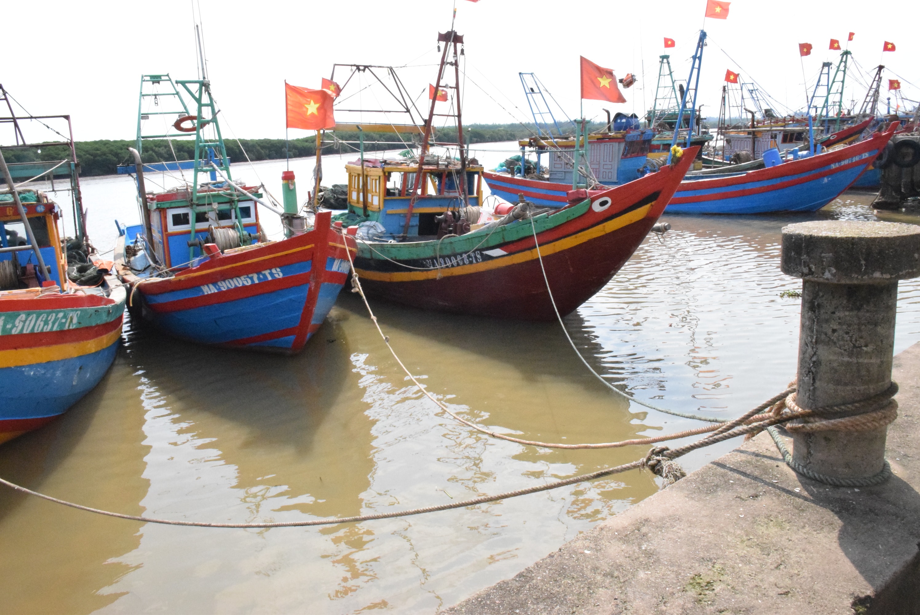 |
| Fishermen proactively moved their boats to safe anchorage positions before the storm hit. Photo: Xuan Hoang |
* Hoang Mai Townis a locality that could be greatly affected by the upcoming storm Conson. Mr. Hoang Ngoc Thuy - Head of Economic DepartmentHoang Mai townsaid, the biggest concern for Hoang Mai town right now is that there are still over 100 boats out of a total of over 1,000 boats operating at sea. In order for 100% of the boats to anchor safely before the storm hits, on the morning of September 9, localities continued to issue notices to ship owners to urgently move their boats back to the mainland. In addition, localities and people focused on human resources to tie down coastal houses, trim tree branches...
*As of this morning (September 9),the whole district of Quynh LuuMore than 500 offshore fishing vessels returned to the fishing port and anchored safely; the remaining vessels anchored at other local fishing ports. During the return trip to avoid storm Conson, fishermen caught more than 2,000 tons of seafood.
The area also has large vegetable growing areas and many coastal tourist spots, so the district is urgently directing localities to focus on storm prevention work against Conson.
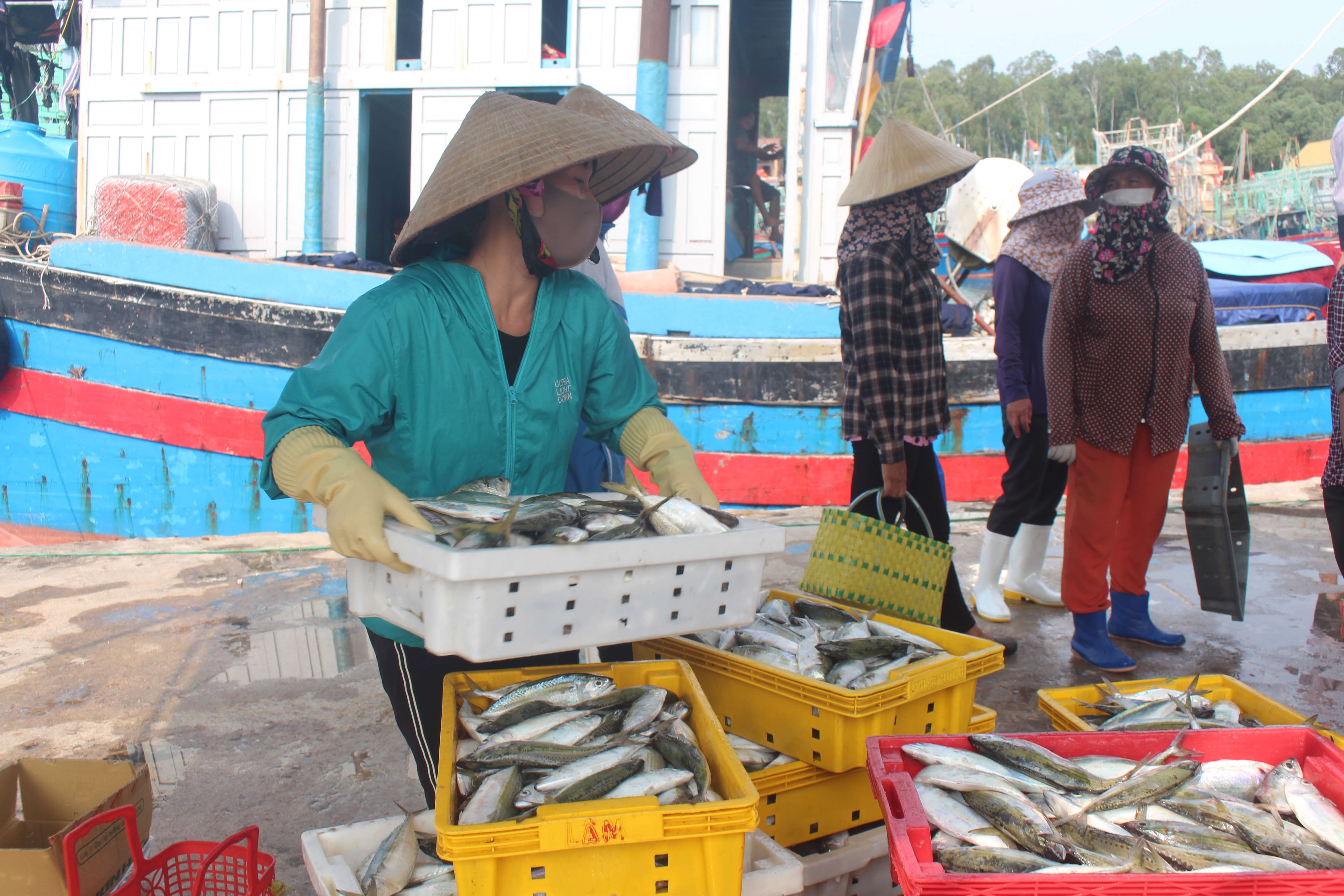 |
| Quynh Luu boats return to avoid the storm carrying lots of seafood. Photo: Viet Hung |
Ms. Vu Thi Bich Hang - Head of the District's Department of Agriculture and Rural Development said that the biggest concern is that more than 400 hectares of vegetables will be flooded due to heavy rain; some summer-autumn rice areas have not been harvested; then there are houses, restaurants, and kiosks at coastal tourist spots. As for boats, fishermen are currently on their way back to the mainland.
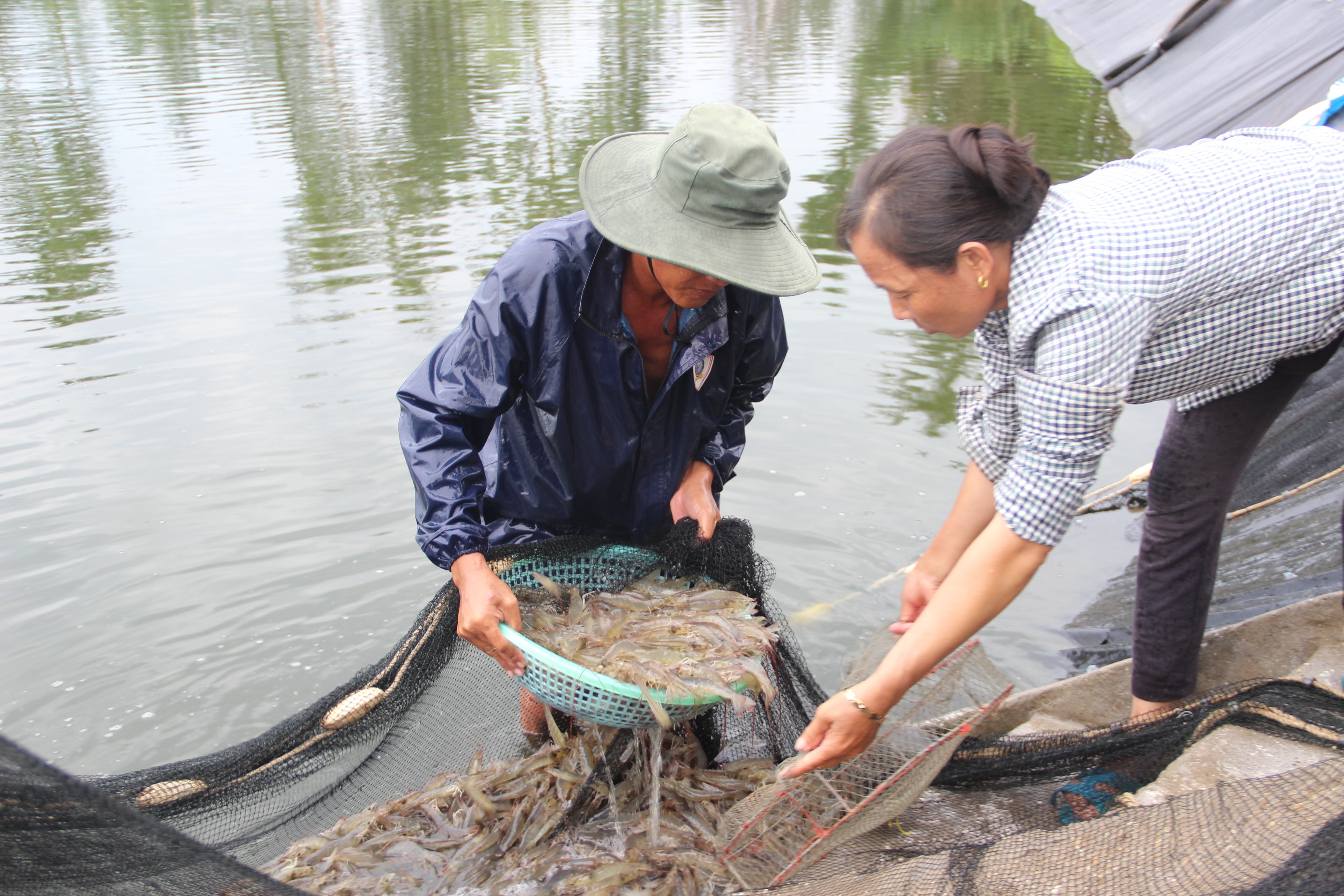 |
| Farmers harvested shrimp areas that were ready for harvest before the storm hit. Photo: Q.An |
To minimize damage caused by storms, the district is currently directing localities to urgently harvest summer-autumn rice, tie down houses and warehouses, prune tree branches, and implement plans to reduce losses when water levels rise in ponds and lakes.aquacultureQuynh Luu district also checked the operation of regulating sluices and drainage channels; Notified ship owners to move their boats to safe anchorages.
"The biggest concern is that hundreds of hectares of vegetables in the coastal areas will be flooded and cause damage if it rains heavily for a long time. Therefore, in addition to dredging the main drainage channels, localities are instructing people to remove the banks to drain the fields immediately after the rain stops to quickly drain the water," said Ms. Vu Thi Bich Hang.
* Dien Chau DistrictAt this time, many winter crops have been planted, so if storm Conson makes landfall in the area, it will affect thousands of hectares of crops. According to Mr. Le The Hieu - Head of the District's Department of Agriculture and Rural Development, the most worrying thing about storm Conson is the 1,800 hectares of winter corn in the 5-6 leaf stage and 900 hectares of peanuts in the flowering period. If the storm makes landfall, accompanied by heavy rain, thousands of hectares of these crops will be damaged.
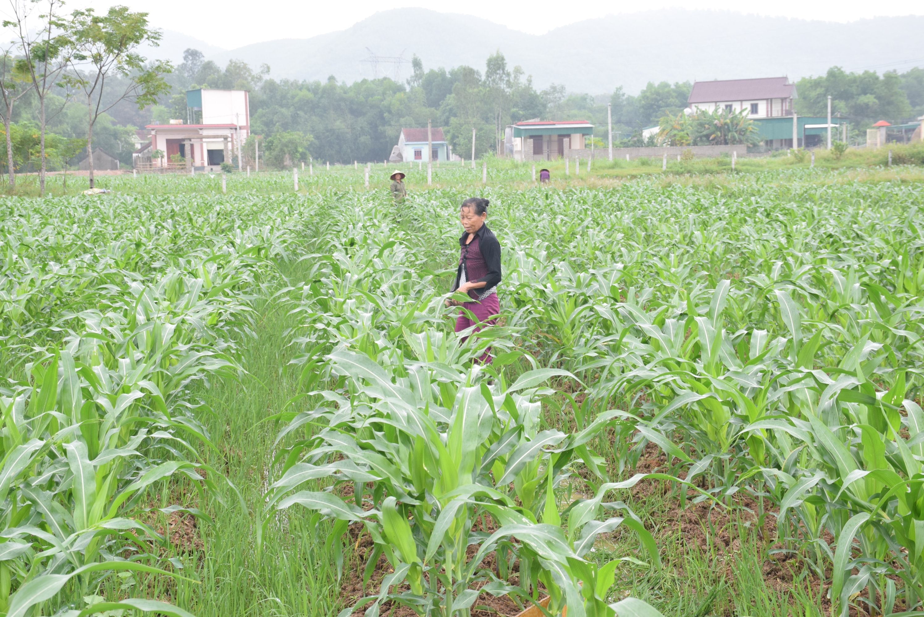 |
| 1,800 hectares of winter corn in Dien Chau are at the 5-6 leaf stage, if a storm comes with strong winds it will be damaged. Photo: Xuan Hoang |
PresentDien ChauThere are 100 hectares of ponds and lakes where summer-autumn shrimp are being raised and are nearing harvest time. To minimize damage, the district has been propagating and instructing people to cover ponds with nets, and to harvest any ponds that can be harvested...
According to the National Center for Hydro-Meteorological Forecasting, at 4:00 a.m. on September 9, the eye of the storm was located at about 15.7 degrees North latitude; 118.8 degrees East longitude, about 780 km East Southeast of Hoang Sa archipelago. The strongest wind near the eye of the storm is level 9 (75-90 km/h), gusting to level 11. The radius of strong winds from level 6, gusting to level 8 or higher is about 120 km from the eye of the storm. It is forecasted that in the coming days, the storm will move to the coast of the North Central provinces.

.png "Nghệ An vươn lên thứ 4 cả nước về Chỉ số sản xuất công nghiệp 8 tháng năm 2025")


.jpg "Cần đẩy nhanh tiến độ tái định cư cho người dân khu chung cư Quang Trung cũ")

