Update on low pressure area in the East Sea that is likely to strengthen
(Baonghean.vn) - At 1:00 a.m. this morning (August 8), the low pressure area was located at about 15.4-16.4 degrees North latitude; 113.9-114.9 degrees East longitude, about 210-310km southeast of Hoang Sa archipelago.
Forecast for the next 24 hours,The low pressure area moves slowly in a north-northwest direction andhave the potential to become strongerAt 1:00 a.m. on August 9, the center of the low pressure area was located at about16.3-17.3 degrees North latitude; 112.9 -113.9East longitude, in the area east of the Paracel Islands.
 |
| Warning of showers and thunderstorms at sea. Illustration photo |
Due to the influence of the low pressure area, during the day and tonight (August 8), in the southern sea area of the North East Sea (including the sea area of Hoang Sa archipelago), the central East Sea area will have showers and heavy thunderstorms, with strong gusts of wind at level 8.
In addition, due to the influence of the tropical convergence zone combined with the strong southwest monsoon, during the day and tonight, in the central and southern East Sea (including the waters of Truong Sa archipelago), the sea from Binh Thuan to Ca Mau will have strong southwest winds at level 6, gusting to level 8, waves from 2-4m high; rough seas.
The South China Sea (including the Truong Sa archipelago), the sea areas from Binh Thuan to Ca Mau, Ca Mau to Kien Giang and the Gulf of Thailand will have heavy thunderstorms. There is a possibility of tornadoes and strong gusts of wind during thunderstorms.Disaster risk level due to strong winds and big waves: level 1.
WARNING OF FLASH FLOODS, LANDSCAPES, LOCAL FLOODING IN NGHE AN
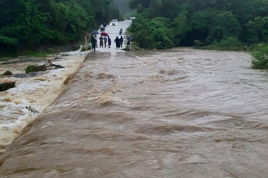
According to the bulletin of the National Center for Hydro-Meteorological Forecasting issued at 2:15 a.m. today (August 8), in the past 3 hours, some places in Nghe An, Kon Tum, Gia Lai and Dak Nong provinces have had heavy to very heavy rain.
Rainfall at some stations is as follows: Se San 4 hydropower plant: 87.4mm, Lang Mit Kom II, Ia O: 26.4mm (Gia Lai), Ia Toi commune: 28mm (Kon Tum), Dak Ru: 40.2mm, Dak Sin: 52mm (Dak Nong), Na Loi: 33.2mm, Coc Na: 24mm/1 hour (Nghe An).
In the next 3 hours, these areas will continue to have moderate to heavy rain, with some places having very heavy rain.
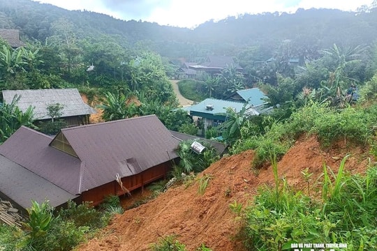
Warning:In the next 3-6 hours, there is a high risk of flash floods, landslides on small rivers and streams in mountainous areas and localized flooding in low-lying areas in Nghe An, Gia Lai, Kon Tum and Dak Nong provinces, especially in Ky Son, Tuong Duong, Con Cuong, Que Phong, Quy Chau districts (Nghe An), Ia Grai (Gia Lai); Tumorong, Ia H'Drai (Kon Tum), Dak R'Lap, Tuy Duc (Dak Nong).Disaster risk level: Level 1.
HEAVY RAIN IN A WIDE AREA FROM DA NANG TO BINH THUAN, CENTRAL HIGHLANDS AND THE SOUTH
According to the bulletin of the National Center for Hydro-Meteorological Forecasting issued at 3:30 am today (August 8), due to the influence of the tropical convergence zone combined with the strong southwest monsoon, during the day and night of yesterday (August 7), in the Central Highlands and the South, there was rain, moderate rain, and heavy rain in some places such as: Dong Phu (Binh Phuoc) 103mm, ....
Currently (August 8),The tropical convergence zone has an axis at about 14-17 degrees North latitude connecting with the low pressure area located at 1:00 a.m. this morning at 15.4-16.4 degrees North latitude; 113.9 -114.9 degrees East longitude, the Southwest monsoon in the South continues to be strong.
Forecast:Due to the influence of the tropical convergence zone and low pressure area combined with the strong southwest monsoon, from now until August 9, in the provinces from Da Nang to Binh Thuan, there will be showers and scattered thunderstorms; the Central Highlands and the South will have rain, moderate rain, heavy rain in some places and scattered thunderstorms. During the thunderstorms, there is a possibility of tornadoes, whirlwinds and strong gusts of wind.Disaster risk level due to heavy rain: level 1.


.png)

.jpg)


