Flash floods - the 'disaster' that devastated the western region of Nghe An
(Baonghean.vn) - After the horrific flash flood in Ky Son on the night of October 1 and early morning of October 2, many people asked the question, when will similar tragedies stop happening again...
Natural "disaster"
According to many hydrometeorological experts, flash floods are extreme flow phenomena when a huge volume of water moves rapidly from high to low terrain. Because the fast-flowing water carries many materials such as soil, rocks, and trees along the way, it has great destructive power. That is why it is considered a dangerous form of "disaster" that can severely devastate mountainous areas, where this type of natural disaster often occurs.
In Nghe An, for the past 10 years or so, there have been continuous flash floods.flash floods wreak havocin many localities. The most serious was the flash flood in Nam Giai commune (Que Phong) in October 2007, which swept away 13 people in Puc and Meo villages.
In Yen Tinh commune (Tuong Duong), the flash flood on the night of May 26, 2009 also killed 5 people in Pa Ty village. In addition, in 2011, 2013, 2018... many flash floods also occurred in Ky Son, Tuong Duong, Quy Hop districts, causing much loss and pain. The flash flood on the night of October 1st to the early morning of October 2nd in Ta Ca commune and Muong Xen town, Ky Son district recently left behind consequences that have yet to be overcome.
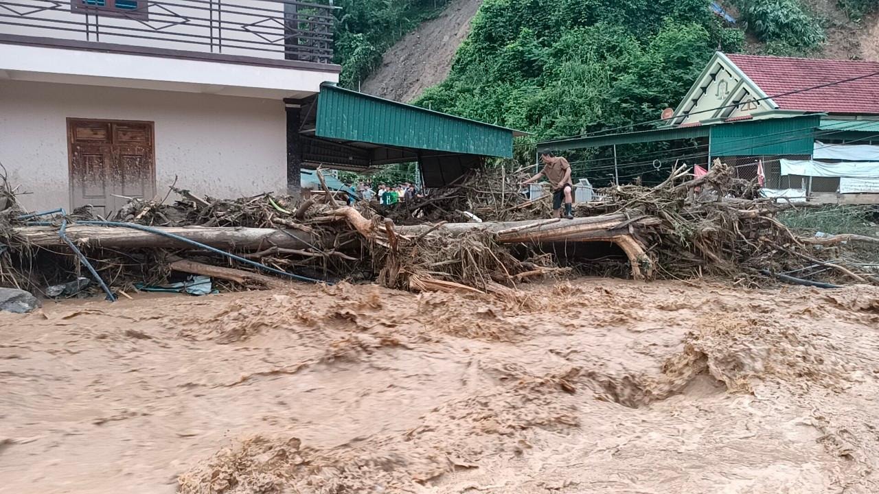 |
Flash floods often cause heavy damage to people and property. Photo: Tien Dong |
Currently, Nghe An and Ha Tinh areas are located entirely within the Ca River basin. This river basin has a total area of 27,200 km2, including a 170km long river flowing through Laos with a basin area of 9,470 km22(accounting for 1/3 of the basin area), the rest is located inland in Vietnam, mainly Nghe An and Ha Tinh.
To warn of flood situations, on the Ca River system in Vietnam, there are many monitoring stations, meteorological and hydrological stations arranged along the Ca River and its tributaries, providing relatively accurate forecast results on flood situations.
 |
Flash floods on the night of October 1 and early morning of October 2 severely damaged Ta Ca commune and Muong Xen town of Ky Son district. Photo: Tien Dong |
However, according to Mr. Nguyen Xuan Tien - Deputy Director of the North Central Hydrometeorological Station, currently the furthest point to set up a hydrometeorological station is in Muong Xen town (Ky Son), while the large Ca River basin located in Laos does not have any monitoring station, exchanging information and data on flood warnings is very difficult. Even the radar system can only scan within a range of 300km, and it is not possible to give early warnings in a further range.
The flash flood area in the mountainous area of Nghe An is divided into two areas: the right bank and the left bank of the Ca River. The left bank includes the districts of Que Phong, Quy Chau, Tan Ky, Quy Hop, and part of the northwest of the districts of Tuong Duong, Ky Son, Con Cuong, and Anh Son; the right bank of the Ca River includes the southwest of the districts of Ky Son and Tuong Duong.
In fact, this type of "disaster" has occurred in many mountainous districts in the West of Nghe An. The concentration of flash floods is uneven, reaching a very high density in Tuong Duong district (communes of Yen Na, Yen Tinh, Yen Hoa), and the South of Que Phong district (Nam Giai, Tri Le)...
 |
Areas along streams are at frequent risk of flash floods. Photo: Tien Dong |
Proactive early prevention
According to statistics from the Irrigation Department, Nghe An currently has more than 250 flash flood warning points in 6 mountainous districts: Ky Son, Tuong Duong, Con Cuong, Que Phong, Quy Chau, Quy Hop, with thousands of households at high risk of damage.
Mr. Nguyen Truong Thanh - Head of the Irrigation Department said: Currently, it is very difficult to give the closest warning, on a small scale, of areas at risk of flash floods. The warning level can only be determined by area based on the amount of rainfall measured in a short period of time. Because in reality, we do not have modern means to give early warning to local authorities to know and take precautions.
Therefore, the way to minimize the risk of damage caused by flash floods is to take early precautions and move away from small streams and steep slopes. In addition, propaganda to raise awareness of flash floods and landslides prevention in mountainous districts needs to be regularly and promptly deployed to each village, hamlet and household.
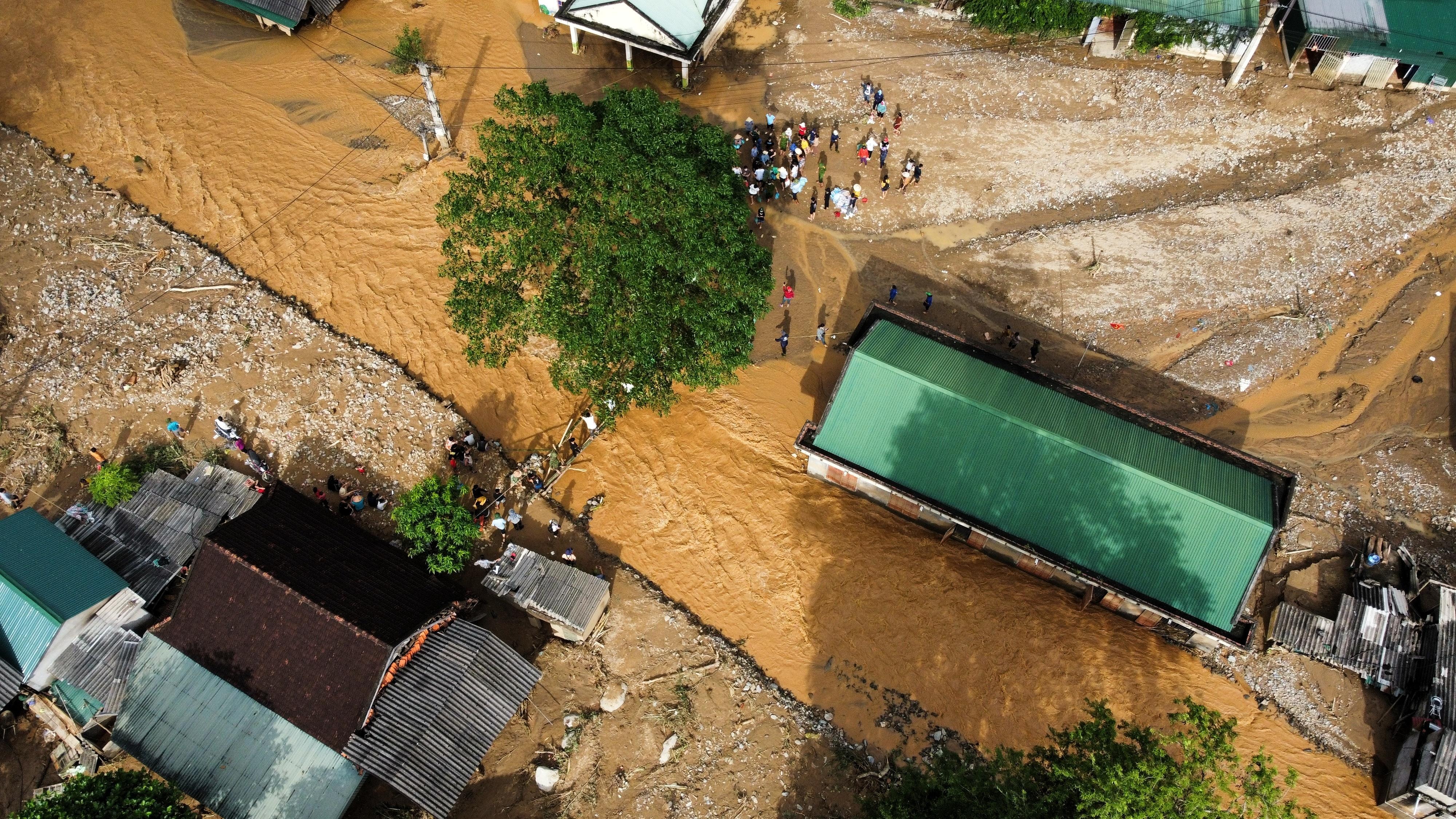 |
Hoa Son village (Ta Ca, Ky Son) devastated by flash floods. Photo: Thanh Cuong |
Mr. Phan Trong Dung - Head of the Department of Agriculture and Rural Development of Que Phong district said that the locality has many areas on red alert for flash floods such as: Tri Le, Thong Thu, Nam Giai, Nam Nhoong, Quang Phong. This is a worrying reality because the mountainous terrain has a large slope, so when floods occur, they often cause serious consequences to people and property.
 |
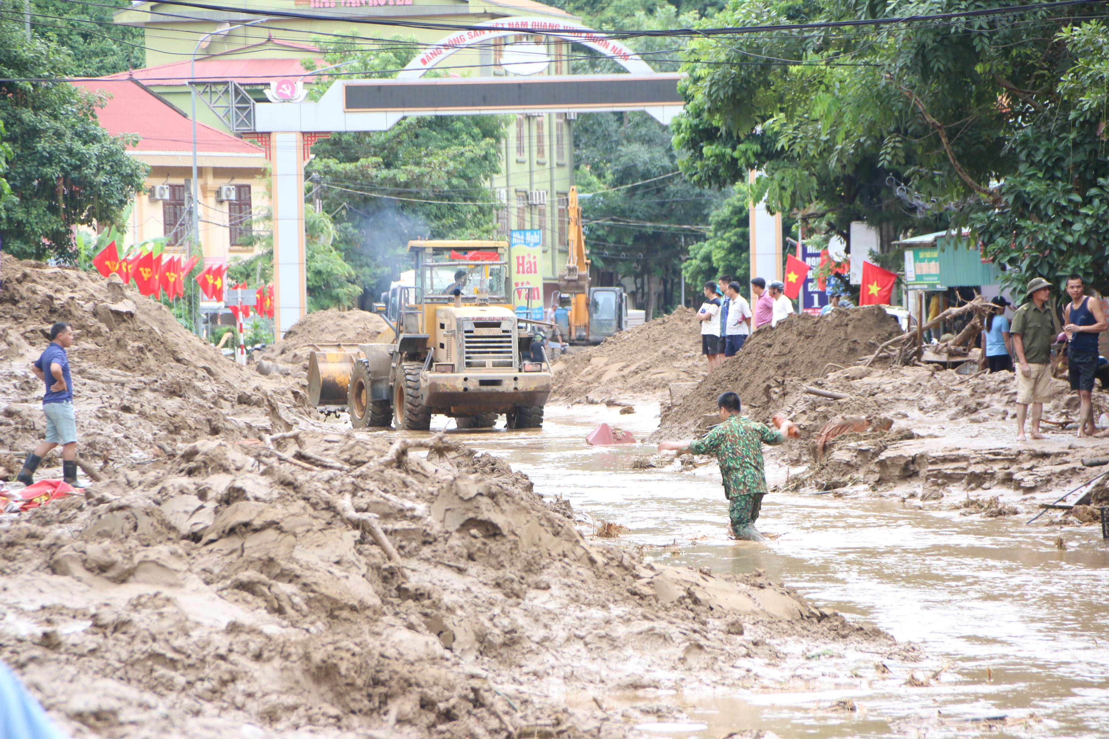
Infrastructure devastated after flash floods. Photo: Tien Dong |
Although there are many places in the area with high risk of flash floods, arranging other safe places for people to live is not simple. Mr. Nguyen Huu Minh - Chairman of the People's Committee of Ky Son district admitted that communes such as Muong Tip, Muong Ai, My Ly, Na Ngoi, Nam Can, Keng Du, Tay Son, Ta Ca, Bao Nam... are areas that have long been warned of very high risk of flash floods. Whenever there are storms, the district has proactively propagated and reminded people to be vigilant, and at the same time mobilized people to evacuate promptly when the situation is complicated to ensure the safety of life and property. However, in the long term, to evacuate people in hot spots to safe places requires a lot of money, not to mention choosing other safer locations, while the terrain in Ky Son is mainly high hills and mountains with steep slopes.
In the long term, Nghe An has also repeatedly recommended that the Central Government prioritize capital allocation to promptly relocate and stabilize the lives of people in areas at high risk of flash floods, landslides, in order to ensure life and production, and minimize damage caused by natural disasters in these areas.

