

.jpg)


Economy
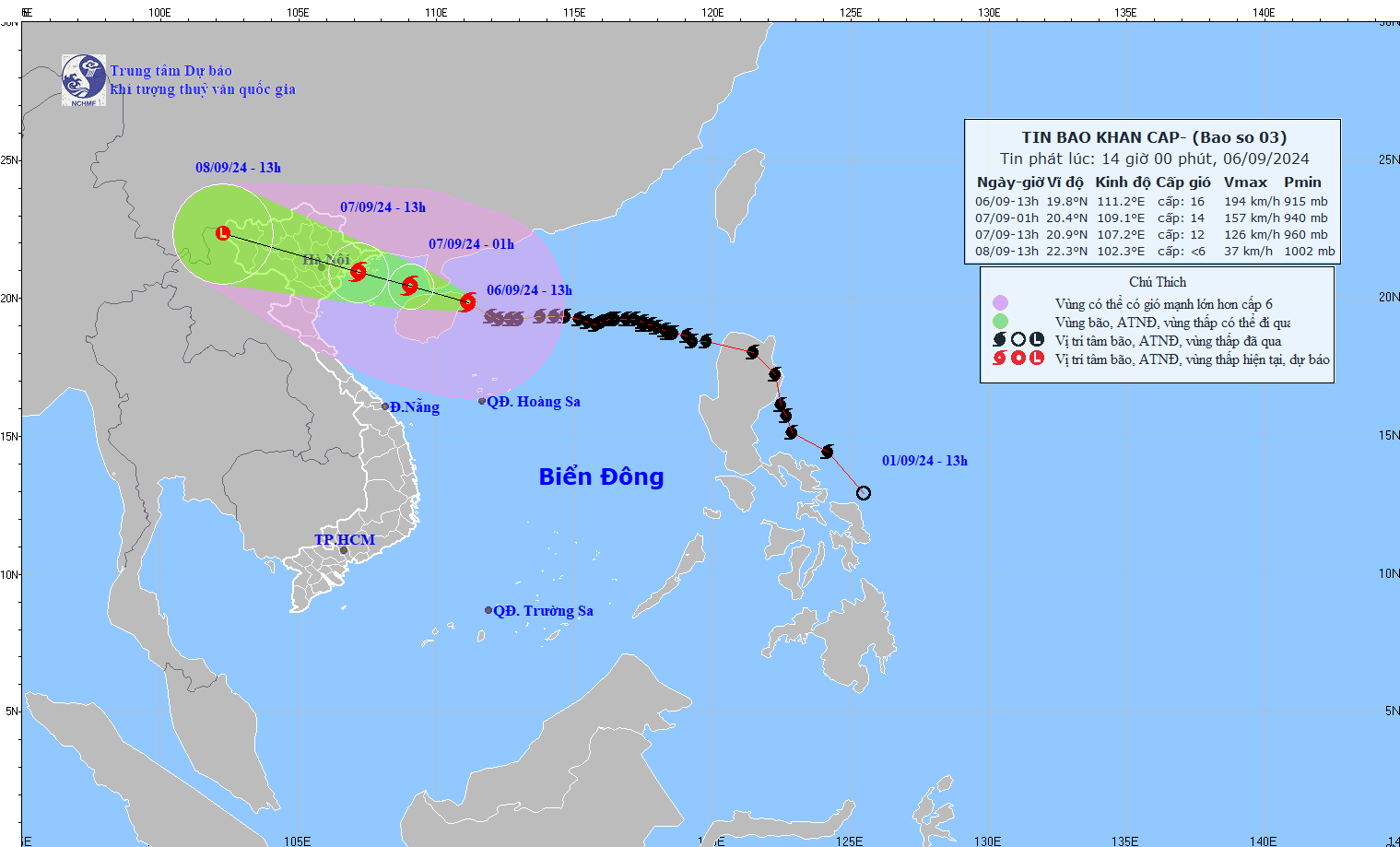
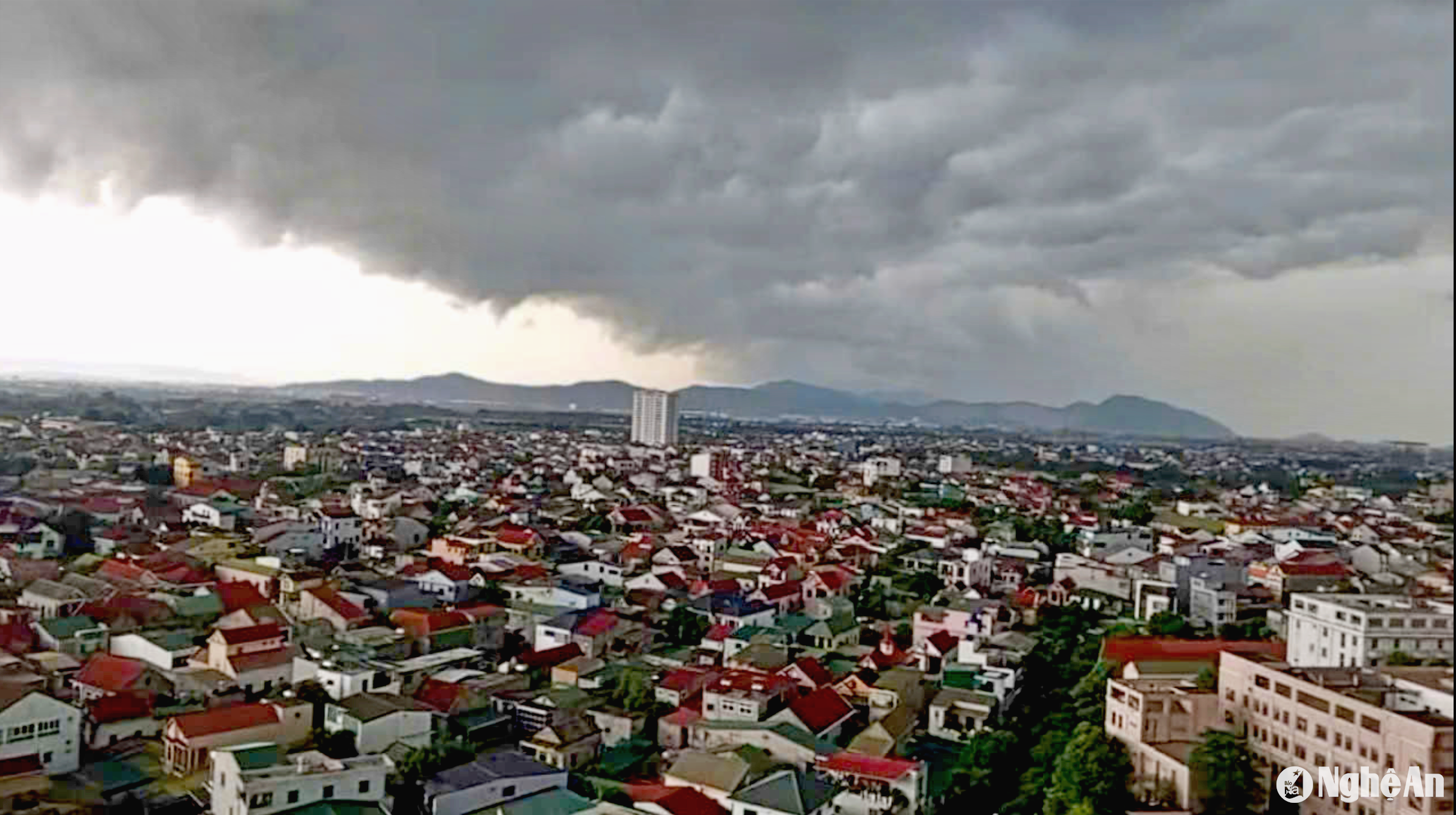
Super typhoon number 3 is about to make landfall
Nghe An Newspaper updates the path and affected areas of super typhoon No. 3 (typhoon YAGI) and the response of localities.
At 10:00 am on September 6:
Location of the storm center: About 19.4 degrees North latitude; 111.9 degrees East longitude, about 105km from Hainan Island, about 550km from Quang Ninh.
Strongest wind:Level 16 (184-201km/h),jerk above level 17.
Forecast:In the next 3 hours, the storm will move to the Northwest, at a speed of about 15-20km/h.
FORECAST OF HEAVY RAIN IN THE NORTHERN REGION AND THANH HOA REGION. NEWS OF THREAD AND STORM, WARNING OF LOCAL HEAVY RAIN, TORNADOES, LIGHTNING, STRONG WINDS IN THE CENTRAL HIGHLANDS AND SOUTHERN REGIONS

1. Rainfall in the past 24 hours
This morning (September 6), in the coastal areas of the Southern Delta and the North Central region, there were showers and thunderstorms, with some heavy rain. The rainfall from 5am to 8am on September 6 was over 30mm in some places such as: Xuan Thuy (Nam Dinh) 74mm, Dong Giao (Ninh Binh) 34.8mm, Ha Trung (Thanh Hoa) 33.6mm, Hoanh Son (Ha Tinh) 37.4mm,...2. Forecast of heavy rain in the next 24 to 48 hours
From the night of September 6 to the night of September 7, in the Northeast region and Thanh Hoa, there will be heavy to very heavy rain with common rainfall of 100-300mm, locally over 400mm.
During the day and night of September 7, the Northwest region will have heavy to very heavy rain with common rainfall of 70-150mm, locally over 200mm.
Detailed forecast:
| Area | Time of impact | Total volume (mm) |
| Northeast and Thanh Hoa | From the night of September 6 to the night of September 7 | 100-300; locally over 400 |
| Northwest | Day and night 07/09 | 70-150, locally over 200 |
Thunderstorms may produce tornadoes, lightning and strong gusts of wind.
3. Warning:During the day and night of September 8, in the North and Thanh Hoa, there will be moderate rain, some places will have heavy rain and thunderstorms with common rainfall of 20-60mm, locally over 90mm. Particularly in the Northwest and Viet Bac regions of the North, there will be heavy rain, some places will have very heavy rain with common rainfall of 50-150mm, some places over 250mm.
4. Warning cdisaster risk reductionheavy rain, tornado, lightning:chamlet1.
5. Forecasting the impact of heavy rain
Heavy rain and localized heavy rain are likely to cause flooding in low-lying areas; flash floods in small rivers and streams, and landslides on steep slopes.(Real-time warning information on areas at risk of flash floods and landslides is provided online on the website of the General Department of Hydrometeorology at:https://luquetsatlo.nchmf.gov.vnand in separate bulletins warning of flash floods and landslides).


