Super typhoon Yutu, level 17, is heading towards the East Sea
(Baonghean.vn) - At 1:00 a.m. on October 29, the center of the storm was at about 17.7 degrees North latitude; 126.9 degrees East longitude, about 480km east of Luzon Island (Philippines). The strongest wind near the center of the storm was level 15 (165-185km/hour), gusting above level 17.
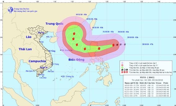 |
| Location and path of the super typhoon. Photo: National Center for Hydro-Meteorological Forecasting |
Forecast for the next 24 hours,The storm is moving in a West-Southwest direction, traveling 15-20km per hour. At 1:00 a.m. on October 30, the center of the storm was at about 16.7 degrees North latitude; 122.8 degrees East longitude, right on the sea east of Luzon Island. The strongest wind near the center of the storm is level 15 (165-185km/hour).level 17.
In the next 24 to 48 hours, the storm will move mainly in a westerly direction, traveling 15-20km per hour. At 01:00 on October 31, the storm center was located at about 16.6 degrees North latitude; 118.7 degrees East longitude, about 670km east of Hoang Sa archipelago. The strongest wind near the storm center is level 12-13 (120-150km/hour).level 1 shock6.
Over the next 48 to 72 hours,The storm is moving in a West-Northwest direction, traveling about 15km per hour. At 1:00 a.m. on November 1, the center of the storm was at about 17.8 degrees North latitude; 116.4 degrees East longitude, about 480km East-Northeast of the Hoang Sa archipelago. The strongest wind near the center of the storm is level 11-12 (100-135km/hour).level 1 shock5.Disaster risk levelin the Northeast East Sea area: level 3.
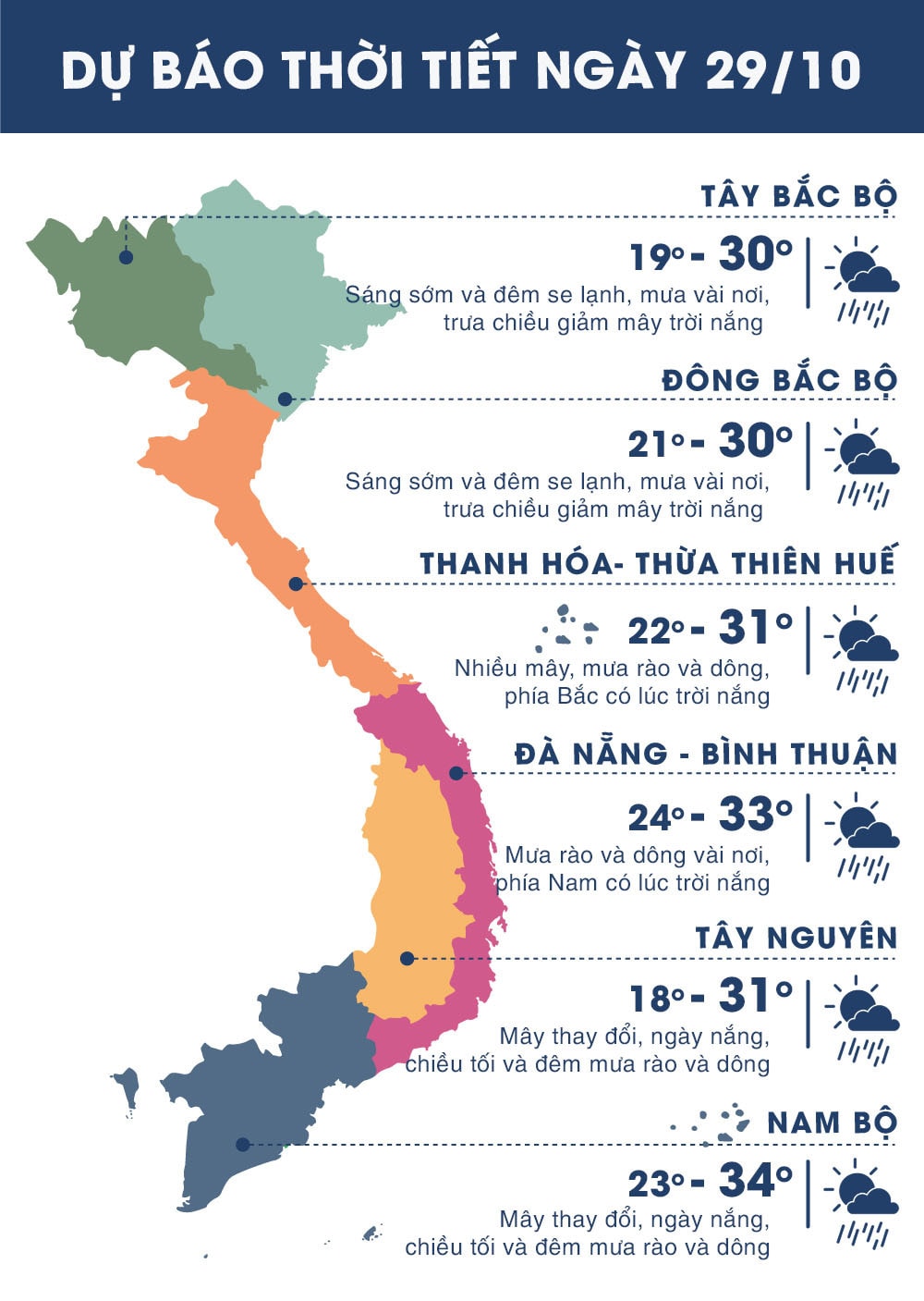 |
| Temperature on October 29 in regions across the country. Photo: news.zing.vn |


 với tinh thần quyết liệt nhất")
