Overview of floods in Nghe An
(Baonghean.vn) - Due to the influence of storm No. 6, from last night (September 24) until now, in many districts of Nghe An, the water level in streams and creeks has risen, causing flooding in many places, especially many roads have been cut off.
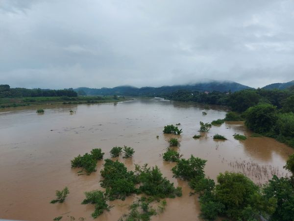
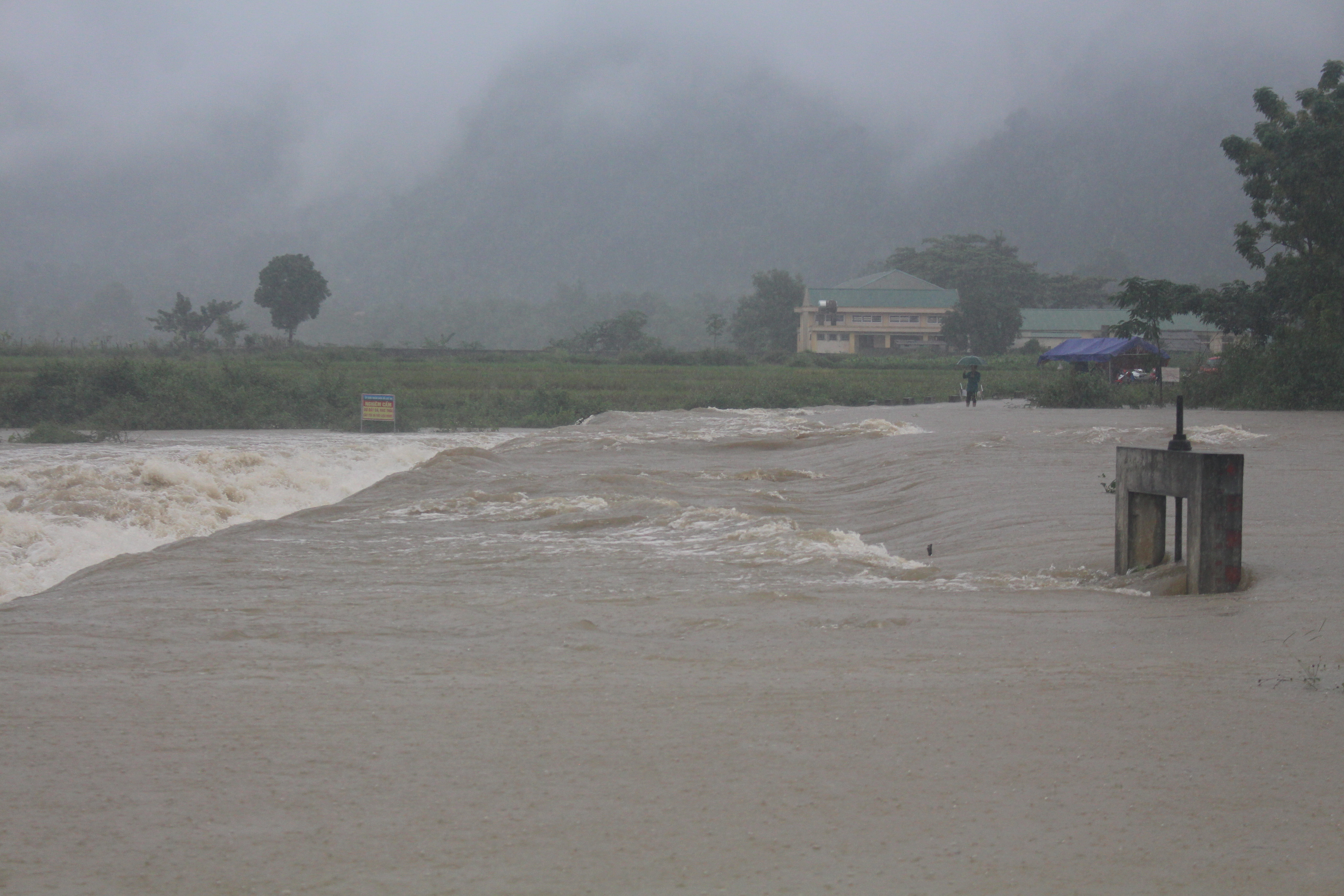 |
| Khe Moi spillway bridge from Mon Son commune to Luc Da (Con Cuong) is deeply submerged in water. Photo: Bao Han |
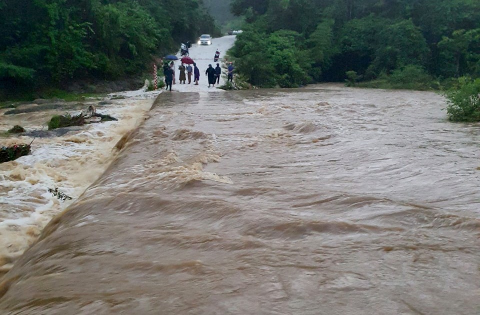
Information from the People's Committee of Luc Da commune (Con Cuong) said that from last night until this morning (September 25), in the area there wereheavy rain, water from upstream poured in with large flow causing the water level in streams and creeks to rise quickly. The overflow bridge on Mon Son and Luc Da roads continued to be flooded. The rising water level caused traffic congestion and separation and isolation.
The Commune People's Committee has also assigned forces to be on duty 24/24 hours. At the spillways and key points, the commune leaders are on duty, not allowing people and vehicles to pass. Currently, in Luc Da commune, there is still heavy rain, flood water continues to rise. In addition to Luc Da commune, in Thach Ngan commune, there are 10 spillways, but up to now, 8 bridges have been overflowed, causing many villages to be cut off and unable to travel.
Mr. Lo Van Ly - Head of Department of Agriculture and Rural DevelopmentCon Cuong districtsaid that by the morning of September 25, in the district, there were 5 overflow points in the communes of Thach Ngan, Mon Son, and Luc Da that were flooded. Currently, the communes are checking the specific damage to traffic landslides and other structures.
 |
| Due to the heavy rains that have lasted for the past few days, many areas in Tan Ky district have been flooded and impassable. Photo: Xuan Hoang |
On the siteTan Ky districtHeavy rain from the 24th to this morning has flooded many spillways and many rice fields are at risk of being flooded. Mr. Nguyen Cong Trung - Head of the District's Department of Agriculture and Rural Development said: Information from the facilities shows that on the morning of September 25, many spillways were flooded, namely: Khe Hao spillway (Tan Hop), Khe Cung spillway (Tan Xuan), Tan Dien spillway (Dong Van), Dap Tray spillway (Giai Xuan), Khe La spillway (Nghia Dung), and some other spillways in Nghia Thai...
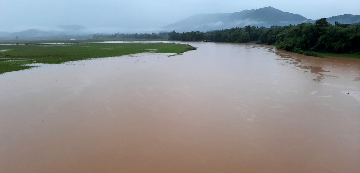 |
| The water level of the Con River passing through Tan Ky district is rising rapidly on the morning of September 25. Photo: Xuan Hoang |
"Currently, the water level of the Con River is rising rapidly. If it continues to rain heavily, hundreds of households in Ky Tan, Nghia Dung, Huong Son, Nghia Hanh communes... are at risk of being flooded," Mr. Nguyen Cong Trung added.
Currently, the District Steering Committee for Natural Disaster Prevention and Control is directing communes to inspect the specific damage situation, encouraging people to harvest crops with the motto "green at home is better than old in the field", and implementing measures to protect aquaculture. The most worrying thing is that there are still about 2,000 hectares of rice in the green stage, if flooded, it will be damaged.
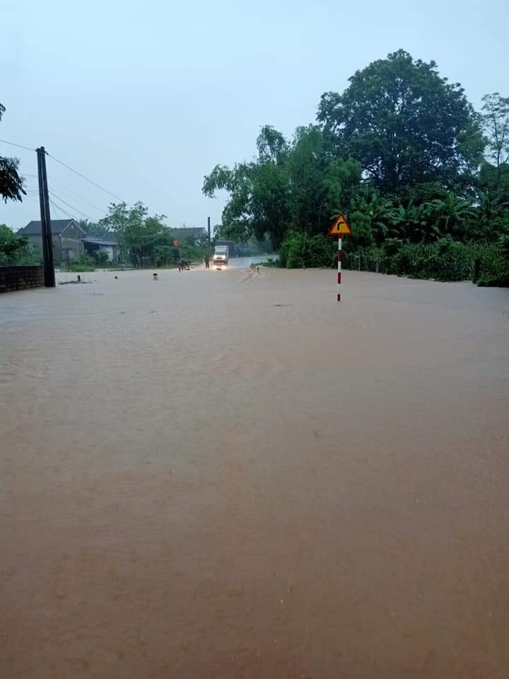
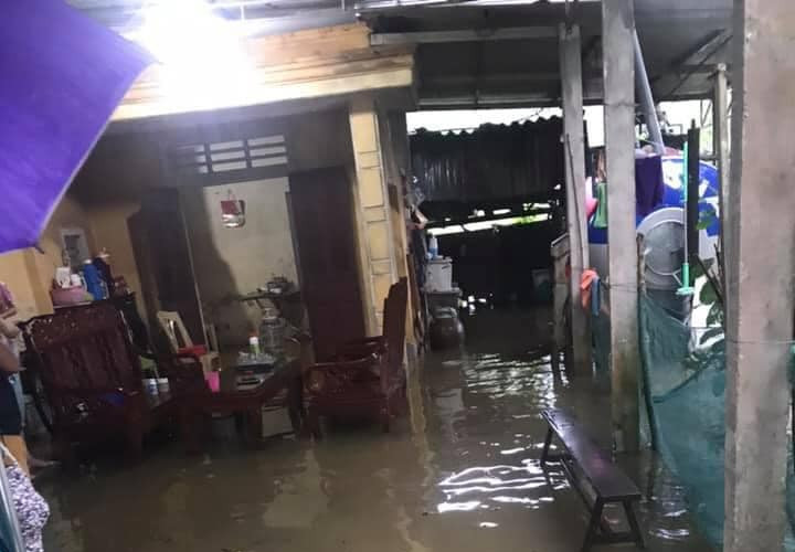
Quynh Luu District:Heavy rains that have lasted since yesterday have caused 184 houses to be flooded, including 145 households in hamlets 2 and 3, Quynh My commune; 02 households in Tuan B hamlet, road 48, Quynh Chau commune, 37 households in hamlet 8, Quynh Lam commune, of which 01 household had to be evacuated.
 |
| National Highway 48 through Quynh Luu district is flooded. Photo: Viet Hung |
957 hectares of vegetables in the communes of Quynh Yen, Quynh My, Quynh Tan, Ngoc Son, Quynh Tam, Quynh Chau, Quynh Nghia, Quynh Minh, Quynh Luong, Quynh Bang, Quynh Tho, Quynh Thuan and 10 hectares of rice in Quynh Chau commune were flooded; 140m of surrounding wall in Quynh My and Ngoc Son communes collapsed; many livestock and poultry died.
In Quy Chau district:Floodwaters inundated 10 bridges in the communes of Chau Binh, Chau Tien, Chau Thang, Chau Hanh, Chau Hoi, and Chau Phong. Due to deep and strong water flows, vehicles could not pass through.
 |
| The spillway over Thai Thinh hamlet, Nghia Loi commune is deeply flooded. Photo: Duc Anh |
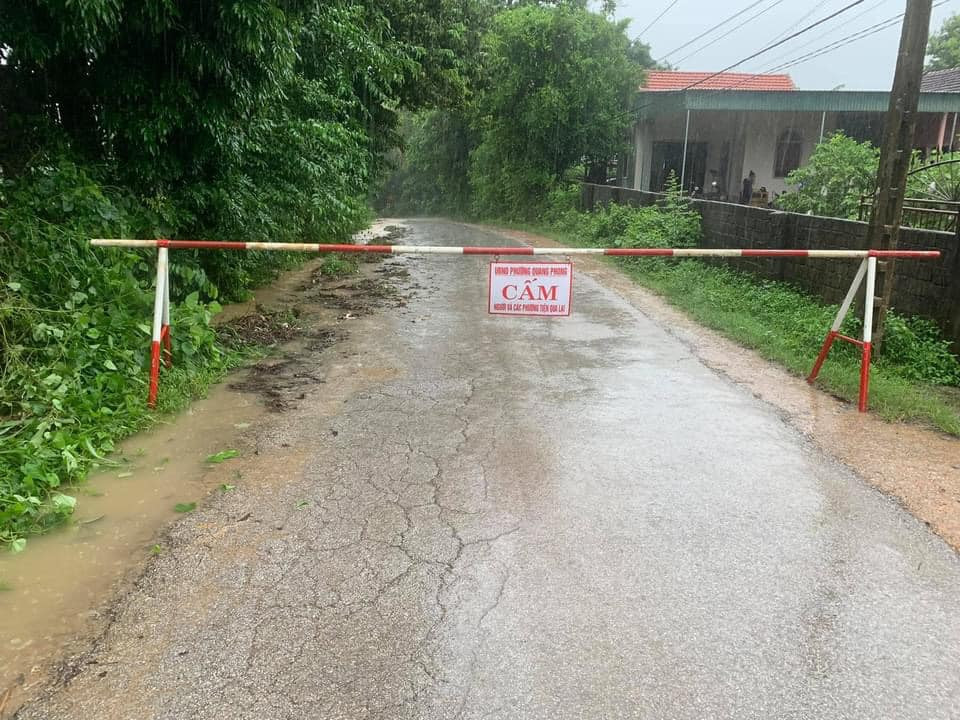
On the siteNghia Dan district, heavy rains lasting on September 24 and early this morning caused some roads and bridges to be flooded in Nghia Loc, Nghia Loi, Nghia Mai... At flooded areas, local authorities assigned people to be on duty 24/7 to guide, absolutely not allowing people and vehicles to pass. In addition, some crop areas in the area were also flooded, such as cassava in Nghia Khanh, rice in Nghia Loc...
Heavy rain over the past two days, with total rainfall measured at over 170mm, has caused localized flooding in many areas in the area.Thai Hoa Town.
 |
| The water level of Hieu River is rising this morning (September 25). Photo: Minh Thai |
Due to the influence of storm No. 6, in recent days in the areaThai Hoa townThere was heavy to very heavy rain that lasted all day and night, so the amount of rainwater in Hieu River rose very high, most communes and wards were flooded locally, and some inter-commune roads were cut off.
Faced with the flood situation, the Steering Committee for Flood Prevention and Control and Search and Rescue of Thai Hoa town has come up with plans to deal with the actual situation. The Military Command has mobilized militia forces to put up warning signs and set up checkpoints in deep and dangerous flooded areas to warn people when passing through these areas.
 |
| Some households in Thai Hoa town have had water flood into their houses. Photo: Minh Thai |
 |
| Thai Hoa town has put up warning signs to inform people about flooded and isolated roads. Photo: Minh Thai |
Inspecting and directly directing the drainage of this area this morning, the leader of Thai Hoa town said: Although regularly dredgingdrainage systemHowever, because the drainage system on Highway 48 is too small, it cannot drain a large amount of water in a short period of time. To ensure people's safety, the Steering Committee has issued warnings on the media so that people can proactively avoid areas with localized flooding.
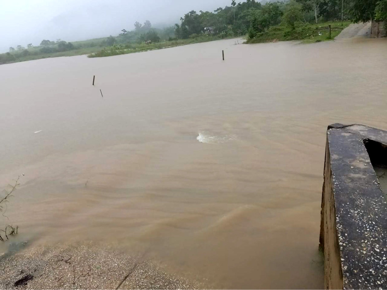 |
| Water level in Dat Lake in Que Phong district rose due to heavy rain. Photo: Van Thanh |
Que Phong district,Due to the impact of storm No. 6, from September 24-25, Que Phong district experienced continuous rain, and the water level of rivers and lakes continued to rise. At Tong Mo irrigation dam - Kim Son town, the water level is currently 30 cm above the spillway, and the strong current has isolated 22 households/98 people in Cham Leo village.
More worryingly, the 1m high, 70m long B40 net, fenced around the spillway by the Que Phong District Irrigation Branch to warn people about deep, dangerous water areas, has been stolen by thieves.
| Floodwaters pouring down Sao Va waterfall. Clip: Nguyen Tam |
Information from the North Central Hydrometeorological Station, in the past 24 hours, the North Central region has had rain, scattered moderate rain, some places have had heavy to very heavy rain and thunderstorms with common rainfall of 50 - 150mm, some places have had over 200mm such as Hoang Mai 200.2mm, Son Hong (Huong Son) 233mm, ...
Forecast:Due to the influence of the Tropical Convergence Zone with its axis through the Central Central region, combined with subtropical high pressure encroaching to the west.
Today and tonight September 25:North Central region: Moderate to heavy rain, some places have very heavy rain with common rainfall of 50-100mm/24h, some places over 120mm/24h.
Nghe An Province: Moderate to heavy rain, some places have very heavy rain and thunderstorms with common rainfall: 50 - 100mm, especially in Quynh Luu district, Vinh city, Thanh Chuong, Do Luong, Yen Thanh.... some places have over 120mm/24h.
During thunderstorms, there is a high possibility of tornadoes, lightning and strong gusts of wind; Localized heavy rain in a short period of time has a high risk of flash floods and landslides in the midlands and mountainous areas, and flooding in low-lying areas.


