From now until the end of 2017, how many storms will our country have?
It is forecasted that from October to the end of 2017, there will be about 4-5 storms and tropical depressions (TDPs) operating in the East Sea, mainly concentrated in the central and southern regions of the East Sea. Of these, about 1-2 storms and TDPs are likely to affect the mainland of our country, concentrated in the Central and Southern regions.
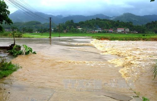 |
| It is forecasted that from now until the end of 2017, there will be about 4-5 storms and tropical depressions in the East Sea. Illustrative photo: VNA. |
According to the forecast of the National Center for Hydro-Meteorological Forecasting, the ENSO phenomenon will continue to maintain a neutral phase in the last months of 2017, the possibility of La Nina appearing will gradually increase in early 2018.
It is forecasted that from October to the end of 2017, there will be about 4-5 storms and tropical depressions operating in the East Sea, mainly concentrated in the central and southern regions of the East Sea. Of these, about 1-2 storms and tropical depressions are likely to affect the mainland of our country and concentrated in the Central and Southern regions. In addition, in the last months of the year, due to the activity of the equatorial trough, the central and southern seas of the East Sea and the western seas may experience strong thunderstorms with tornadoes, whirlwinds and gusts.
According to the National Center for Hydro-Meteorological Forecasting, in October, there is a possibility of 1-2 small floods on the rivers of the North, with flood peaks at levels below alert level 1 (BĐ). From November to December 2017, water levels on rivers will generally be approximately equal to or 5-20% lower than the average.
The 2017 flood peak in the downstream of the main rivers from Thanh Hoa to Ha Tinh is likely to be at level 1-2, approximately the average flood peak; the rivers from Quang Binh to Thua Thien Hue are at level 2-3, equivalent to the average; there is a high risk of major floods and flash floods in the upstream of the main rivers and on small rivers and streams. The flood season in the Central region and the Central Highlands is likely to end late.
The 2017 flood peak in the upper Mekong River is likely to be at the average level (Tien River at Tan Chau: 4.2m; Hau River at Chau Doc: 3.8m), the annual flood peak will appear around the first half of October 2017. Although the flood peak is at the average level, it still has the potential to have a major impact on the region.
In terms of hydrography, the risk of storm surges and large waves will still be concentrated in the Central Coast. In addition, cold air waves will increase in frequency in the last months of the year, causing large waves of 3-4m in the offshore sea area and 2-3m in the coastal areas of the provinces from Quang Ninh to Ca Mau.
In the Southern coast, high tides will appear in the early days of October, November and December. Meanwhile, in the Central coast, especially Phu Yen, the risk of high tides is concentrated in November and December during the Northeast monsoons that penetrate deep into the area...
According to Tin Tuc Newspaper


