Application of software to build flood discharge scenarios for the largest irrigation reservoir in Nghe An
(Baonghean.vn) - As one of the irrigation lakes with the largest capacity and basin in Nghe An, Vuc Mau Lake has special importance in serving the socio-economic development as well as flood and storm prevention of the province.
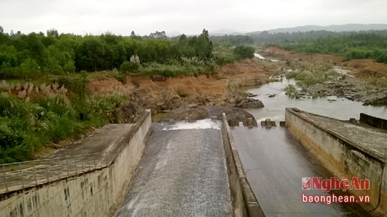 |
| Vuc Mau Lake has special importance in serving the socio-economic development as well as flood and storm prevention of Nghe An province. |
Mau Lake has a total capacity of 74.1 million m3, useful capacity 62.6 million m3on the upper Hoang Mai River, with a basin area of 215km2and flows into the sea at Lach Con estuary in Quynh Luu district, Nghe An province.
The project was built in 1978 in Quynh Trang commune (Hoang Mai town) and was repaired and upgraded in 2008. Vuc Mau lake has 4 rain gauge stations: Vuc Mau, Dong Xuan, Lang Trang and Da Bac.
This is one of the irrigation lakes with the largest capacity and basin in Nghe An province, of special importance in serving the socio-economic development as well as flood and storm prevention of the province. In addition to the task of supplying water for 3,600 hectares of production land and domestic water for 100,000 people in 19 communes and wards of Hoang Mai town and Quynh Luu district, the lake also has the function of flood prevention.
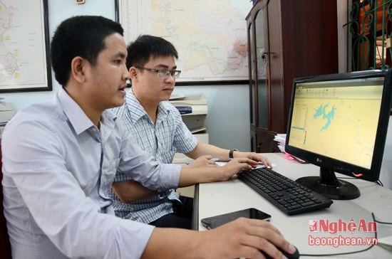 |
| Staff of the Standing Office of the Provincial Steering Committee for Natural Disaster Prevention and Search and Rescue deploy software to build flood discharge scenarios for Vuc Mau Lake. |
Practices in management and operation ensure the safety of works and downstream areas, especially in the context of climate change, natural disasters are increasingly complex, unpredictable, and pose many potential risks to dam safety. Meanwhile, there is no scenario for flood discharge from Vuc Mau reservoir.
This situation makes the state management of dam safety still confused, leading to passive downstream areas and causing heavy damage when Vuc Mau reservoir discharged flood. That requires studying scenarios and perfecting calculation technology to serve the management and actual operation of the annual flood prevention reservoir system.
In response to that request, the Department of Agriculture and Rural Development proposed to build a software that synchronizes software tools with displays to calculate the flow rate to and from the reservoir, and a map warning of downstream flooding, serving the work of flood prevention downstream of Vuc Mau reservoir.
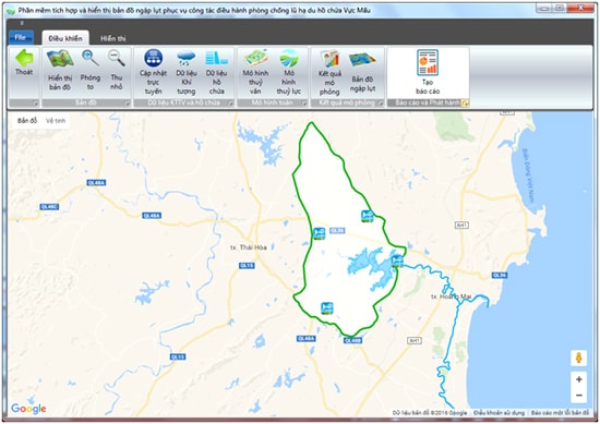 |
| Main interface of flood scenario building software for Vuc Mau lake. |
Using this software, the most adverse scenarios affecting reservoir safety are assumed. For each scenario built on the basis of forecasts of rainfall, rainfall intensity, rainfall duration and using typical historical rainfall events at 4 rain gauge stations, the software will simulate the rainfall distribution process corresponding to the assumed total rainfall.
Combined with the current reservoir water level parameters, the software will give results on the parameters of water flow to the reservoir, reservoir water level... corresponding to each assumed calculation period. From there, it will give results on how to operate the reservoir to ensure the correct operating process (number of gates that need to be opened, time and gate aperture that must be opened as well as the possibility of flooding downstream of the reservoir,...).
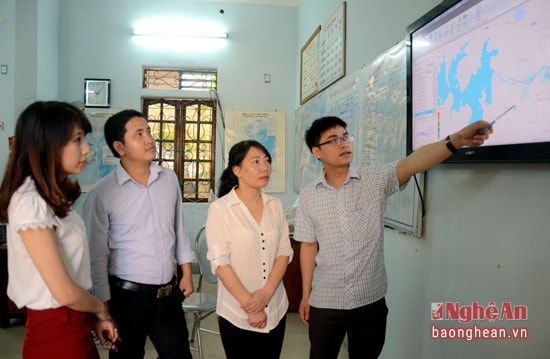 |
| Staff of the Standing Office of the Provincial Steering Committee for Natural Disaster Prevention and Search and Rescue manage the operation of Vuc Mau reservoir through software to build flood release scenarios for Vuc Mau reservoir. |
Integrated Hydrology and Hydraulics software with flood map display for the management and flood prevention of the downstream of Vuc Mau reservoir helps the operation of Vuc Mau reservoir to ensure the process has been approved by the competent authority. Using the software helps to minimize the flooded area in the upstream and downstream areas of the reservoir, helping managers have proactive response plans in the safe operation of the dam and downstream areas in all weather conditions.
According to Mr. Nguyen Sy Hung - Deputy Director of the Department of Agriculture and Rural Development, Chief of the Standing Office of the Provincial Steering Committee for Natural Disaster Prevention and Search and Rescue: "Using software to build a flood discharge scenario for Vuc Mau Lake will meet the expectations of people downstream of the lake, minimizing damage to people and property during the flood season. We are currently implementing and building possible flood discharge scenarios, testing some actual scenarios and soon announcing the flood discharge scenario of Vuc Mau Lake to the operating unit and people".
Thanh Le
| RELATED NEWS |
|---|


.png "Chính phủ thông qua báo cáo nghiên cứu tiền khả thi dự án đường bộ cao tốc từ xã Hưng Nguyên (Nghệ An) đến biên giới Lào")
.jpg "THPT Thanh Chương 3 - Nửa thế kỷ viết nên kỳ tích")
