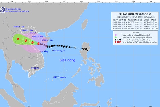
Storm No. 3 is about 240km from the mainland of provinces from Thanh Hoa to Quang Binh.
(Baonghean.vn) - From this evening (July 18), on the mainland of Southern Thanh Hoa, Nghe An, and Ha Tinh, there will be strong storm winds of level 8, gusting to level 11. The risk level of natural disasters due to storms is level 3.
According to the forecast of the National Center for Hydro-Meteorological Forecasting, this afternoon (July 18), storm No. 3 has passed Hainan Island and entered the Gulf of Tonkin. Due to the storm's influence, Bach Long Vi Island has experienced strong winds of level 7, gusting to level 9.
13:00 on July 18, the center of the storm is located at about 18.8 degrees North latitude; 108.0 degrees East longitude, right on the Gulf of Tonkin and about 240km east of the mainland provinces from Thanh Hoa to Quang Binh. The strongest wind near the center of the storm is level 8-9 (60-90km/hour),level 11.
 |
| Fishing boats of Cua Hoi (Nghe An) come ashore to take shelter from storm No. 3. Photo: Nam Phuc |
Forecast for the next 12 hours, the storm moves quickly to the West, about 25-30km per hour;Tonight and tonight (July 18), the storm center with strong winds of level 8, gusting to level 10 will directly affect coastal areas of provinces from Thai Binh to Quang Binh.The storm will then move inland and weaken into a tropical depression..
At 1:00 a.m. on July 19, the center of the tropical depression was at about 18.9 degrees North latitude; 105.4 degrees East longitude, on the mainland of the North Central region. The strongest wind near the center of the tropical depressionlevel 7 strong(50-60km/h),level 9.
Forecast for the next 12 to 24 hours,The tropical depression continued to move westward, traveling about 20-25 km per hour and weakened into a low pressure area over Upper Laos.
Due to the influence of the storm, in the Gulf of Tonkin there are strong winds of level 7, the area near the storm's eye has strong winds of level 8-9,level 11, waves 3-5m high; very rough seas. Coastal areas of the Northern Delta and North Central Coast have sea levels rising above the tidal range of about 0.5-0.7m; waves 2-4m high; very rough seas.
From this evening (July 18), on the mainland of Thai Binh, Nam Dinh, Ninh Binh, Thanh Hoa, Nghe An, Ha Tinh and Quang Binh provinces, the wind will gradually increase to level 6, then increase to level 7, gusting to level 9; in particular, South Thanh Hoa, Nghe An and Ha Tinh will have strong storm winds of level 8.level 11.Storm disaster risk level: level 3.
From this afternoon, in the provinces of the Northern Delta and midlands, the provinces from Thanh Hoa to Quang Binh will have very heavy rain and it will last until about July 20 (common rainfall is 100-300mm/period, some places over 350mm).
Warning: From July 18 to July 20, on the upper reaches of the Red River - Thai Binh, Hoang Long River, rivers from Thanh Hoa to Quang Binh, there will be a flood. Flood amplitude on the rivers is as follows: upper reaches of the Red River - Thai Binh from 2-4m; Hoang Long River from 1-2m; rivers from Thanh Hoa to Quang Binh from 3-5m.
During this flood, the flood peak on the Da River reached level 1; Thao River, Lo River, Hoang Long River and rivers in Thanh Hoa, Nghe An, Ha Tinh, Quang Binh reached levels 1-2, while Buoi River (Thanh Hoa), Ngan Sau and Ngan Pho Rivers (Ha Tinh) reached levels 2-3.Warning level of natural disaster risk due to floods, flash floods, landslides: level 2.
FLOOD, FLOOD, LANDSCAPE, AND INFLATION WARNING IN THE NORTHERN REGION AND PROVINCES FROM THANH HOA TO QUANG BINH
Currently, the flood on Ngan Sau and Ngan Pho rivers (Ha Tinh) is receding. The water level at 07:00 on July 18 on Ngan Sau river at Chu Le was 9.95m, 0.55m below level 1, at Hoa Duyet was 6.8m, 0.7m below level 1; Ngan Pho river at Son Diem was 8.84m, below level 1.
From noon this afternoon (July 18) to the night of July 19, due to the influence of storm No. 3, in the Northern Delta and midland areas, the provinces of Hoa Binh, Son La, Thanh Hoa to Quang Binh will have very heavy rain.
From July 19-20, heavy rain is likely to spread to the northern mountainous provinces and the Northwestern region (very heavy rain is concentrated in Vinh Phuc, Phu Tho, Tuyen Quang, Yen Bai, Son La).
Flood warning:
From July 18 to July 20, a flood will occur in the upper reaches of the Red River - Thai Binh, Hoang Long River, and rivers from Thanh Hoa to Quang Binh. The flood amplitude on the rivers is as follows: the upper reaches of the Red River - Thai Binh from 2-4m; Hoang Long River from 1-2m; rivers from Thanh Hoa to Quang Binh from 3-5m. During this flood, the flood peak on the Da River will rise to level BĐ1; Thao River, Lo River, Hoang Long River, and rivers in Thanh Hoa, Nghe An, Ha Tinh, and Quang Binh will rise to levels BĐ1-BĐ2, while the Buoi River (Thanh Hoa), Ngan Sau and Ngan Pho Rivers (Ha Tinh) will rise to levels BĐ2-BĐ3.
Flash flood, landslide and flooding warning:
There is a high risk of landslides and flash floods in the northern mountainous areas, especially in the provinces of Hoa Binh, Son La, Lai Chau, Dien Bien, Lao Cai, Yen Bai, Ha Giang, Tuyen Quang, Quang Ninh, Thanh Hoa, Nghe An, Ha Tinh, Quang Binh; flooding in low-lying areas and urban areas in the provinces of Hai Duong, Ha Nam, Nam Dinh, Ninh Binh, Thai Binh, Hoa Binh, Hanoi, Vinh Phuc and from Thanh Hoa to Quang Binh.(It is necessary to pay attention to detailed flash flood and landslide warning information to district level in flash flood and landslide warning bulletins).
Warning level of natural disaster risk due to floods, flash floods, landslides in mountainous areas of the North: level 1;In the provinces of Hoa Binh, Son La, Thanh Hoa, Nghe An, Ha Tinh: level 2.


.jpg)


.jpg)
.jpg)
