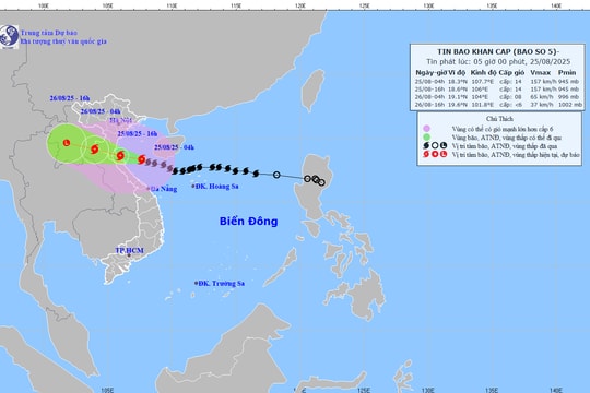
Storm Son-Tinh is about 190km from the mainland of provinces from Thanh Hoa to Quang Binh.
(Baonghean.vn) - At 4:00 p.m. on July 18, the eye of the storm was located at approximately 18.8 degrees North latitude; 107.5 degrees East longitude, right on the Gulf of Tonkin. The strongest wind near the eye of the storm was level 8-9 (60-90km/h), gusting to level 11.
According to the news released at 5:00 p.m. on July 18 by the National Center for Hydro-Meteorological Forecasting, the forecast for the next 12 hours is, the storm moves west, about 20-25km per hour;Tonight and tonight (July 18), the storm center with strong winds of level 8, gusting to level 10 will directly affect coastal areas of provinces from Thai Binh to Quang Binh.The storm will then move inland and weaken into a tropical depression..
At 4:00 a.m. on July 19, the center of the tropical depression was at about 18.9 degrees North latitude; 104.9 degrees East longitude, on the mainland of the North Central region. The strongest wind near the center of the tropical depressionlevel 6 strong(40-50km/hour),level 8 jerk.
 |
| Storm No. 3 is about 190km from the mainland of the provinces from Thanh Hoa to Quang Binh, with rough seas. Illustrative photo |
Forecast for the next 12 to 24 hours,The tropical depression continued to move westward, traveling about 20-25 km per hour and weakened into a low pressure area over Upper Laos.
Due to the direct impact of storm No. 3 in the North Central region:
* At sea:From this evening (July 18), there will be strong winds of level 6 - level 7, near the eye of the storm will be strong winds of level 8 - level 9, gusts of level 10, waves 3 - 5m high. The sea is very rough. Coastal districts from Thanh Hoa to Ha Tinh are likely to have sea levels rising above the tidal range of about 0.5m; waves 2 - 4m high. The sea is very rough.
* On land:From this evening and tonight (July 18), there will be heavy to very heavy rain and thunderstorms. (During thunderstorms, beware of tornadoes, lightning and strong gusts of wind.Coastal districts in the North Central region have winds gradually increasing to level 6 - level 7, areas near the storm center have winds of level 8, gusting to level 10.
This rain will last until around July 20. Total rainfall from July 18 to 20 is likely to reach: 150 - 300mm, in some places over 300mm.
Heavy rain in a short period of timehighly likely to causeflash floods and landslides in mountainous areas;floodingin coastal plains and urban areas.Disaster risk level due to heavy rain: level 2
* Flood warning: From July 18 to July 20, on the upper reaches of the Red River - Thai Binh, Hoang Long River, rivers from Thanh Hoa to Quang Binh, there will be a flood. Flood amplitude on the rivers is as follows: upper reaches of the Red River - Thai Binh from 2-4m; Hoang Long River from 1-2m; rivers from Thanh Hoa to Quang Binh from 3-5m.
During this flood, the flood peak on the Da River reached level 1; Thao River, Lo River, Hoang Long River and rivers in Thanh Hoa, Nghe An, Ha Tinh, Quang Binh reached levels 1-2, while Buoi River (Thanh Hoa), Ngan Sau and Ngan Pho Rivers (Ha Tinh) reached levels 2-3.Warning level of natural disaster risk due to floods, flash floods, landslides: level 2.


.jpg)


.jpg)
.jpg)
