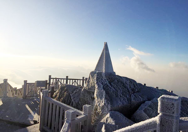
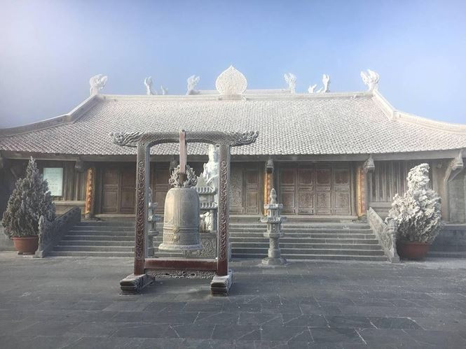
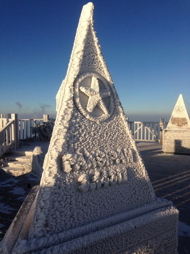
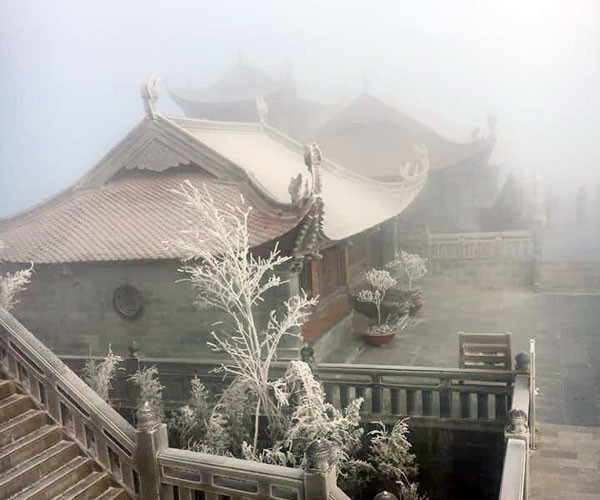
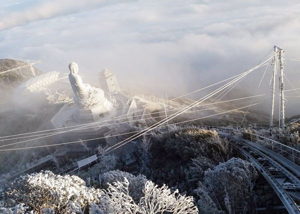
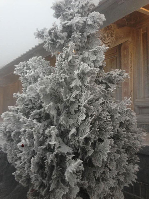
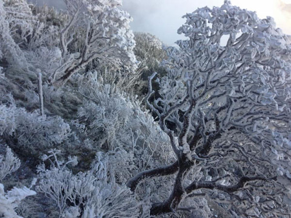
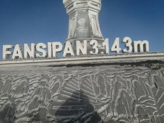
Due to the influence of cold air, early in the morning of December 19, snow and ice appeared at the top of Fansipan mountain (Sa Pa) from an altitude of about 2,800m and above.
According to Lao Cai newspaper, on the morning of December 19, the temperature at the top of Fansipan dropped below 0 degrees Celsius, causing water to condense on tree branches, the cable car station area was covered in ice, and at times there was light snow. The snow covered the entire high mountain peak, creating a very beautiful scene.
Quoting Mr. Luu Minh Hai, Director of Lao Cai Hydrometeorological Center, the article said: This cold air mass is not strong, but in some high mountain peak areas, the temperature is still low, combined with changes in air pressure, so it is very easy for ice and snow to form.
It is forecasted that from now until the end of the year, extreme weather will continue to be unpredictable. Snow and ice phenomena will occur more often. Such phenomena can only be predicted when they are about to occur during strong cold spells - said Mr. Luu Minh Hai.
According to the National Center for Hydro-Meteorological Forecasting, htoday (December 19),Strong cold air continues to strengthen in our country. In the Gulf of Tonkin, the sea off the Central Coast has strong northeast winds of level 6-7, gusting to level 8-9.
The lowest temperature last night and this morning (December 19) was in the Northern Midlands and Delta; the North Central region was generally from 8-11 degrees Celsius, mountainous provinces 4-7 degrees Celsius; some places had lower temperatures such as Sin Ho (Lai Chau) 2.8 degrees Celsius; Pha Din (Dien Bien) 3.4 degrees Celsius; Sa Pa (Lao Cai) 3.3 degrees Celsius, Trung Khanh (Cao Bang) 2.0 degrees Celsius, Mau Son (Lang Son) 2.6 degrees Celsius.
Forecast, nToday and tonight (December 19), cold air continues to strengthen.
Due to the influence of strong cold air, from today (December 19) to December 21, widespread cold will continue to occur in the North and North Central regions, and severe cold in mountainous areas; northeast wind inland level 3, coastal areas level 4-5, coastal areas of the South Central provinces have gusts of level 6-8.
Due to being deep in the cold and dry air mass, in the North and North Central provinces there are few clouds, sunny days, no rain at night. The lowest temperature in the morning and night in the Northern Delta is 9-12 degrees, in the mountainous and midland provinces 6-9 degrees, in the high mountains below 5 degrees. There is a possibility of frost and frost in the mountainous and high mountains;disaster risk level: level 1.
In Hanoi, the lowest temperature is from 9-12 degrees. The Gulf of Tonkin, off the Central and Southern coasts continue to have strong northeast winds of level 6-7, gusts of level 9, waves of 3-5m high; in the North and Central East Sea (including the waters of the Hoang Sa archipelago), strong winds of level 7-8, gusts of level 9, waves of 4-6m high. Rough seas.
Some pictures on top of Fansipan when ice and snow appear:
 |
| Photo: Lao Cai Newspaper/ Tien Phong |
According to Baochinhphu.vn


")

 đã đi vào vùng biển phía Đông khu vực giữa Biển Đông")

 cách Hoàng Sa 540km, thẳng tiến vùng biển Huế - Quảng Ngãi, đang tăng cấp")
