Close-up of 'the worst road in Nghe An province'
(Baonghean.vn) - Provincial Road 543D is over 100km long and runs through a series of communes in Ky Son district, but has seriously degraded. Many sections have even suffered landslides, making it impossible for cars to pass for more than 2 years.
| Clip: Tien Hung - Cong Kien |
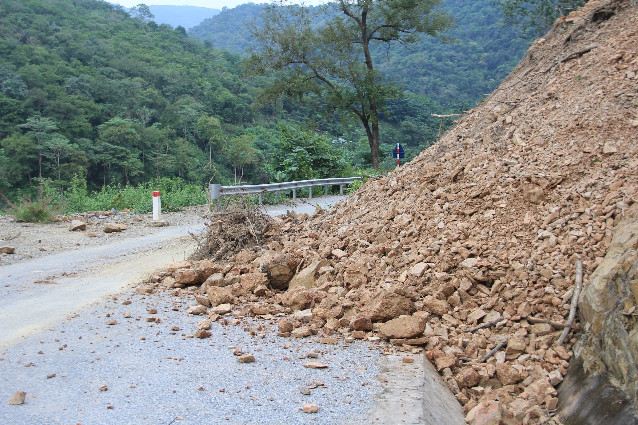 |
| Provincial Road 543D starts from Muong Xen town, passes through Ta Ca, Muong Tip, Muong Ai, Na Ngoi communes... and then intersects with National Highway 7 at Khe Kien. This route is more than 100km long, and has been seriously degraded for many years, often suffering from landslides. In the photo is one of hundreds of landslides on this route through Ta Ca commune. Photo: Tien Hung |
 |
| The most serious is the section from Muong Xen to Muong Ai commune. This road is 36km long but only 7km is paved as shown in the photo. However, on these paved roads, rocks and soil from the mountains often slide down, occupying the entire roadway. Photo: Cong Kien |
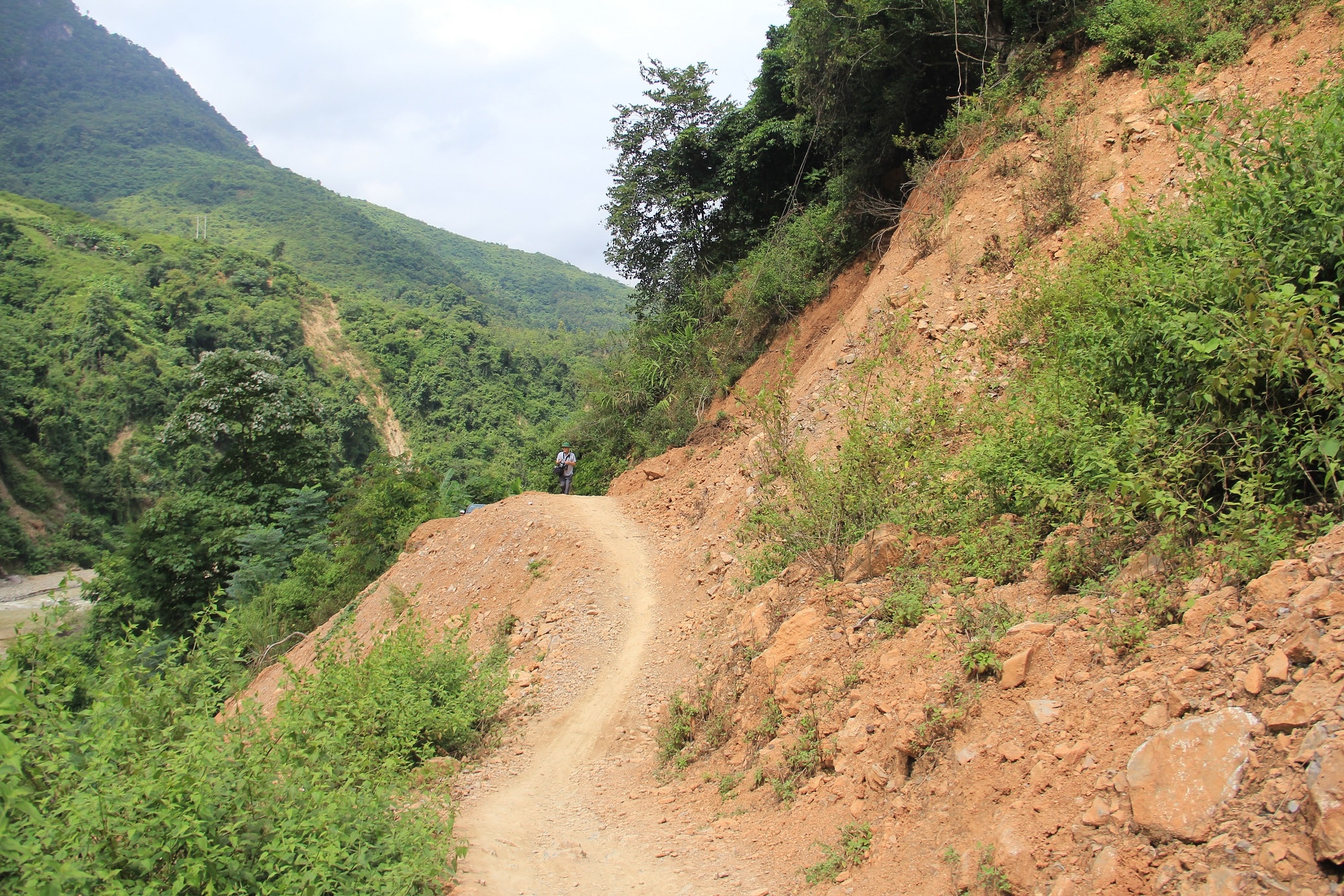 |
| The rest of this provincial road is mostly rugged dirt and rocks. On one side is a steep cliff, on the other side is the Nam Tip and Nam Mo streams that flow rapidly all year round. Photo: Tien Hung |
 |
| A bridge on the route was recently destroyed by floodwaters, with some spots left with only the steel frame. Photo: Cong Kien |
 |
| To go through this route, if the weather is nice, only 4-wheel drive vehicles can pass. With this vehicle, running at the highest speed for a distance of 36km, it still takes more than 3 hours. "Just one rain shower and no vehicle can pass. You have to walk all day to get to Muong Xen town", said Mr. Nguyen Huu Minh - Chairman of the People's Committee of Ky Son district. Photo: Tien Hung |
 |
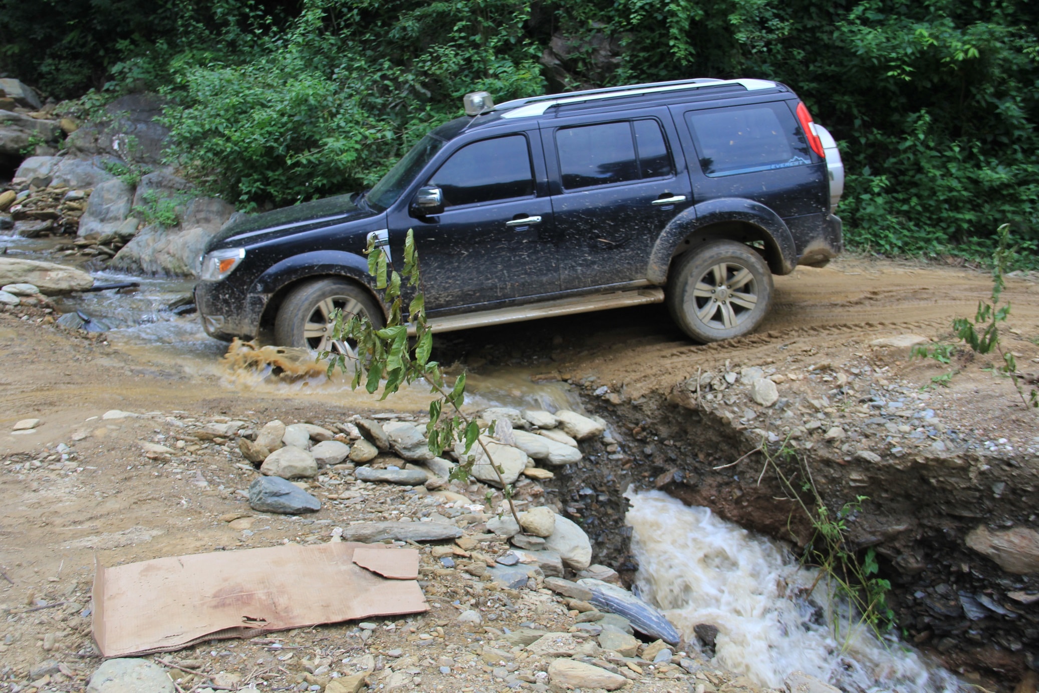
| Water from the creek cuts across the road. Drivers must be very careful before driving here. This provincial road is known as the worst road in Nghe An province. Therefore, although Muong Ai and Muong Tip communes are not the farthest away, they take the most time to get here. Photo: Cong Kien |
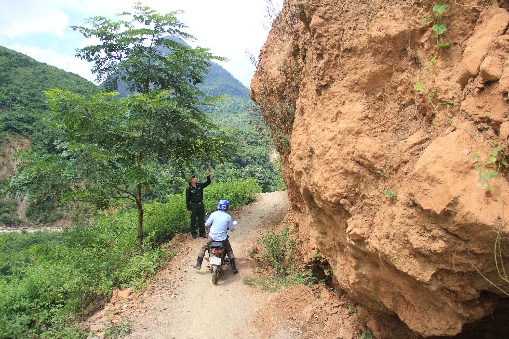 |
| Cars traveling on this route must stop at the center of Muong Ai commune and then turn back to Muong Xen, and cannot continue to Na Ngoi commune. The reason is that more than 2 years ago, a giant rock fell from the mountain and blocked the National Highway. The government and people then tried to fix it but it was only enough for motorbikes to pass because one side was the Nam Tip River. Photo: Cong Kien |
 |
| During the 2018 flood, Muong Ai and Muong Tip communes were isolated for nearly 2 months. The government had to mobilize a series of vehicles to work day and night to restore traffic. Photo: Tien Hung |
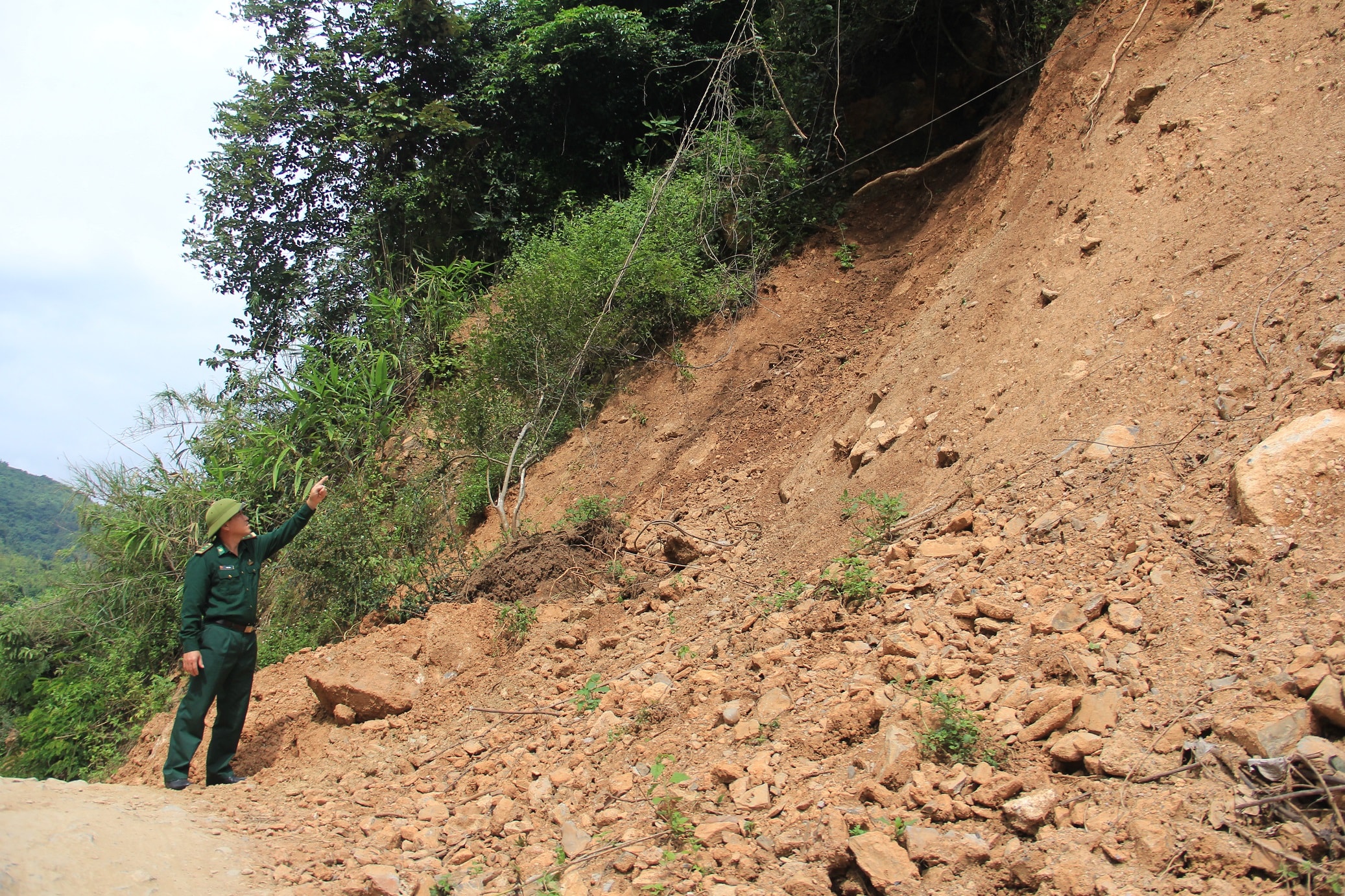 |
| Currently, landslides still lurk on this route. Photo: Cong Kien |
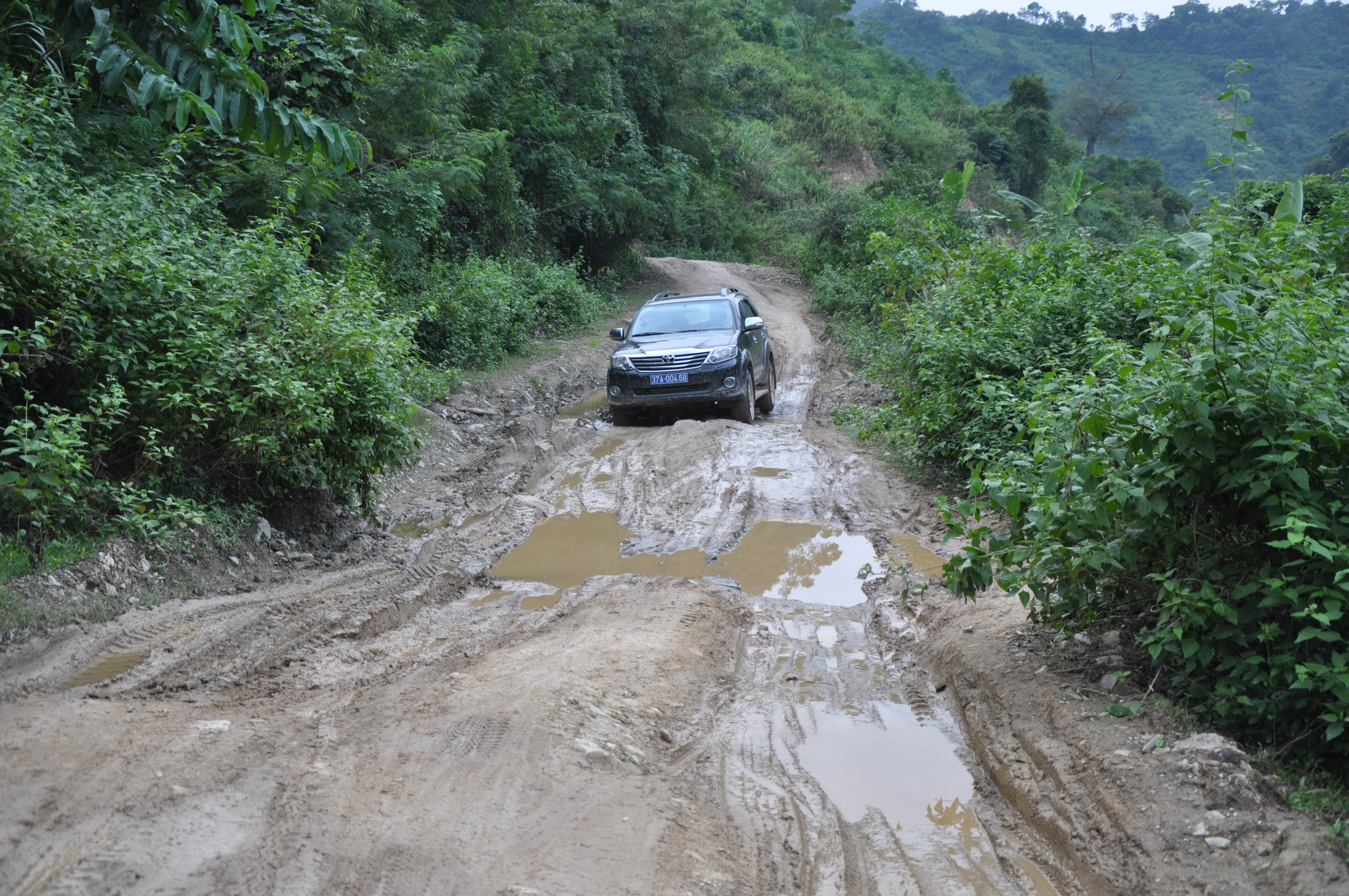 |
| Many sections that were not threatened by landslides were swamped. Photo: Tien Hung |
