Geological exploration drilling at the subsidence site on National Highway 16.
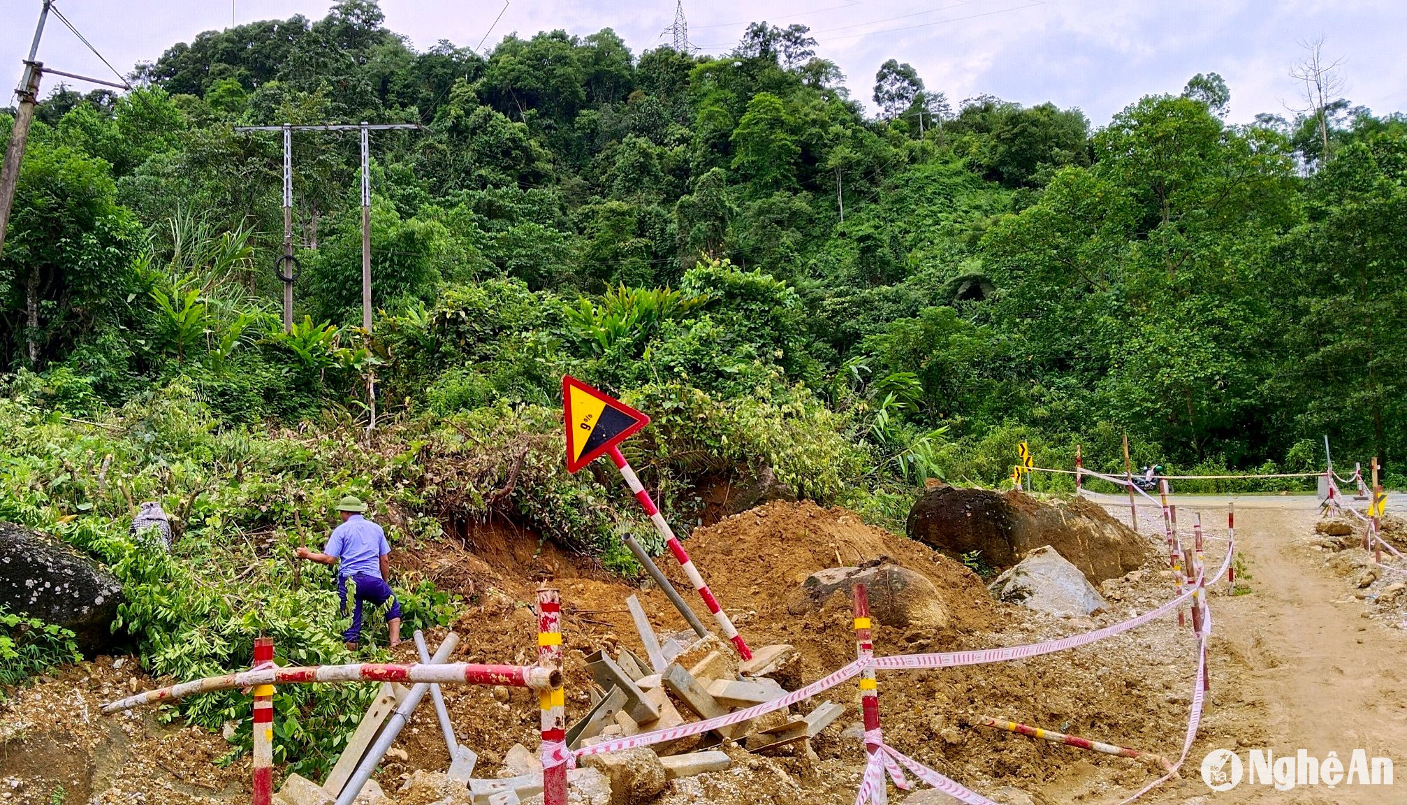
As of the afternoon of July 24th, the subsidence point on National Highway 16 in Que Phong district continued to sink by another 50cm, reaching a measured depth of 5.3 meters.
The subsidence along National Highway 16, at kilometer 264+700 on Chuoi slope, Chau Kim commune, Que Phong district, shows no signs of abating. As of the afternoon of July 24th, the measured depth had reached 5.3 meters, 10 times greater than on the first day the incident occurred (July 15th).
.jpg)
Mr. Nguyen Xuan Son, Head of the Que Phong Traffic Management Unit, said that the area has weak soil, and landslides occurred in 2021 and 2023. However, this subsidence is the most severe, and the continuous rain in recent days has caused the soil and rocks to sink even deeper, posing a risk of a long stretch of road being washed away.
.jpg)
Currently, the Department of Transportation is conducting geological surveys at the subsidence point on National Highway 16 to report to the Ministry of Transportation. The measured data will serve as the basis for specialized agencies to implement long-term remedial measures for this subsidence point. In the short term, two options have been proposed: building an elevated bridge or rerouting National Highway 16 to bypass the area prone to subsidence and landslides.
Mr. Nguyen Xuan Son - Head of Que Phong Traffic Management Unit
What's concerning now is that the temporary road opened to serve the transportation needs of the people is showing signs of subsidence and damage after continuous rains, making it only passable by motorbike; cars cannot pass through.
The Que Phong Traffic Management Unit stated that they are currently coordinating the construction of a new temporary road, located approximately 13 meters from the old one towards the embankment. This location has a more stable soil foundation, and surveys have shown no signs of subsidence or erosion. The opening of this temporary road will facilitate the construction unit's long-term road repairs and improve traffic flow for residents.
Currently, Que Phong district is still prohibiting traffic through the subsided section of National Highway 16, requiring people to strictly comply with the instructions and regulations of checkpoints and traffic controllers. People should follow the instructions of the Department of Transport, except in unavoidable circumstances (e.g., patients needing emergency medical care) where functional forces must inspect and escort them through the landslide section of the road.
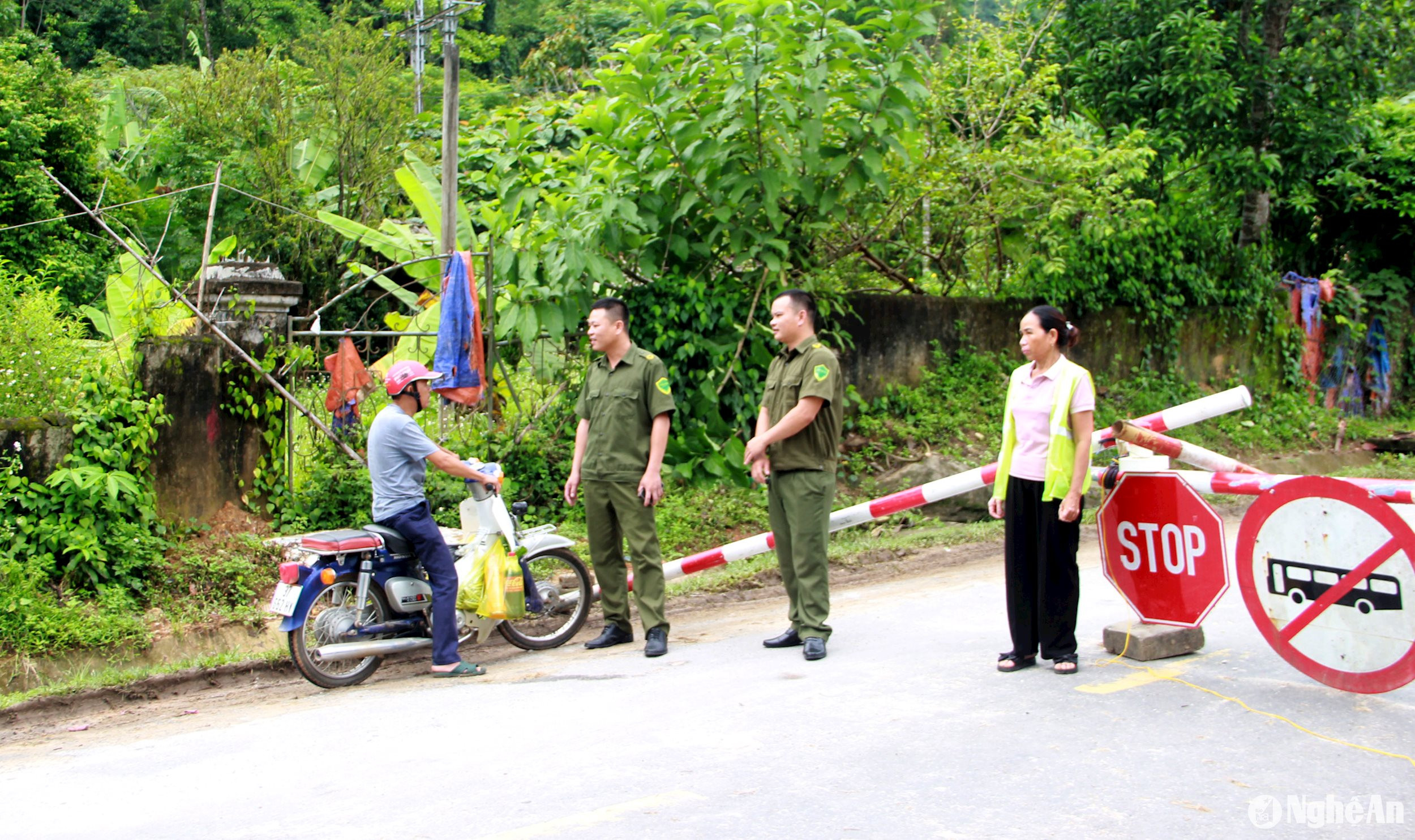
On July 23rd, Mr. Nguyen Van De, Vice Chairman of the Provincial People's Committee, personally inspected the subsidence site on National Highway 16 and directed Que Phong district to continue focusing on controlling and ensuring safety at the landslide location; and to implement solutions to ensure the livelihoods of people affected by the road closure. After the storm subsides, he requested the Department of Transport and the local authorities to coordinate to allow motorcycles and cars under 5 tons to temporarily pass through.

