Sacred land at the lower reaches of the Lam River
(Baonghean.vn) - In about 10-15 minutes by car, we can temporarily leave behind the noisy and bustling city of Vinh to immerse ourselves in a vast, airy landscape with endless mountain ranges, winding rivers, and peaceful villages. That place is also known as sacred land.
Go up the mountain to admire the scenery.
Since I first started my career as a journalist, a teacher from a rural area in the central highlands advised me: "If you have plenty of time, you should visit the Lam Thanh - Trieu Khau area, downstream of the Lam River, to admire the scenery. It will give you a new perspective on your homeland within the flow of its history and culture."
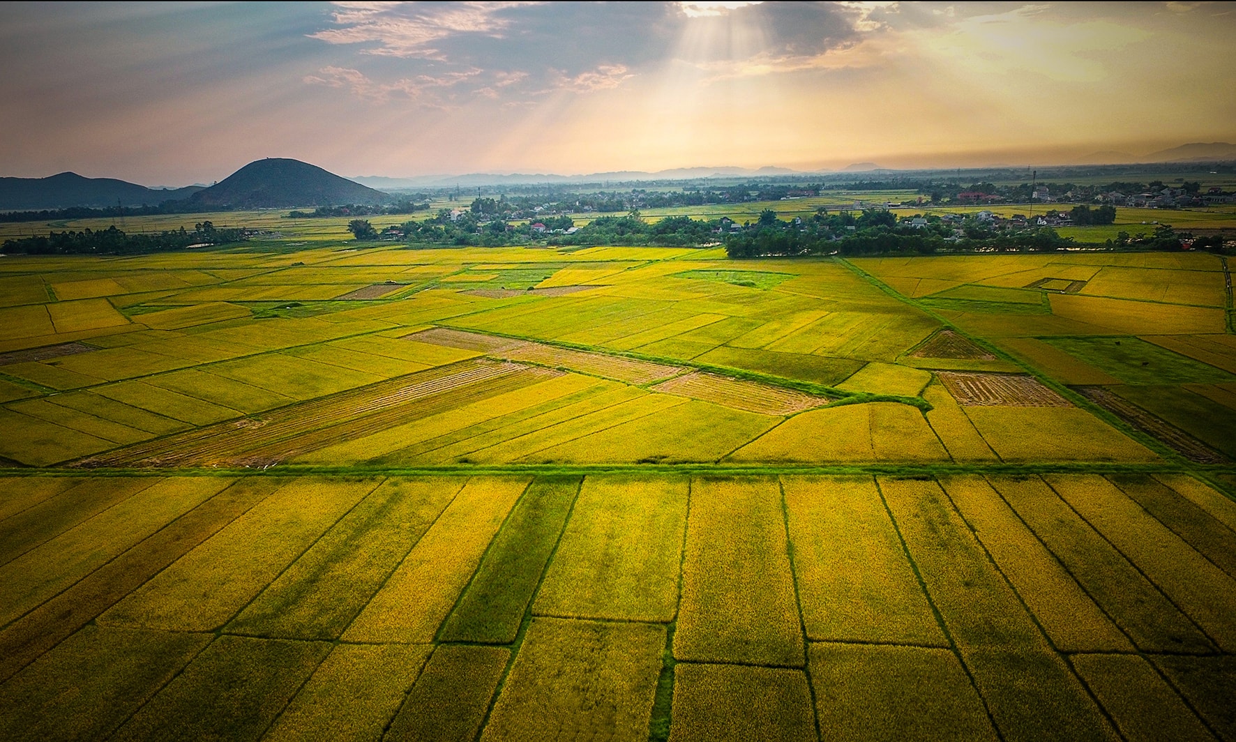 |
| Landscape of the lower Lam River region as seen from Lam Thanh Mountain. Photo: Nguyen Sach. |
Following my teacher's advice, on weekends when I had some free time, I would drive along the Lam River. Here, my worries and anxieties seemed to dissipate, leaving behind a sense of tranquility and peace.
Along the Lam River embankment, in the downstream area of Hung Nguyen district, if you drive slowly, you will feel the cultural charm of this very peaceful countryside. This cultural charm is evident in the historical sites; a stretch of less than 7 km contains dozens of classified historical and cultural relics, including famous ones such as Hoang Muoi Temple, Thanh Liet Temple, King Le Temple, and Lam Thanh Mountain…
 |
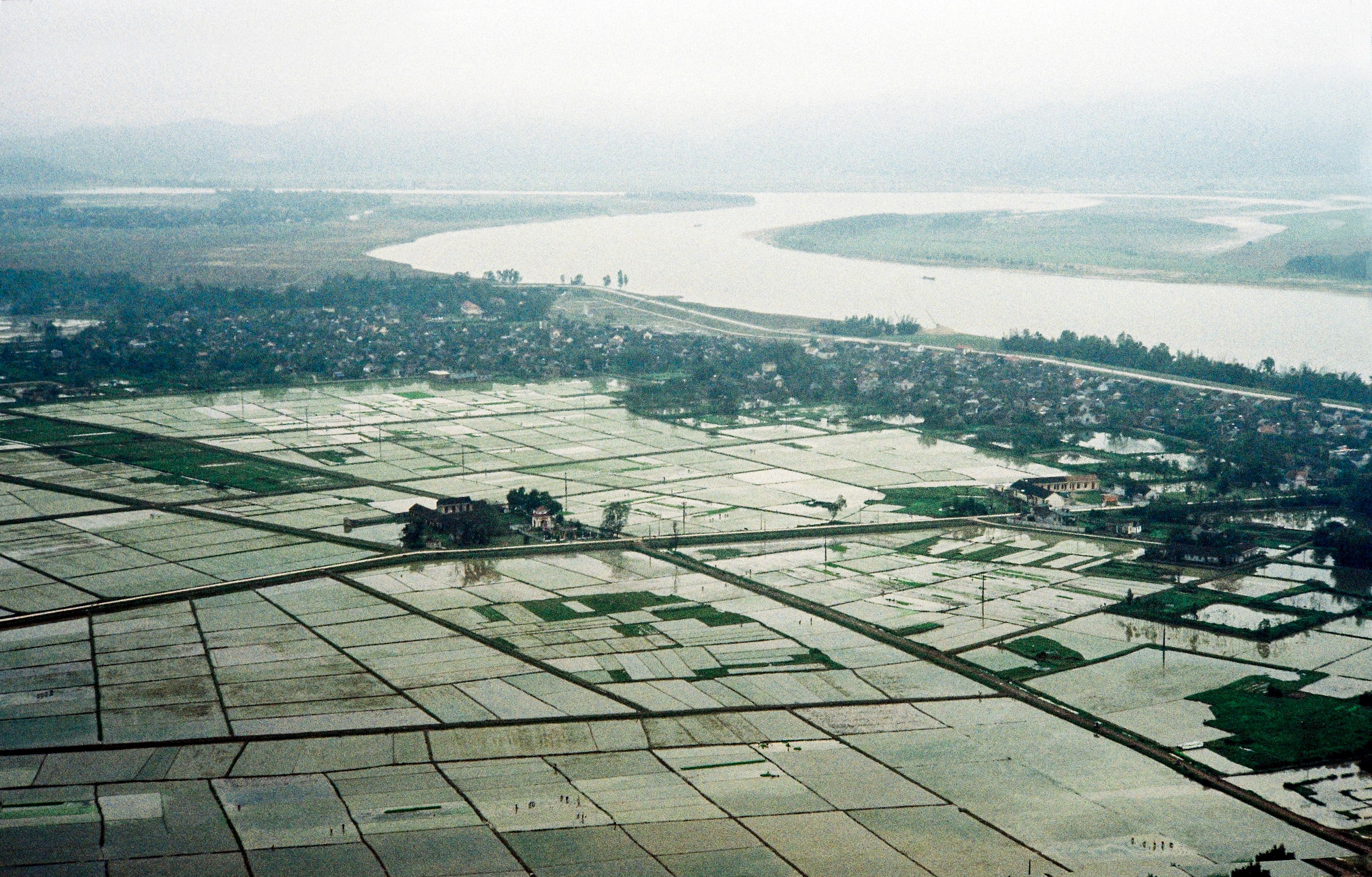
| Lam Thanh Mountain historical site (Hung Nguyen). Photo: Nguyen's book. |
The presence of relics hundreds, even thousands of years old, marks the enduring cultural heritage of the villages downstream of the Lam River. Not to mention the ancient communal houses and ancestral temples with moss-covered tiled roofs, and each village and mountain name still holds vivid stories and ancient evidence, representing the spiritual legacy for generations to come.
When I visited the Lam Thanh - Trieu Khau area (now the communes of Hung Lam, Hung Phu, and Hung Khanh), I often climbed Lam Thanh Mountain – a famous mountain known for having once been a stronghold of the invading Ming army. It was also the meeting point and site of the glorious victory of the Lam Son rebels nearly 600 years ago, paving the way for Le Loi and his generals' march to liberate Dong Do citadel.
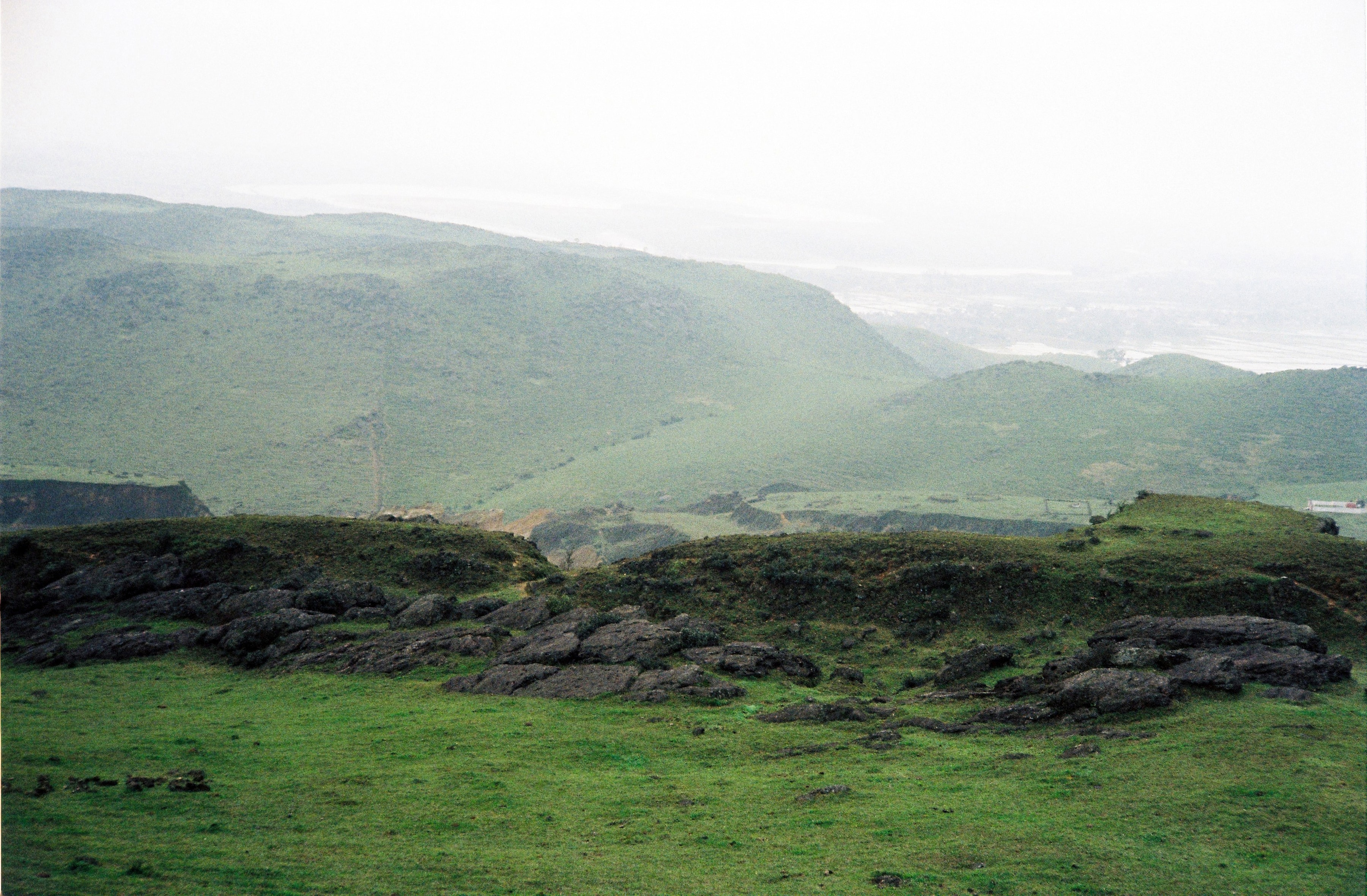
Every time I go up the mountain, I often stand for a long time to admire the scenery near and far, first of all the winding road along the left bank of the Lam River and the lush, prosperous villages. The road runs along the Ta Lam dike (also known as dike 42), starting from Nam Dan district, passing through Hung Nguyen to Ben Thuy. Today, it continues all the way to Cua Hoi, where the river flows into the sea.
 |
| Landscape of the lower Lam River region as seen from Lam Thanh Mountain. Photo: Nguyen Sach. |
Even that dike is a marvel of the people of Nghe An in their flood control efforts, as generations have poured their energy into reinforcing and maintaining it to block the floodwaters, ensuring lasting peace. There are also villages located outside the dike, which are often flooded annually, disrupting their lives. But from generation to generation, the people have always been prepared to face the rising waters.
Climbing Lam Thanh Mountain, I was free to let my gaze wander – to the distant mountain range and the river's surface like a mirror reflecting the deep blue sky. Occasionally, boats sailing back and forth added a touch of life to the picturesque landscape, evoking a harmony between nature and human emotions.
Descending the mountain to reach the sacred land.
Descending the mountain, I once again visited two of the most ancient temples in the region – Thanh Liet Temple and King Le Temple. Thanh Liet Temple (Hung Lam) is located outside the dike, situated on a strip of alluvial land along the river, with a large stream in front. The temple still retains its ancient architecture, its grounds shaded by old trees, all evoking the sacred atmosphere of the countryside.
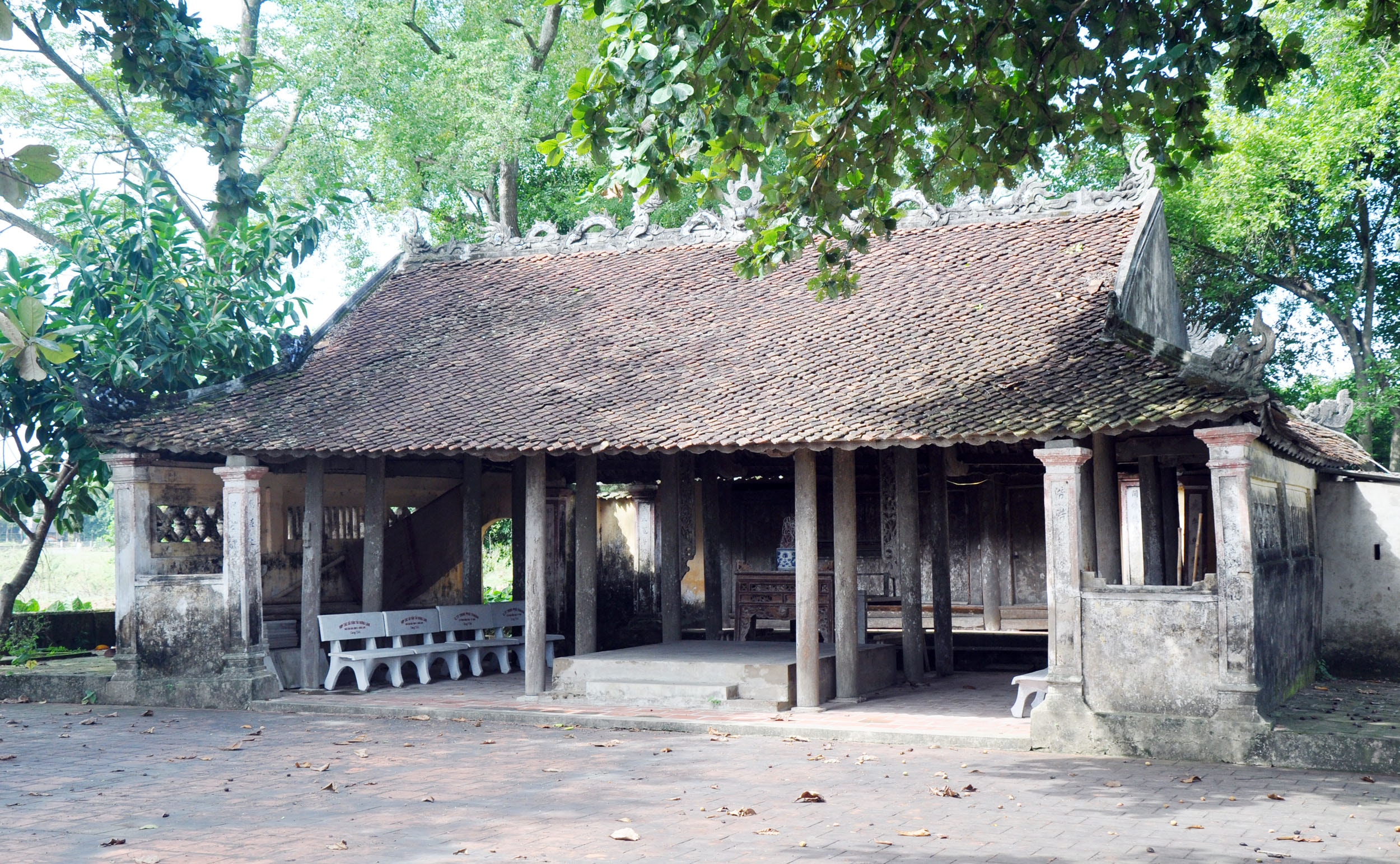 |
| The ancient charm of Thanh Liet Temple, Hung Lam commune (Hung Nguyen district). Photo: Cong Kien |
According to historical records, Thanh Liet Temple was built during the Later Le Dynasty, dedicated to benevolent deities who contributed to protecting the nation and its people. Most of the deities worshipped here are associated with life in the riverine region, such as: Thuy Phu Phu Tang Cam Lam Dai De, Thuy Quoc Dong Binh Quan, Ha Ba Thuy Quan Long Vuong Chua Te, Thuy Tinh Phu Nhan (Mother of Water), Long Vuong Chua Te Thuy Toc, Sat Hai Dai Vuong Hoang Ta Thon, Nguyen Bieu…
From Thanh Liet Temple, heading down to Hung Khanh to light incense before the ancestral tablets of the Le Kings, I felt as if I could still hear the echoes of the battle cries from nearly 600 years ago. Hung Khanh, formerly known as Trieu Khau, was where King Le Loi of Binh Dinh chose to establish his headquarters to gather supplies, train, and recruit soldiers to besiege the Ming invaders in Nghe An citadel (built on Lam Thanh mountain).
The people of Trieu Khau wholeheartedly supported the Lam Son rebels, contributing rice to feed the troops and enthusiastically joining forces, united in their determination to drive out the enemy. This contributed to increasing the strength of the Ming army, pushing them to the brink of defeat and forcing them to surrender, resulting in the fall of Nghe An. Later, King Le Thanh Tong ordered the construction of a temple dedicated to Le Thai To (Le Loi) in the Trieu Khau area, naming it the Temple of King Le.
During the reign of Le Hy Tong, in the Chinh Hoa era (1680 - 1740), the ancestral tablets of King Le Thai Tong and King Le Thanh Tong were brought to be worshipped at the Le King Temple. Thus, the temple on the sacred land of Trieu Khau became the place of worship for the ancestral tablets of three wise Le kings who made great contributions to the nation's history.
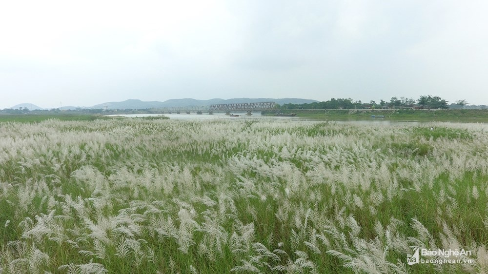 |
| Reed fields along the Lam River in Nam Cuong commune (Nam Dan district). (Archival photo) |
With time still available, I continued upstream along the Ta Lam dike, then crossed the Yen Xuan bridge (Hung Xuan) to Nam Cuong (Nam Dan). Here, along the riverbank, the reeds are covered in a pristine white carpet this season, a pure white color that has drawn many people away from the city to enjoy moments of peace.

