Stone embankment to prevent landslides along National Highway 16.
Que Phong District has directed local authorities and relevant forces to erect warning signs for vehicles and to construct gabion retaining walls to prevent landslides and rockfalls onto the road along National Highway 16.
In recent days, due to the impact of Typhoon No. 4, Que Phong district has experienced heavy rain in many areas, causing landslides on roads and affecting people's transportation. The most dangerous section is the Chuoi slope on National Highway 16.
.jpg)
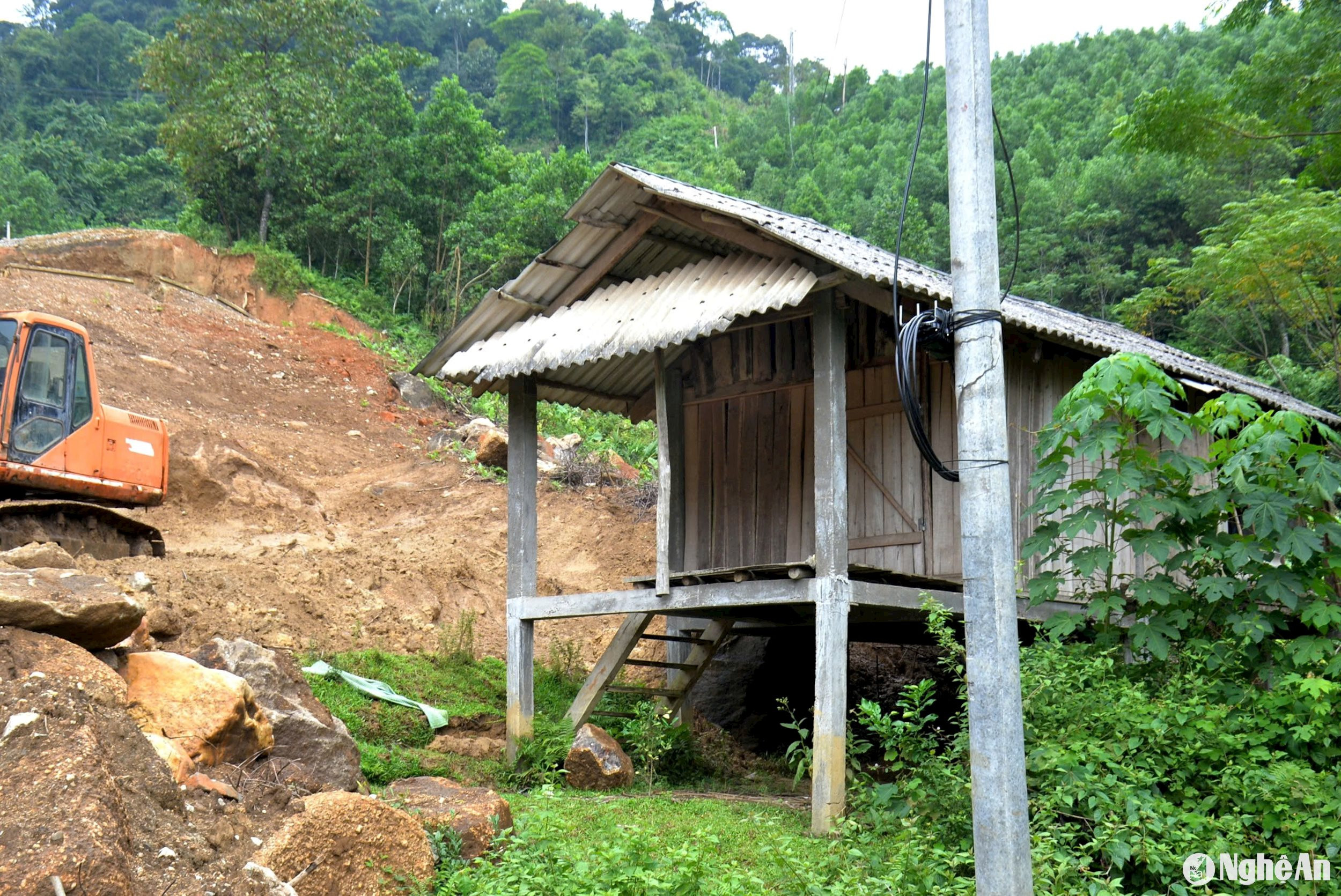
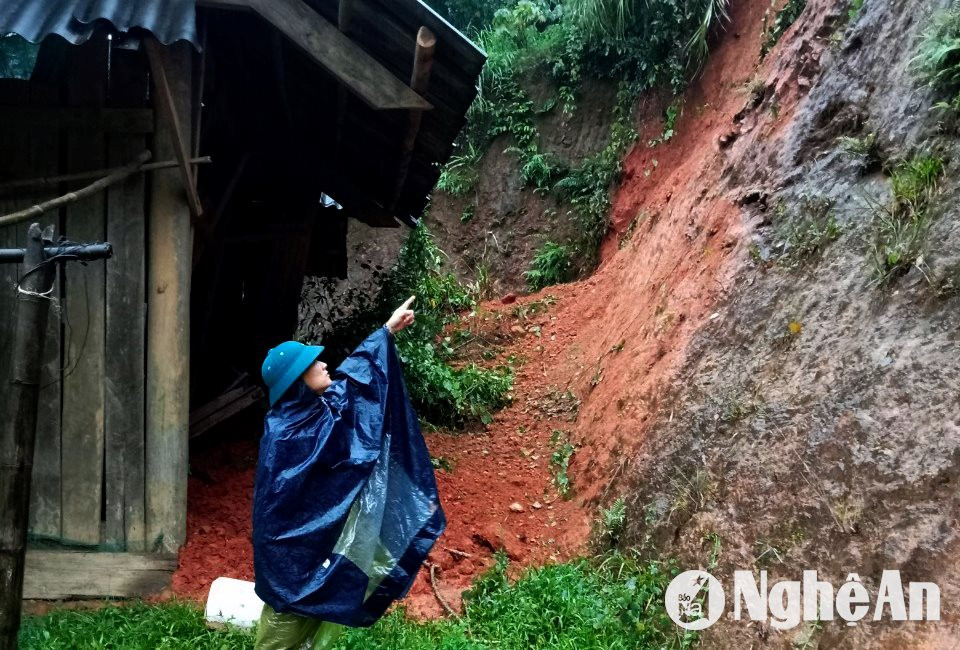
According to reporters, this landslide area is about 300 meters from the subsidence site that occurred last July. The soil and rocks here are weak after the rains, and large cracks are clearly visible. Many huge rocks have rolled down to the edge of the road, posing a significant danger.
.jpg)
Mr. Vi Van Chung from Tri Le commune said: "This section of National Highway 16 is both steep and has many curves, making it difficult for vehicles to pass through. Now, with the appearance of dangerous landslides, people are very scared, and many don't dare to travel through here, especially at night..."
Given the situation, authorities have implemented a plan to build an embankment to prevent landslides at this location. Mr. Nguyen Xuan Son, Head of the Road Transport Department of Que Phong District, said: "There is an underground water source at this point, and coupled with the continuous rain in recent days, the risk of further landslides is very high. Currently, the unit is constructing a 41-meter-long gabion embankment underneath to prevent soil and rocks from spilling onto the road. This is a temporary solution to minimize risks during these days of heavy rain."
.jpg)
Reportedly, the subsidence point on National Highway 16 continues to sink after the recent rains, with a measured depth of approximately 6 meters. However, since a temporary road has been completed, people can still travel safely, except for heavy vehicles which are not allowed to pass through the checkpoint.
Landslides are not only occurring on National Highway 16, but currently, there are still dangerous landslide areas in Que Phong district, such as on National Highway 48D and the roads leading to Nam Giai and Cam Muon communes…
Mr. Lo Minh Tuong, Chairman of the People's Committee of Nam Giai commune, said: After the recent continuous rain, the road from the intersection of Chau Kim commune to the commune has many landslides of varying sizes, including four major ones in Pong and Puc villages. Currently, 45 households in these villages are at high risk and are ready to be relocated when the weather worsens. The local authorities have also established teams to inspect and assess vulnerable points in the area, and are educating people not to collect firewood or catch fish along streams and creeks…
During the discussion, Mr. Bui Van Hien, Vice Chairman of the People's Committee of Que Phong district, said: Regarding landslide-prone areas along roads and residential areas, the district has directed local authorities to erect warning signs and ropes to alert people and remind them to avoid these areas. For high-risk areas, machinery will be mobilized to level the ground and create pathways for people, minimizing isolation during heavy rain. In addition, communes need to proactively review vulnerable points and have forces, vehicles, and supplies ready 24/7 to respond according to the "four on-the-spot" principle.

