Difficulties in overcoming landslides in Hung Nguyen
(Baonghean.vn) - Huyện Hưng Nguyên đang tìm phương án xử lý các điểm sạt lở núi tại xã Hưng Thành và Hưng Yên Nam để đảm bảo an toàn cho người dân trong mùa mưa bão.
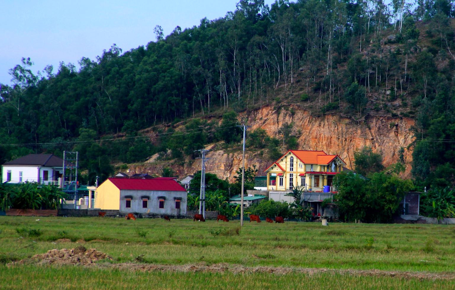
After the recent flood, the next door was damaged.ngập lụt trên diện rộngIn Hung Nguyen district, landslides have continuously occurred, such as Tho Lo mountain (Hung Thanh commune); Lai hill, Ram hill, Troc mountain (Hung Yen Nam); Cho hill, Da Da hill, Ram hill (Hung Yen Bac); Xom 8 mountain (Xuan Lam commune)... In which, Hung Thanh and Hung Yen Nam communes are the most dangerous because the cracks can collapse at any time.
 |
Large landslide at Lai hill right next to a house in Hung Yen Nam commune, Hung Nguyen district. Photo: QA |
According to observations, the crack at Tho Lo mountain, Hung Thanh commune is about 150 meters long, the depth of the subsidence point is over 1 meter; currently, 12 households and 55 people are directly affected, of which 8 households are subject to emergency evacuation when there is heavy rain.
Mr. Hoang Duc Thong - Chairman of Hung Thanh Commune People's Committee said: In the face of the landslide at Tho Lo mountain, the locality has implemented synchronous solutions. In the immediate future, the commune has chosen the old Hung Phu Commune People's Committee headquarters as a shelter for people to live in if there is heavy rain. At the same time, a command post has been established right at the foot of the mountain, with a force on duty 24/7 to grasp the situation, support people in transporting goods, and evacuate promptly if a landslide occurs...
In Hung Yen Nam commune, two peaks of Lai and Ram appeared with landslides hundreds of meters long right next to people's houses. According to statistics from local authorities, there are about 600 households living under these two peaks, stretching from hamlets 3, 4, 5, 6. Of these, 50 households are at high risk, their houses are only a few meters away from the peak, so they are forced to evacuate when there is heavy rain.
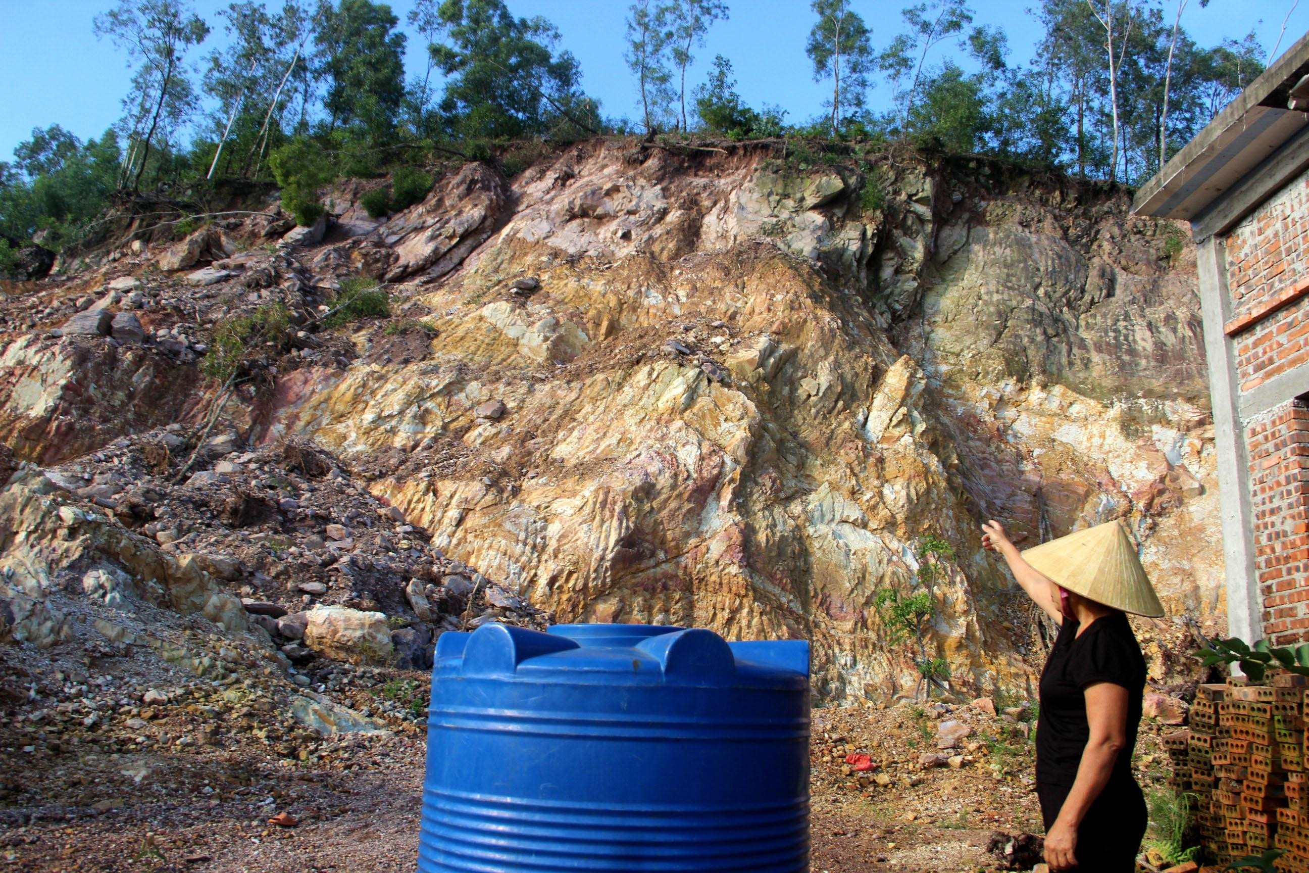 |
People in Hung Yen Nam commune are worried about living next to a landslide at the foot of the mountain. Photo: QA |
Currently, the local government has built dozens of meters of stone embankment at the foot of the mountain to protect the households below. However, according to observations, this is a temporary measure because if there is a large landslide, soil and rocks can easily overflow this embankment, and people will still have to evacuate when it rains heavily. Therefore, there is still a need for long-term solutions to ensure people's lives.
Discussing this issue, Mr. Hoang Anh Tien - Vice Chairman of Hung Nguyen District People's Committee said: In addition to on-site plans such as evacuating people to safe places and sending forces to stand guard at vulnerable points, the district has asked for opinions from provincial departments and branches to bring in machinery to level landslides to prevent rocks and soil from falling. For landslides in Hung Yen Nam commune, the district is mobilizing vehicles and taking advantage of sunny weather to carry out construction.
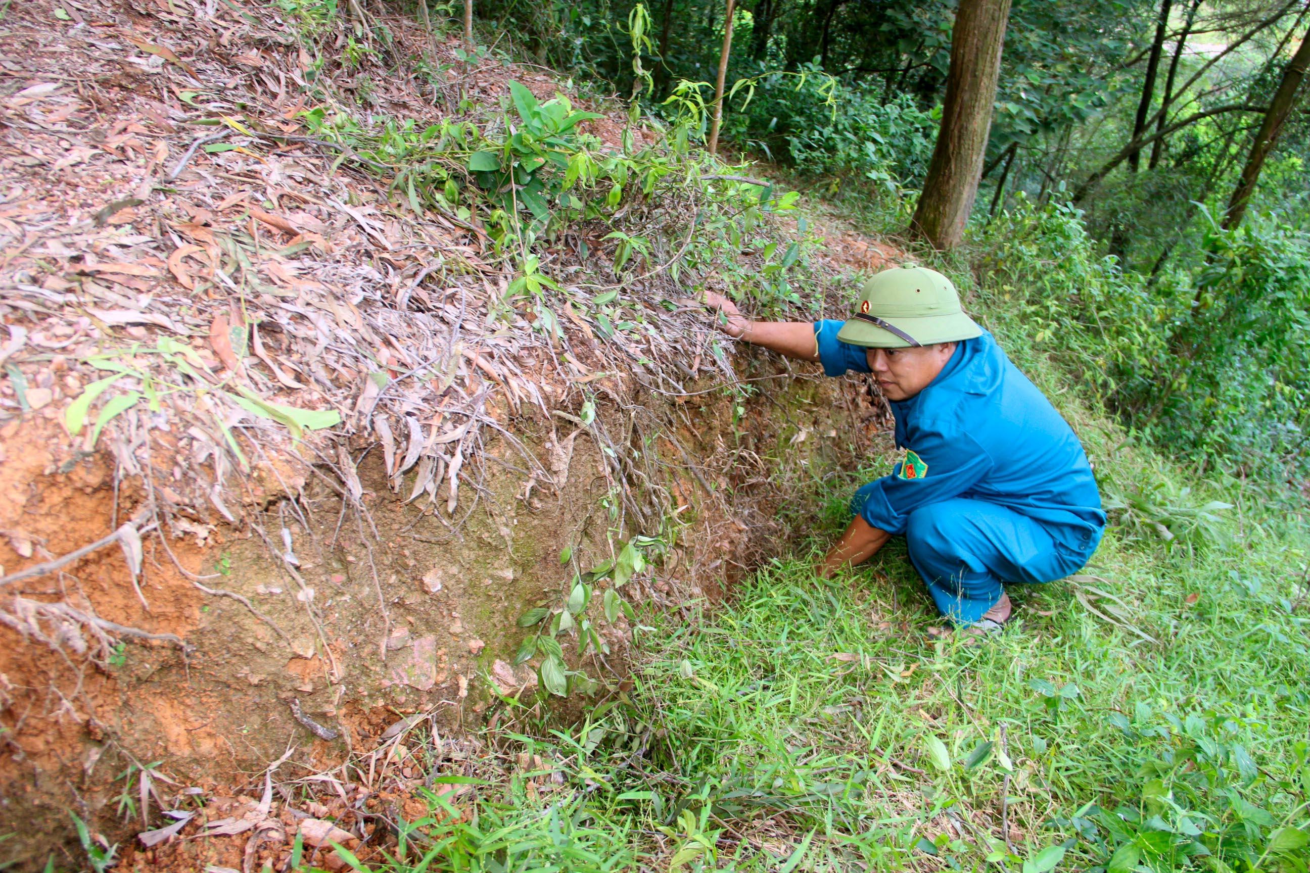 |
Landslide at Tho Lo mountain, Hung Thanh commune. Photo: QA |
"Regarding the landslide in Hung Thanh commune, the district is waiting for the opinion of the Ministry of Culture, Sports and Tourism because the landslide area is located in the Lam Thanh Mountain historical relic area. After receiving approval, the landslide at Tho Lo mountain will be fixed soon, ensuring the safety of households," Mr. Tien emphasized.


 may mắn thoát nạn trong gang tấc")


