Ru Nguoc (Thanh Chuong) continues to erode
(Baonghean.vn) - After heavy rains, some locations at Nguoc Mountain (Thanh Chuong, Nghe An) continued to experience landslides, posing a potential safety risk.
On April 28 and 29, Nghe An in general and Thanh Chuong district in particular experienced heavy rains over a wide area. This greatly affected the lives and production activities of the people. Thousands of hectares of corn and rice were broken.
In particular, landslides continued to occur in the Nguoc mountain area of Thanh Ngoc and Ngoc Son communes.
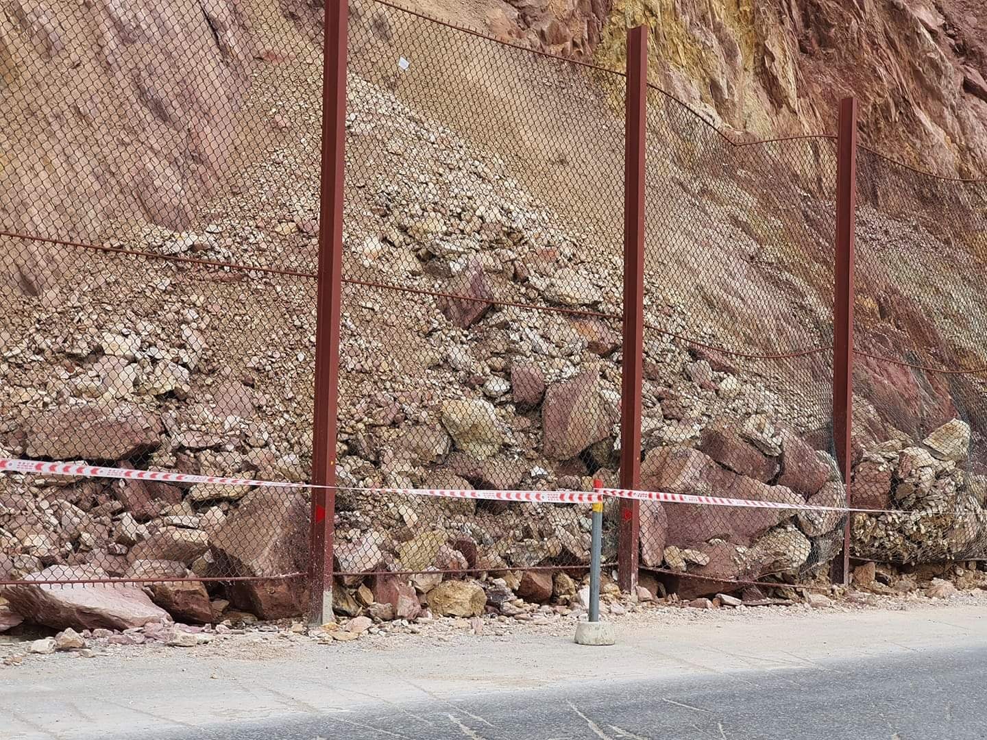 |
| Masses of rock and soil continue to slide. Photo: Van Ly |
According to the reporter’s records on the morning of April 30, at the locations of Ru Nguoc, hundreds of cubic meters of soil and rocks collapsed and spilled onto the roadside. Fortunately, thanks to the mesh barrier, the amount of soil and rocks were retained.
However, the protective mesh layer was strongly impacted and deformed, burst, and broke. The risk of unsafety is present.
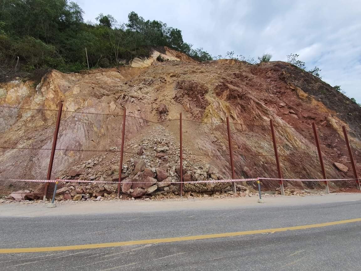 |
| The amount of soil and rocks was stopped by the steel mesh fence. Photo taken on the morning of May 1, 2021. Photo: Dinh Hao |
Over the years, landslides at Ru Nguoc have occurred frequently and with increasing severity. In 2020, a landslide occurred here, causing a temporary blockage of National Highway 46. To minimize landslides and limit the impact on people and vehicles passing through this area, the General Department ofRoadhas invested in a remedial project. Accordingly, the investor has covered the roof, created layers, and installed a high-mesh steel pile system. However, the resistance of the newly invested steel mesh system cannot be guaranteed in the near future.
Ru Nguoc is over 109m high, located on the Lam River. National Highway 46 runs through the foot of Ru Nguoc, so on one side is a high cliff, on the other side is a deep abyss of Lam River.
")

