Tropical depression appears in the East Sea
(Baonghean.vn) - Early this morning (August 10), the low pressure area in the northwest of Hoang Sa archipelago strengthened into a tropical depression.
At 4 o'clock,The center of the tropical depression is located at about18.5 degrees North latitude; 111.3 degrees East longitude, about 100km East Southeast of Hainan Island (China). The strongest wind near the center of the tropical depression is level 6 (40-50km/hour),level 8. The range of strong winds of level 6, gusting to level 8 is about 50km from the center of the tropical depression.
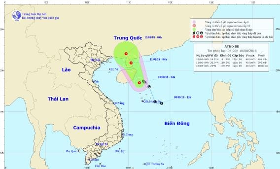 |
| Location and path of the tropical depression. Photo: National Center for Hydro-Meteorological Forecasting |
Forecast for the next 24 hours,The tropical depression is moving in a north-northwest direction, traveling 10km per hour. At 4:00 a.m. on August 11, the center of the tropical depression was at about 20.9 degrees North latitude.; 110.3 degrees East longitude, in the eastern area of Leizhou Peninsula (China). The strongest wind speed is near the center of the tropical depression.stronggrant6(40-50km/h),level 8. The range of strong winds of level 6, gusting to level 8 or higher is about 50km from the center of the tropical depression.
Due to the influence of the tropical depression, in the northwest sea area of the North East Sea, there will be showers and thunderstorms, strong winds of level 6, gusts of level 8; rough seas.
Dangerous areas in the East Sea in the next 24 hours: (strong wind level 6 or higher): North of latitude 17.5 degrees North; East of longitude 109.0 degrees East.
Over the next 24 to 48 hours,The tropical depression moved in a northwest direction, traveling 5km per hour.
In addition, due to the influence of the tropical convergence zone combined with the strong southwest monsoon, during the day and tonight (August 10), in the central and southern East Sea (including the waters of Truong Sa archipelago), the sea from Binh Thuan to Ca Mau will have strong southwest winds at level 6, gusting to level 8, waves from 2-4m high; rough seas.
The Gulf of Tonkin, the South East Sea (including the Truong Sa archipelago), the seas from Binh Thuan to Ca Mau, Ca Mau to Kien Giang and the Gulf of Thailand will have heavy thunderstorms; there is a possibility of tornadoes and strong gusts of wind during thunderstorms.Disaster risk level due to strong winds and big waves: level 1.
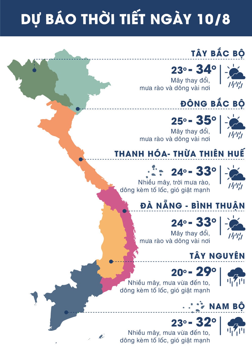 |
| Temperature on August 10 in regions across the country. Photo: news.zing.vn |


.png "Nghệ An chủ động ứng phó áp thấp có khả năng mạnh lên thành áp thấp nhiệt đới, mưa lớn, nguy cơ lũ quét, sạt lở đất")
