Landslide on Dinh River bank threatens many houses and farmland in Quy Hop
Along the Dinh River in Quy Hop District, there is serious erosion, eating into houses and sugarcane growing areas, causing panic and anxiety among local people.
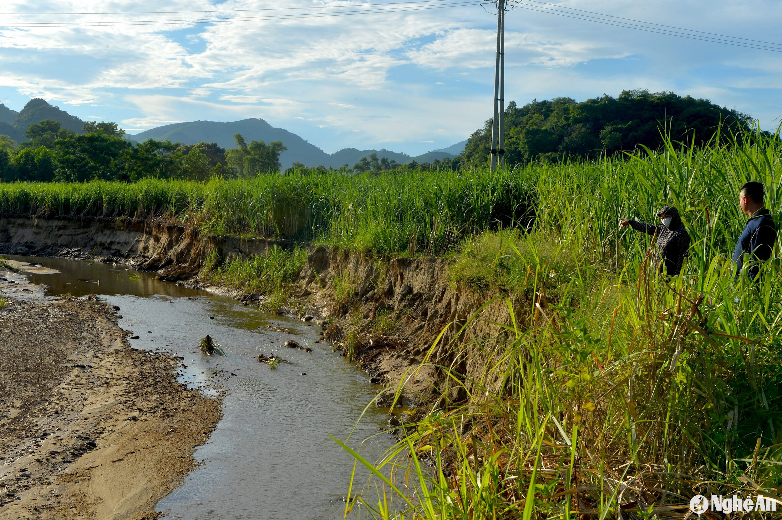
On the way to Soi Duoi hamlet, Tho Hop commune, Quy Hop district, we saw that riverbank erosion had eaten deep into many sugarcane areas. Mr. Truong Van Nhuan in Soi Duoi hamlet said: "Just a few weeks ago, the first flood of the season, more than 2 sao of sugarcane of my family were swept away into the Dinh river. At this rate, many areas of cultivated land will be swept away into the river."
.jpeg)
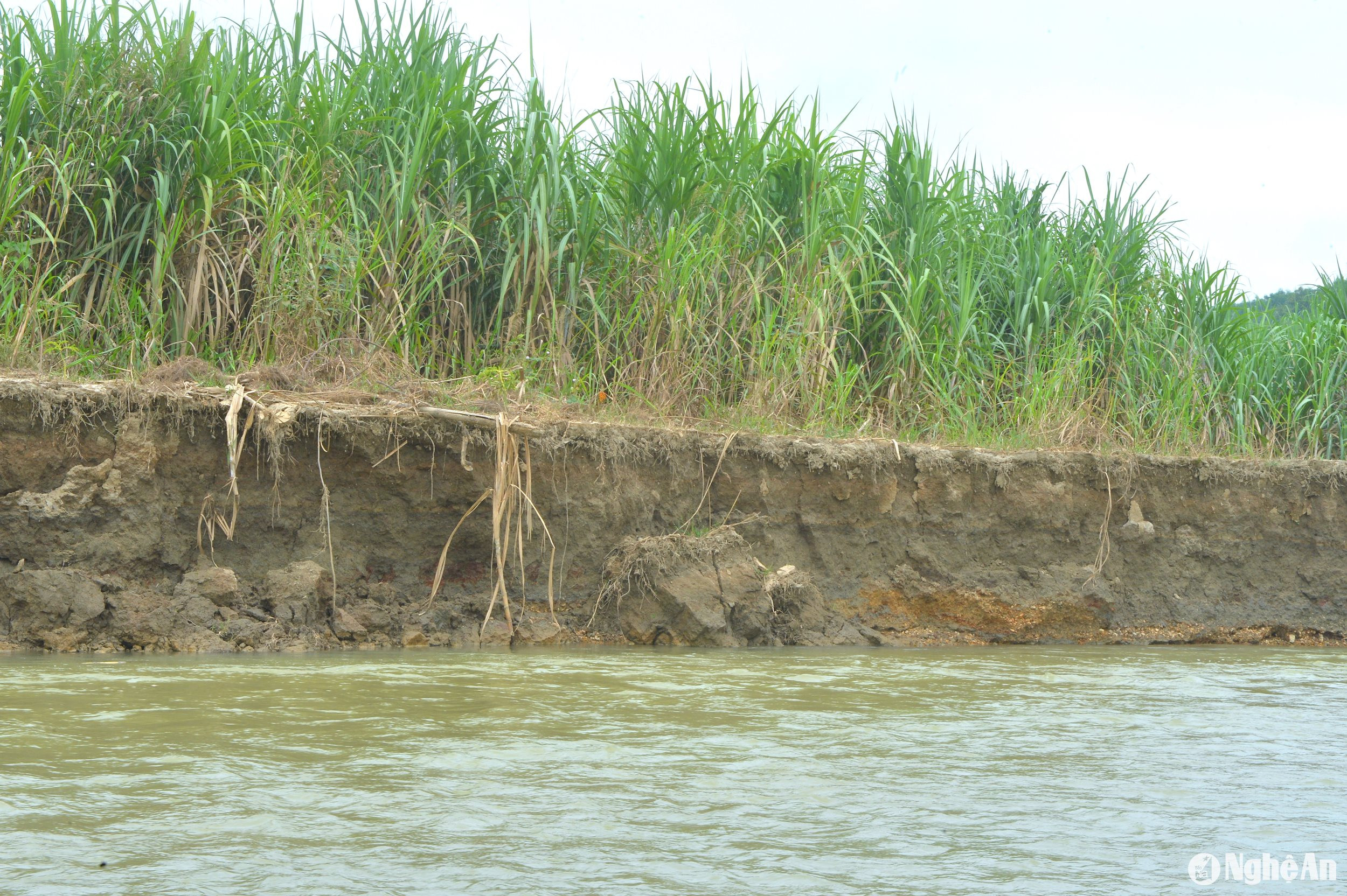
Ms. Truong Thi Hoa - Head of Soi Duoi hamlet led us to the eroded sugarcane field and shared: In the past 5 years, the erosion of the Dinh river bank has encroached on over 100 meters of cultivated land. In Soi Duoi hamlet alone, over 20 hectares of sugarcane land have been swept away into the river.
What is particularly dangerous is that the 110 kV power pole passes about 8-10 meters from the river bank, and just a few floods will put the power pole under the river. Most of the people living in the landslide area still face many difficulties in life, losing their land and having to work for hire in different places.
Mr. Truong Van Hoan - Chairman of Tho Hop Commune People's Committee added: Dinh River runs through the commune for more than 3 km, and over the past 5 years, riverbank erosion has caused serious damage. The whole commune has about 30 hectares of cultivated land, mainly sugarcane, that have been washed away into the river. Currently, 1 household in Xuan Tien hamlet is affected.
Next door is Tam Hop commune, which has also been severely affected by landslides on the Dinh River bank over the past many years. A representative of the People's Committee of Tam Hop commune said: "The Dinh River section passing through the commune has been eroded for about 3/6 km, with over 155 households at risk of landslides; of which, over 40 households are located in particularly dangerous areas, mainly in Tan Mung, Dinh, Dong Chao hamlets...
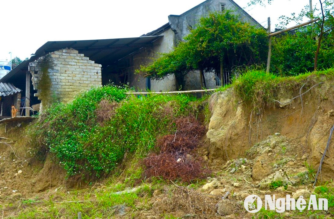
At the landslide point on the riverbank of Yen Luong village, Chau Quang commune, in 2023, the reporter went back to investigate. Now the riverbank landslide has eaten deeper into the sugarcane field. At Mr. Lu Van Ly's house in Yen Luong hamlet, the landslide has eaten into near the wall of the house.
Mr. Sam Thanh Ngoc - Vice Chairman of Chau Quang Commune People's Committee said: Up to this point, the entire commune has been eroded by Nam Huong River for 1/3 km, 42 households in Yen Luong hamlet have been affected.
Due to riverbank erosion, from 2023 to now, the commune has lost another 3 hectares of sugarcane land, bringing the total area of sugarcane land washed into the river to over 10 hectares. To deal with the erosion during this year's rainy season, for Mr. Lu Van Ly's household in Yen Luong hamlet, during the rainy season, the commune will ask the family to move to a safe place. While submitting a request to superiors for support for riverbank embankment, the commune will hire excavators to straighten the flow of some sections to limit erosion.
Mr. Lang Van Dung - Deputy Head of the Department of Agriculture and Rural Development of Quy Hop district added: Dinh River originates from tributaries including Nam Huong and Nam Ton rivers.formed with a length of nearly 25 km passing through Quy Hop district.
The situation of landslides on the banks of Dinh River, Nam Ton River, Nam Huong River passing through Chau Quang, Tho Hop, Tam Hop communes... in recent years has been complicated, causing much damage to property as well as affecting people's lives. Riverbank landslides have washed away many areas of sugarcane cultivation land, and washed away ancillary structures of people's houses.
Currently, the entire Quy Hop district has only built one embankment point in Le village, Chau Quang commune, with a length of over 400 meters. To ensure the safety of the people, during the rainy and stormy season, the district directs the communes to send forces to keep watch, grasp the situation and have plans to evacuate households in the riverbank landslide area when necessary.
In the long term, people in the landslide areas of Chau Quang, Tho Hop, and Tam Hop communes hope that the State will have solutions to invest in anti-erosion embankments so that people can stabilize their lives.


.jpg "Người dân miền núi Nghệ An đội nắng kè rọ đá chống sạt lở núi")