Many people take the wrong route when traveling on the extended N5 route.
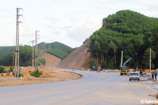
The N5 road extended from Hoa Son commune, Do Luong district to Ho Chi Minh – Tan Ky road has a branch leading to Do Luong Cement Factory. Because it is a level road and there are no signs, many people going to Tan Ky district have lost their way.
On the morning of November 20, Mr. Nguyen Van Hung in Nghi Loc district had to go to Tan Ky district for work. While traveling on the extended N5 route, reaching Bai Son commune, Do Luong district, there was a branch road leading to Do Luong Cement Factory. Because there was no sign and the two routes were similar, Mr. Hung took the wrong way to the factory.
.jpg)
According to the reporter's records, not only Mr. Hung but also many people when coming to the branch on this extended N5 route were also confused, not knowing which way to go to Tan Ky district.
Mr. Cao Dang Xuan, Bai Son commune, Do Luong district shared: This is a new road that has just been put into use, so many people are not familiar with the road, and there are no signs, so many people go to Tan Ky district but make the wrong turn to the road to the cement factory. My house is near the N5 extension, so almost every day people stop to ask for directions.
.jpg)
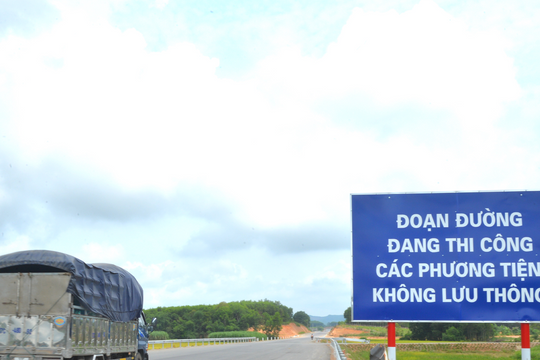
According to the reporter's observation, at this branch point there are no signs indicating the direction of travel, but only signs restricting speed, prohibiting U-turns and paying attention. Therefore, people often go astray, especially those who are traveling on this new route for the first time.
It is known that the N5 road extension project connecting Hoa Son commune, Do Luong district to Ho Chi Minh - Tan Ky road has a length of 21 km. Of which, it passes through the communes of Hoa Son, Thinh Son, Bai Son, Giang Son Dong in Do Luong district (10.162 km); Minh Thanh, Thinh Thanh communes in Yen Thanh district (9.768 km); Ky Tan commune (1.43 km) in Tan Ky district.
The extended N5 road is designed on a level III delta scale, with a 12 m wide road surface and a total investment of nearly 740 billion VND.
.jpg)
When the entire N5 route is opened to traffic, it will become the main axis connecting districts in the Western Nghe An economic zone such as Tan Ky, Anh Son, Con Cuong, Ky Son... with the Southeast Economic Zone to Cua Lo International Port cluster, thereby improving the capacity of freight and trade transportation, creating an important basis for attracting investment projects in economic zones in the Southeast of Nghe An province; contributing to promoting socio-economic development, reviving the life of the Western Nghe An region.
Faced with the reality that many people go the wrong way when traveling on the extended N5 route, it is thought that the authorities should soon install signs on this road section to make it convenient for people to participate in traffic.


