Under the Shadow of Lam Thanh
(Baonghean.vn) - Accompanied by cultural researcher Thai Huy Bich (Hung Nguyen, Nghe An) to the banks of the Lam River, at the foot of Lam Thanh Mountain, we couldn't help but feel regret that an entire area of valuable cultural and historical heritage has been swept away, leaving only the reflection of Lam Thanh Mountain silently shimmering on the Lam River…
A valuable cultural sediment
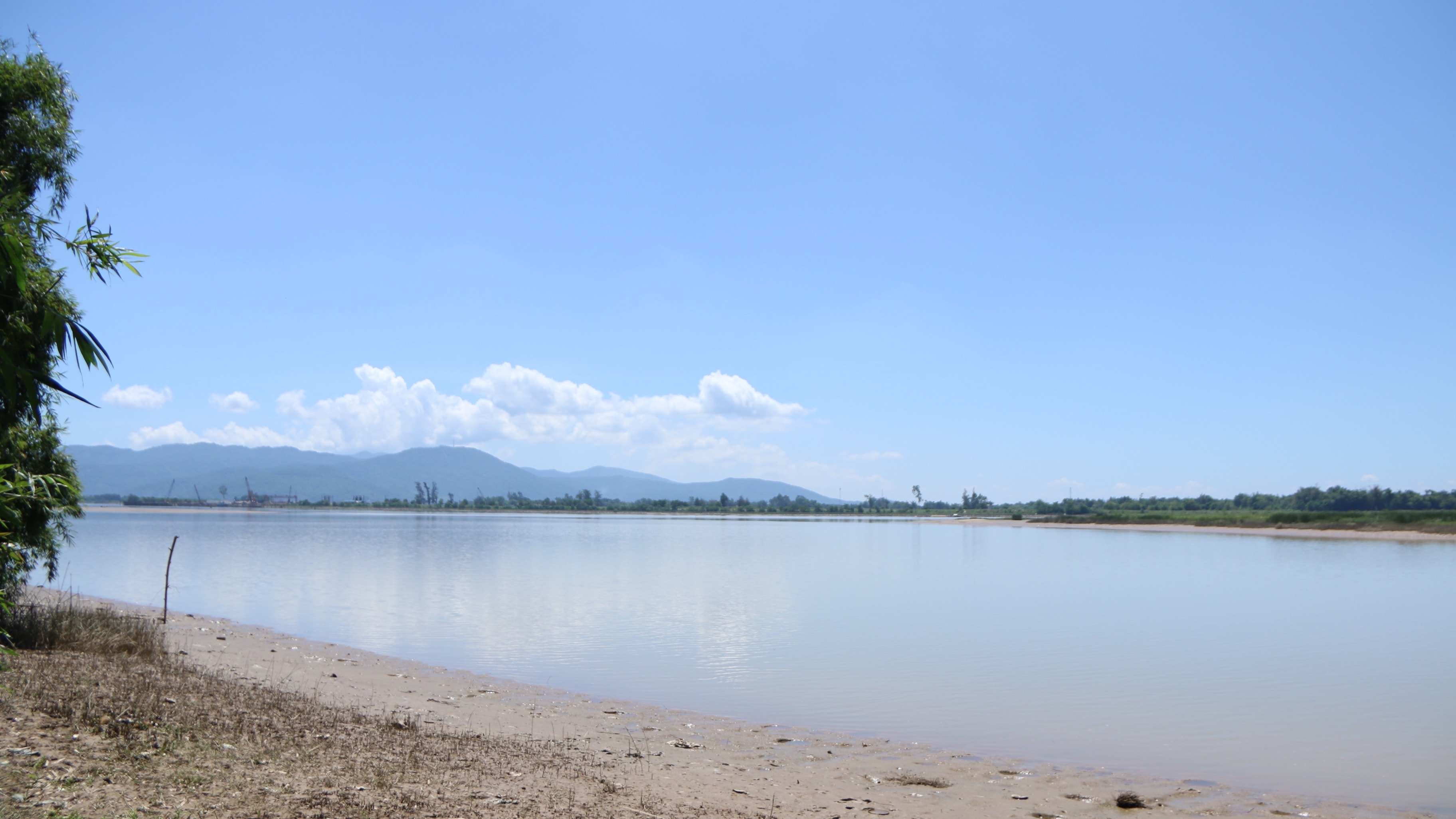
As previously arranged, we tried to leave early, following Provincial Road 542 to the Lam River bank near Yen Xuan and then heading straight in that direction.Lam Thanh mountainFrom the former Hung Lam and Hung Phu areas, we proceed straight ahead. As cultural researcher Thai Huy Bich explains, Lam Thanh Mountain is located in the heart of Nghe An province, boasting a striking elevation amidst the plains, situated near a river confluence. In the past, a national highway ran along its foothills. Boats could travel east and west along the Lam River, and south along the La River. Therefore, it served as a strategic military base and the political, economic, and cultural center of Nghe An for generations.
According to many historical documents, during the Ming dynasty's rule, Lam Thanh mountain became a military outpost, but from the beginning of the Later Le dynasty (1428) to the end of the Tay Son dynasty (1801), for 370 years, Lam Thanh was the administrative center of Nghe An. The administrative center was not located within the citadel built by Truong Phu, but when referring to this administrative center, historical records always refer to it as Nghe An citadel, or Lam Thanh, Hung Son citadel, Nghia Liet citadel…
It wasn't until the early 19th century, when King Gia Long ascended the throne, marking the beginning of the Nguyen dynasty, that the Yen Truong area was chosen to build a new administrative and political center, and the Nghe An provincial capital around Lam Thanh gradually faded into the past.
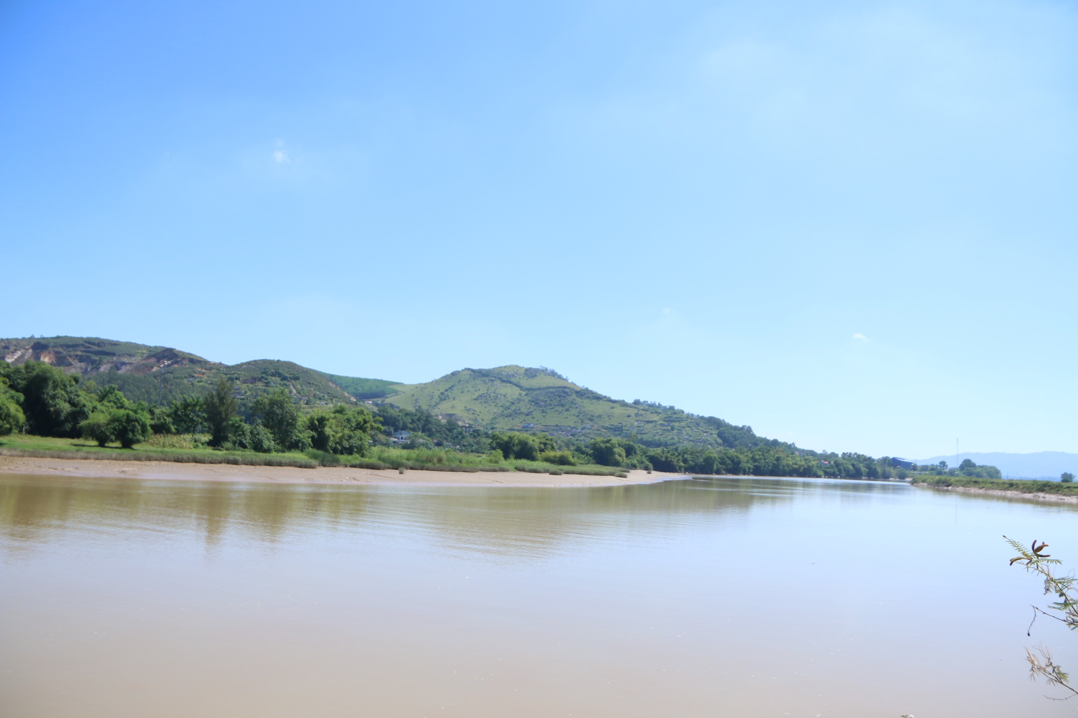 |
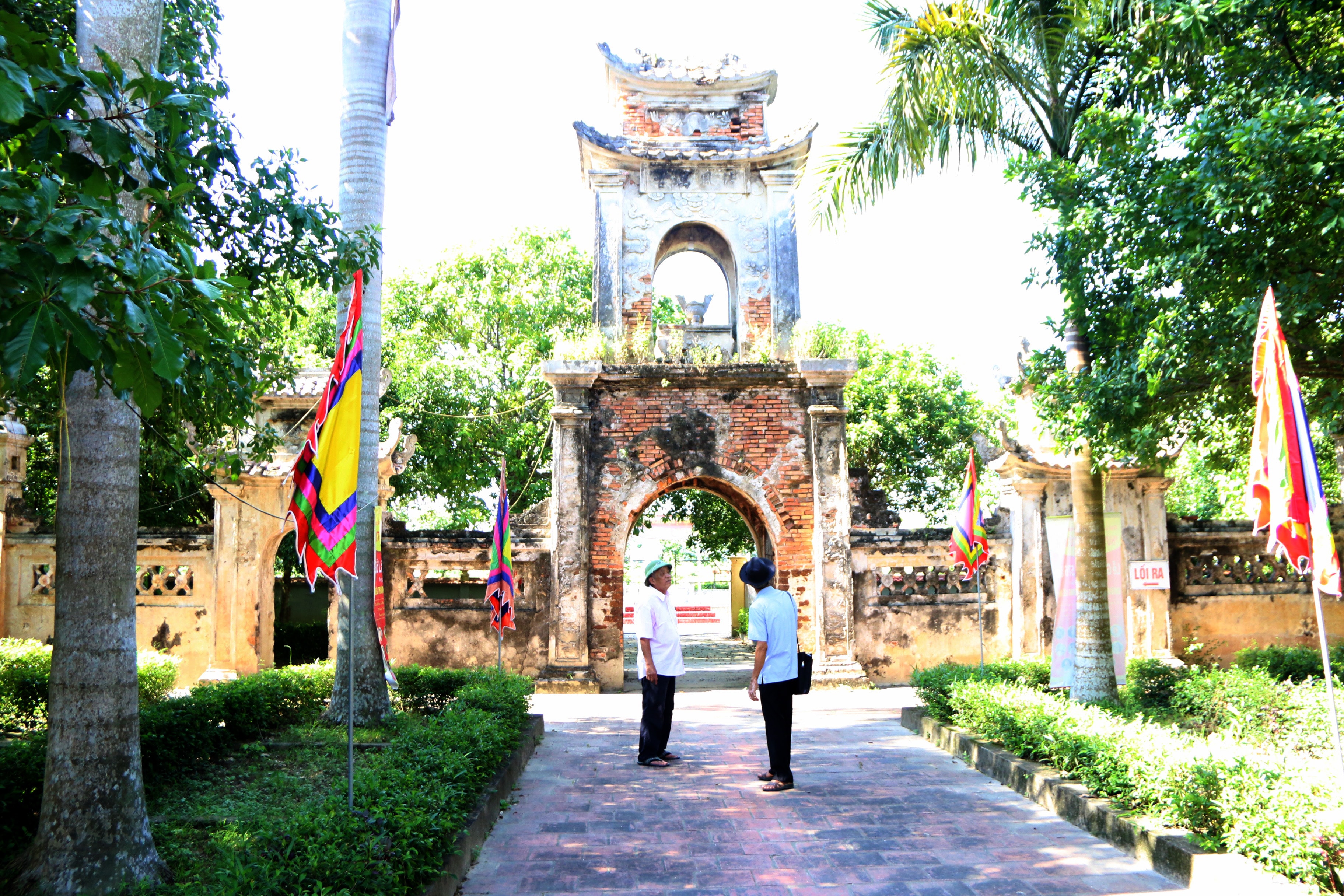
Lam Thanh Mountain is located next to the confluence of the Lam and La rivers. Photo: Tien Dong |
The past has receded, and the harshness of nature, coupled with the vicissitudes of history, has eroded many precious cultural values of Lam Thanh Mountain. Despite this, the area holds a rich cultural and historical heritage, closely linked to many periods of prosperity and decline of the nation in general and the Nghe An region in particular.
According to cultural researcher Thai Huy Bich, Lam Thanh Mountain has many names. In the past, the locals called it Ru Rum (meaning blue), and the Lam River was also called Rao Rum. Ru Rum or Lam Son, although different names, were later called Lam Thanh Mountain or Ru Thanh because of the ancient citadel on the mountain.
In Bui Duong Lich's Nghe An Chronicle, Lam Thanh Mountain is described in considerable detail. “Lam Thanh Mountain is located in Phu Dien commune, Hung Nguyen district. Formerly known as Dong Tru Mountain, it also has the names Tuyen Nghia Mountain and Hung Son (Bear Mountain). The mountain is tall, majestic, and rises prominently in the middle of the plain. Within one peak is a fortress built by Truong Phu of the Ming Dynasty. On the summit is a hole for planting a flag. Legend says this is where a bronze pillar was once erected. Halfway up the mountain is the Tuyen Nghia Temple.”
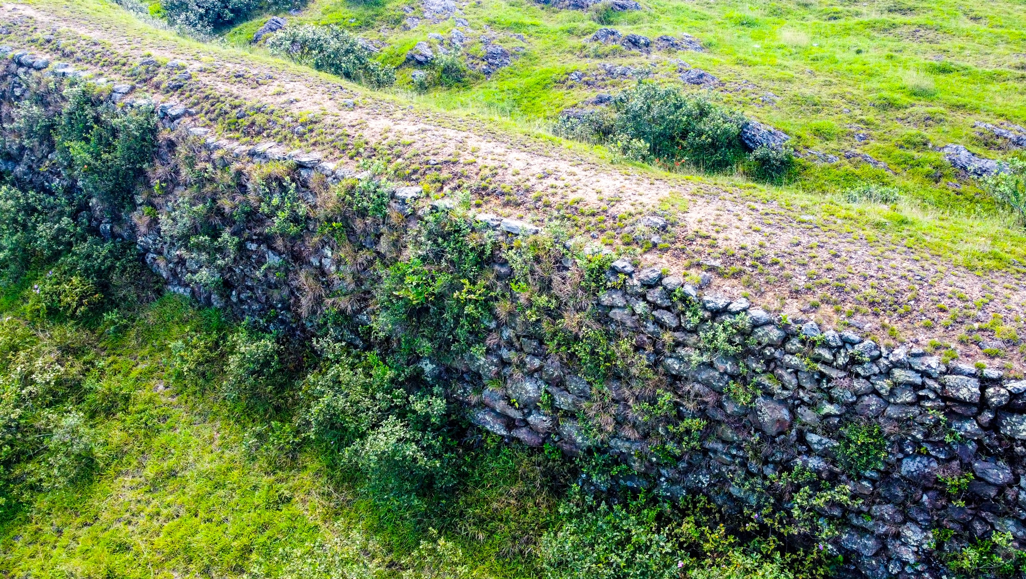 |
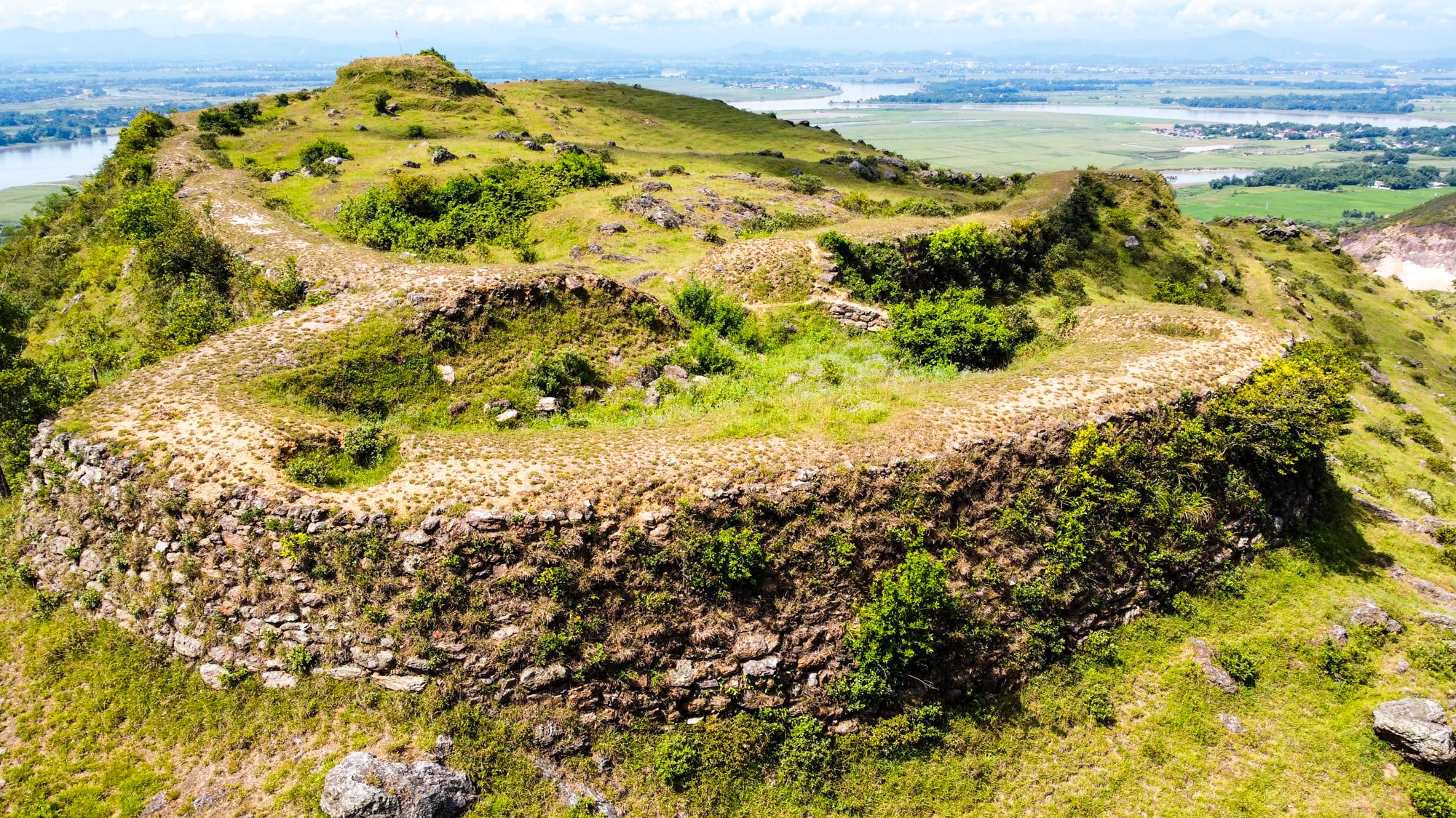
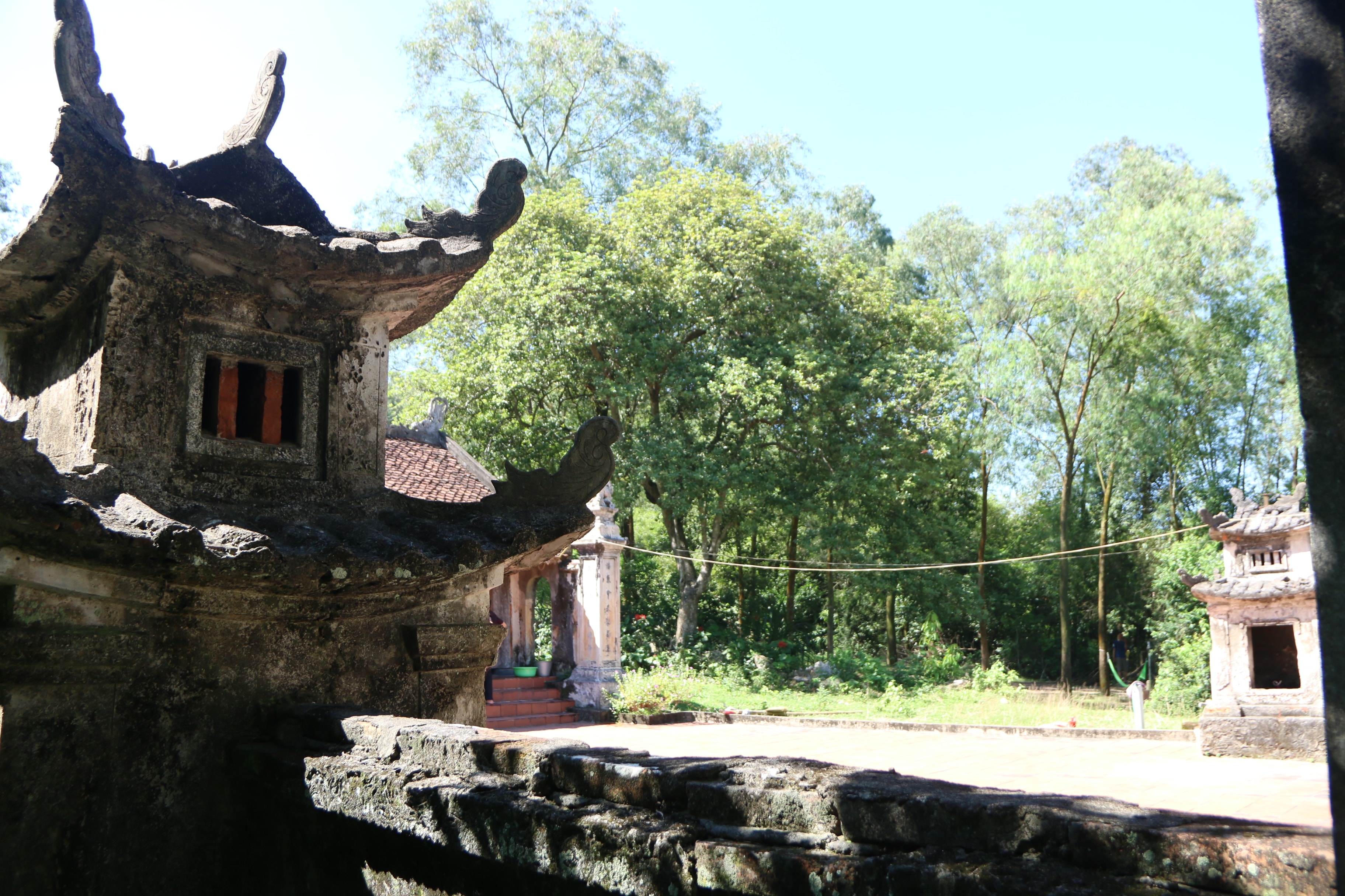
A relatively intact section of the city wall on Lam Thanh Mountain. Photo: Thanh Cuong. |
Regarding the name of Tuyen Nghia Mountain, historical records state that at its base lies the Tuyen Nghia Temple, dedicated to Thai Phuc, a Ming Dynasty general who defended Nghe An citadel. He defected to the Lam Son rebel army and was subsequently killed by the Ming Emperor upon his return. Later, King Le Thai To ordered the construction of a temple to worship him, bestowing upon him the divine title of Tuyen Nghia Dai Vuong.
Historian Bui Duong Lich also described in detail the arrangement of government offices around the foot of Lam Thanh mountain. “At the foot of the mountain is An Quoc Pagoda. During the reign of King Trung Quang of the Tran Dynasty (1409-1413), Imperial Censor Nguyen Bieu, from La Son district, was ordered to go on a diplomatic mission to seek investiture and died here. To the west of the mountain is a stream with very sweet water. To the southwest is Nghia Liet commune, formerly the location of the Hien Ty (also known as the Niet Ty, in charge of criminal cases). To the south is Trieu Khau Temple (a temple dedicated to Le Khoi), formerly the location of the Thua Chinh Ty (also known as the Bo Chinh Ty, in charge of household affairs). And Ve So ward, formerly the location of the Tran Thu's residence (the residence of the Tran Thu, later called the Governor-General, in charge of a province). In front of the residence was the former provincial examination hall.”
 |
Viewed from above, the section of stone wall on Lam Thanh Mountain remains relatively intact. Photo: Thanh Cuong |
 |
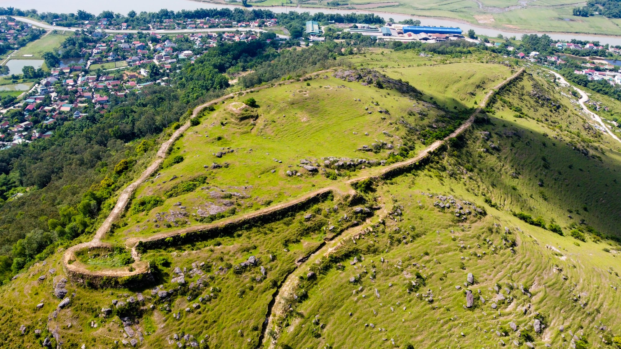
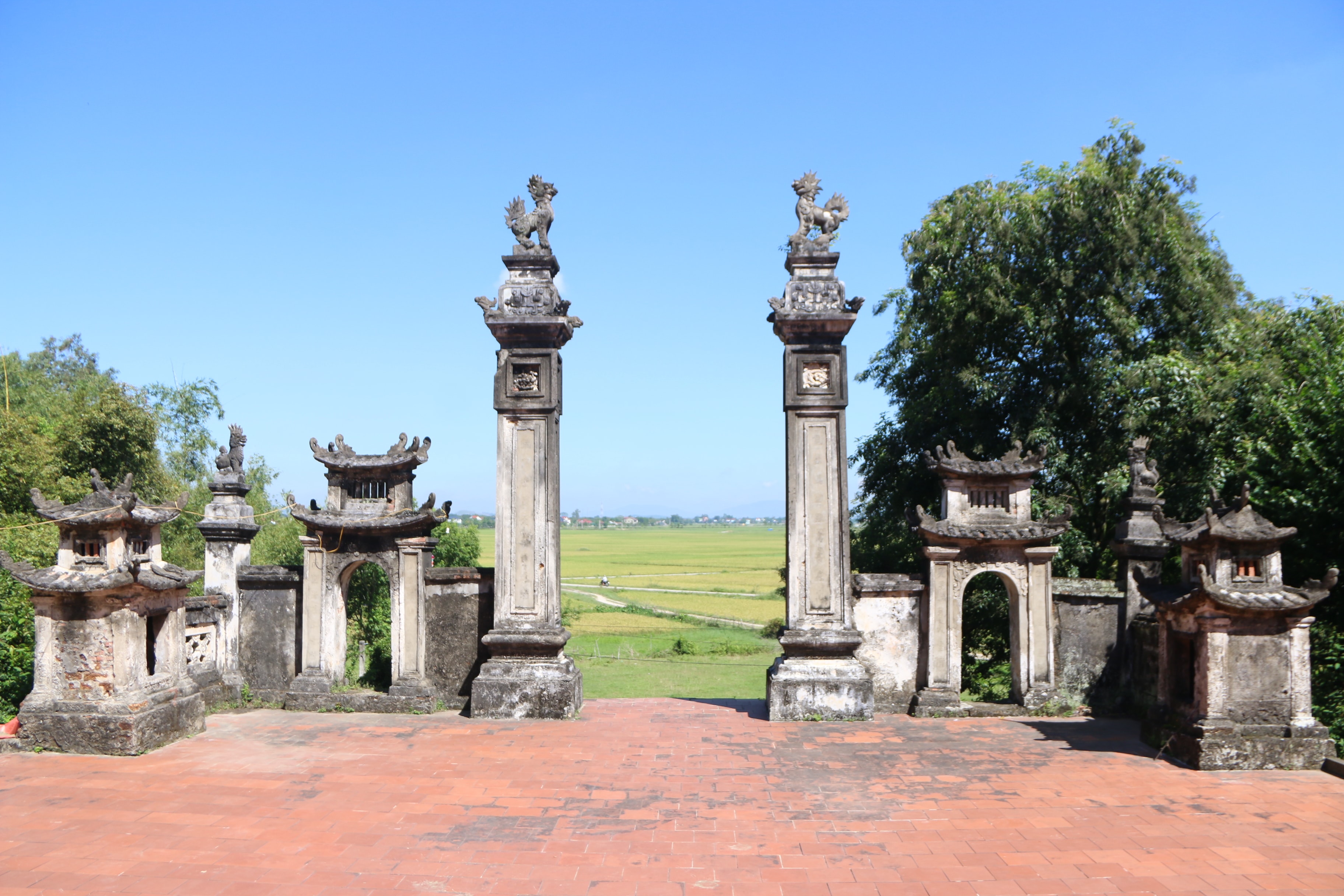
From the top of Lam Thanh hill, looking south, you can see the confluence of the Lam and La rivers. Photo: Thanh Cuong |
According to the Nghe An Chronicle, "In front of Lam Thanh Mountain, the Lam River flows through a very wide area, where the La River in Thien Loc District flows in. At the confluence of the Minh Luong River and the Lam River, there is a rocky rapids in the middle of the river. To the east is a ferry landing called Phu Thach, at the beginning of which Chinese people reside and trade, with tiled houses close together and boats gathered, called Phu Thach Street."
When mentioning the land at the foot of Lam Thanh Mountain, one cannot fail to mention the story of "eating a human head" associated with the famous figure Nguyen Bieu. He was from Noi Dien village, now part of Yen Ho commune (Duc Tho district, Ha Tinh province). He passed the Thai Hoc Sinh examination (equivalent to a Doctorate) and served as a high-ranking official under the Later Tran dynasty. On July 1st, 1413 (the year of Quy Ty), while on a diplomatic mission to negotiate with the Ming general Zhang Fu on Lam Thanh Mountain, he was forced to kneel by the enemy. However, he remained resolutely seated. The enemy prepared a feast, offering him a cooked human head. Without any fear, he used chopsticks to poke out the eyes of the head, mixed it with vinegar, and ate it. The Ming soldiers were terrified by this act, treated him respectfully, and allowed him to leave.
 |
According to researcher Thai Huy Bich, before the ancient Lam Thanh citadel, there was the Lam Kieu bridge - where the famous figure Nguyen Bieu wrote eight characters before being murdered by the Ming invaders. Photo: Tien Dong |
 |
The area surrounding Lam Thanh Mountain once had six temples dedicated to Nguyen Bieu. The photo shows the Nguyen Bieu temple in Xuan Lam commune today. Photo: Tien Dong |
 |
The gate of the Nguyen Bieu temple faces the Lam River. Photo: Tien Dong |
When he arrived at Lam Kieu Bridge, Truong Phu, influenced by Phan Lieu – the governor of Nghe An province – who had defected to the enemy, ordered his capture. Knowing he could hardly survive, he used his fingernail to scratch eight characters on the bridge's railing: "On the first day of the seventh month, Nguyen Bieu died." Recaptured, he cursed Truong Phu for plotting to seize the country while outwardly feigning righteousness and refusing to kneel. The enemy then ordered him tied up at An Quoc Pagoda and beaten to death. Later, King Le ordered a temple to be built in his hometown, bestowing upon him the divine title of Nghia Liet Dai Vuong. In Hung Nguyen District, where he died, the village was named Nghia Liet, belonging to Hung Lam commune (now Xuan Lam). Notably, the area around Lam Thanh Mountain once had six temples dedicated to Nguyen Bieu.
Ancient Traces of Phuc Le
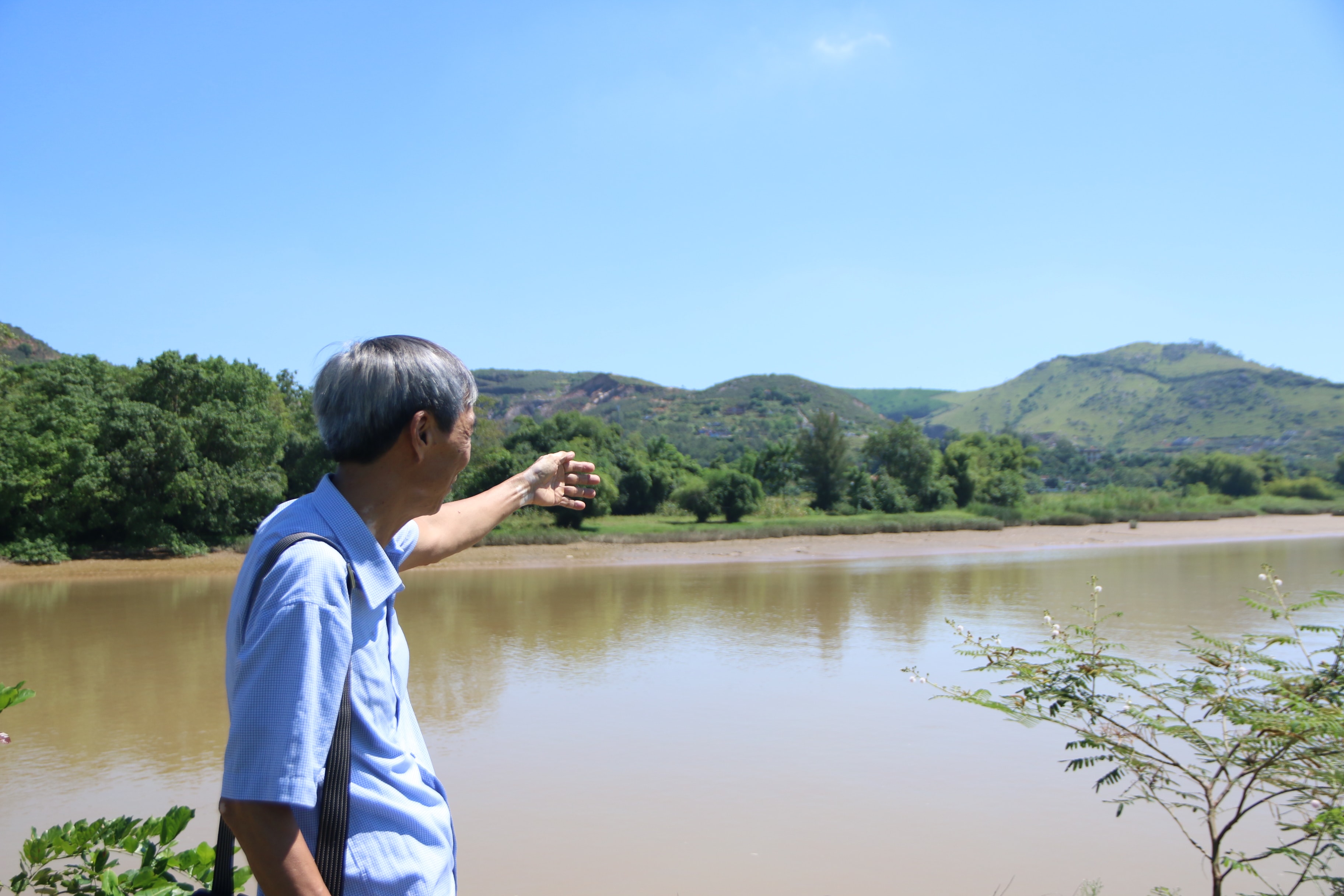
Following the historical trail, we arrived at the banks of the Lam River. Pointing southward, amidst the vast expanse of the river's waters, cultural researcher Thai Huy Bich lamented that an entire area, once bustling with activity, had been swept away. Among them was Phuc Le commune, once marked on maps by the Japanese and a destination for merchant ships from all over, now completely eroded and washed away by the river.
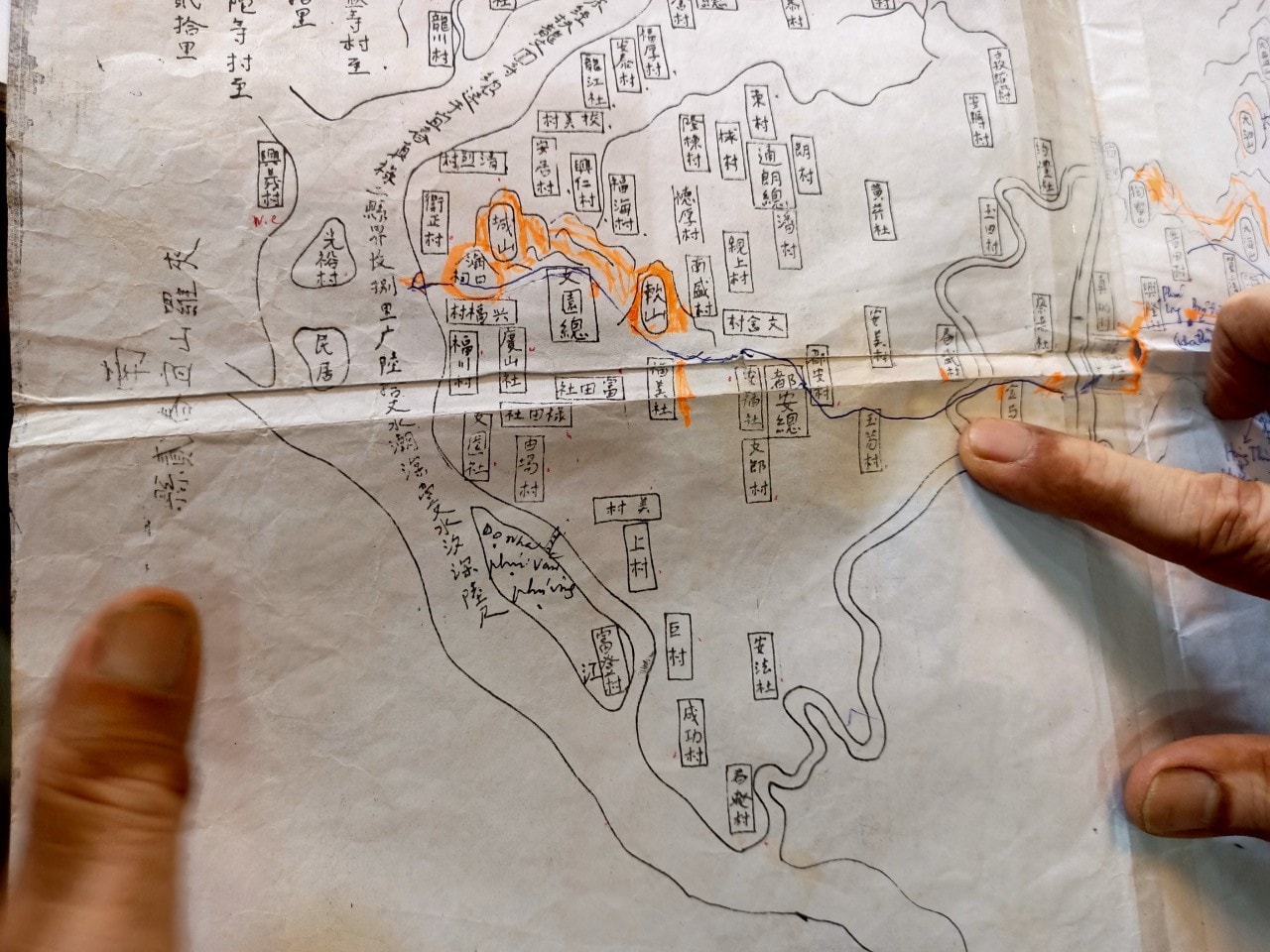 |
This map shows the area at the confluence of rivers in the past, a place that the Japanese once marked and which was a thriving trading center from the late 16th to the early 19th centuries. Photo: Tien Dong |
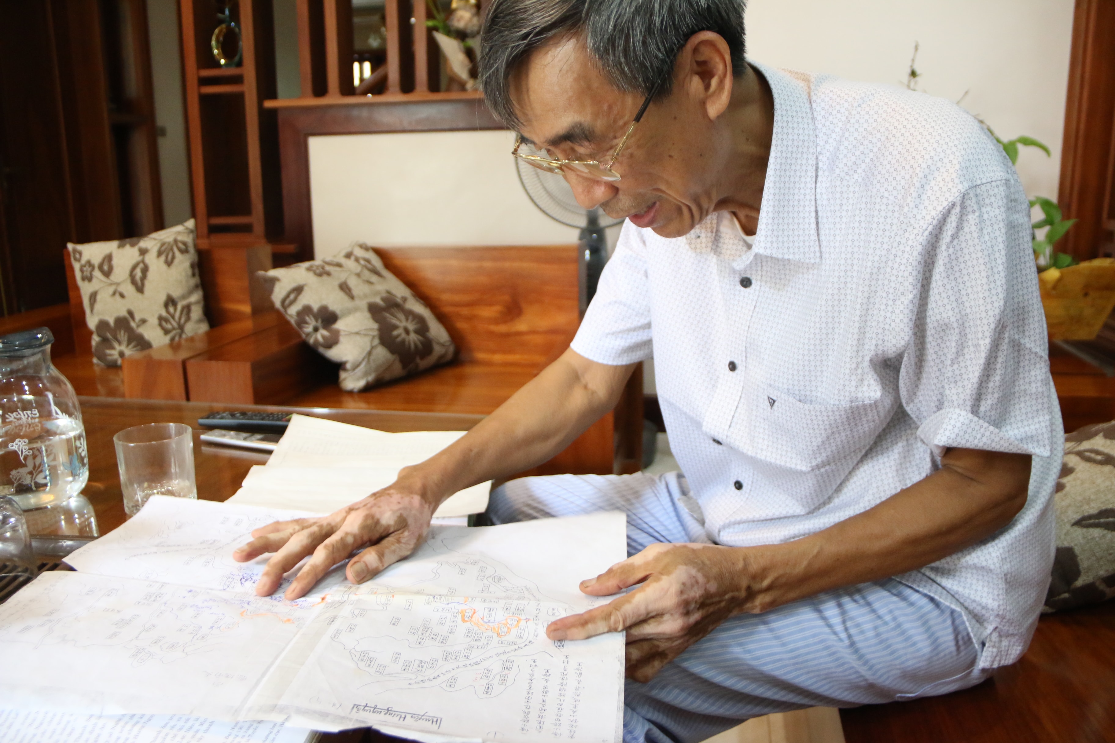 |
Researcher Thai Huy Bich stands beside a map marking the Phuc Le area and the ancient Phu Thach trading street. Photo: Tien Dong. |
In the late 16th century, the Japanese established trading posts in Phuc Le commune, Hung Nguyen district, to trade with the North and in Hoi An (Quang Nam province) to trade with the South. Their trade flourished most during the years 1593-1616. On maps of Vietnam at that time, the Japanese circled Hung Nguyen district in red. The most important goods they sold to Vietnam were weapons and copper, after which they purchased agricultural and forestry products to take back to Japan.
Until the late 18th and early 19th centuries, Trang Market (in the Trieu Khau area – where the imperial examination hall was located) and Phu Thach Street on the southern bank were very prosperous trading centers, becoming a bustling port city of Nghe An province. The area was lively both on land and on the river. A folk song is still passed down here."Trang Market is held seven times a month – Those who want to go on foot can walk, those who want to go by boat can go."
 |
An entire once bustling trading area has now been swept away by erosion into the Lam River. Photo: Tien Dong |
“The Japanese leaving Hung Nguyen to establish Hien Street in Hung Yen may have been due to the gradual erosion of Phuc Le commune's land into the river. Furthermore, during the five years from 1655 to 1660, the Trinh-Nguyen war made the Lam River the dividing line between Dang Trong and Dang Ngoai. Both banks of the Lam River were fierce battlefields. This could be the main reason why the Japanese had to relocate their trading post,” – Cultural researcher Thai Huy Bich commented.
Currently, in some communes along the Lam River in Hung Nguyen district, there are many Han Nom documents that still bear the name of Phuc Le commune. Based on the surviving documents, it can be concluded that Phuc Le commune was erased from existence due to erosion into the Lam River between 1866 and 1872. A portion of the population of Phuc Le commune moved to Phuc My commune, now Phuc My village, formerly Hung Chau commune, now Chau Nhan commune.
 |
Lam Thanh Mountain as seen from Quang Vinh commune (Duc Tho district, Ha Tinh province). Photo: Tien Dong |
To gain a deeper understanding of the origins and remaining traces of Phuc Le commune, we made our way across the Lam River. After crossing the Trai and Hao ferries, well-known landmarks, we finally reached Duc Vinh and Duc Quang communes (now Quang Vinh commune, Duc Tho district, Ha Tinh province). This area is located opposite Lam Thanh mountain, on the other side of the Lam River, where much of Hung Nguyen district's land has been eroded. Some villages in Duc Vinh commune, such as Phu Thach, Vinh Dai, and Hung Phuc, originally came from Hung Nguyen district. In Duc Quang commune, there is Quang Du village, formerly part of Trieu Khau commune. Today, many families with roots in Hung Nguyen district still reside here, and they regularly visit their ancestral homeland every year.
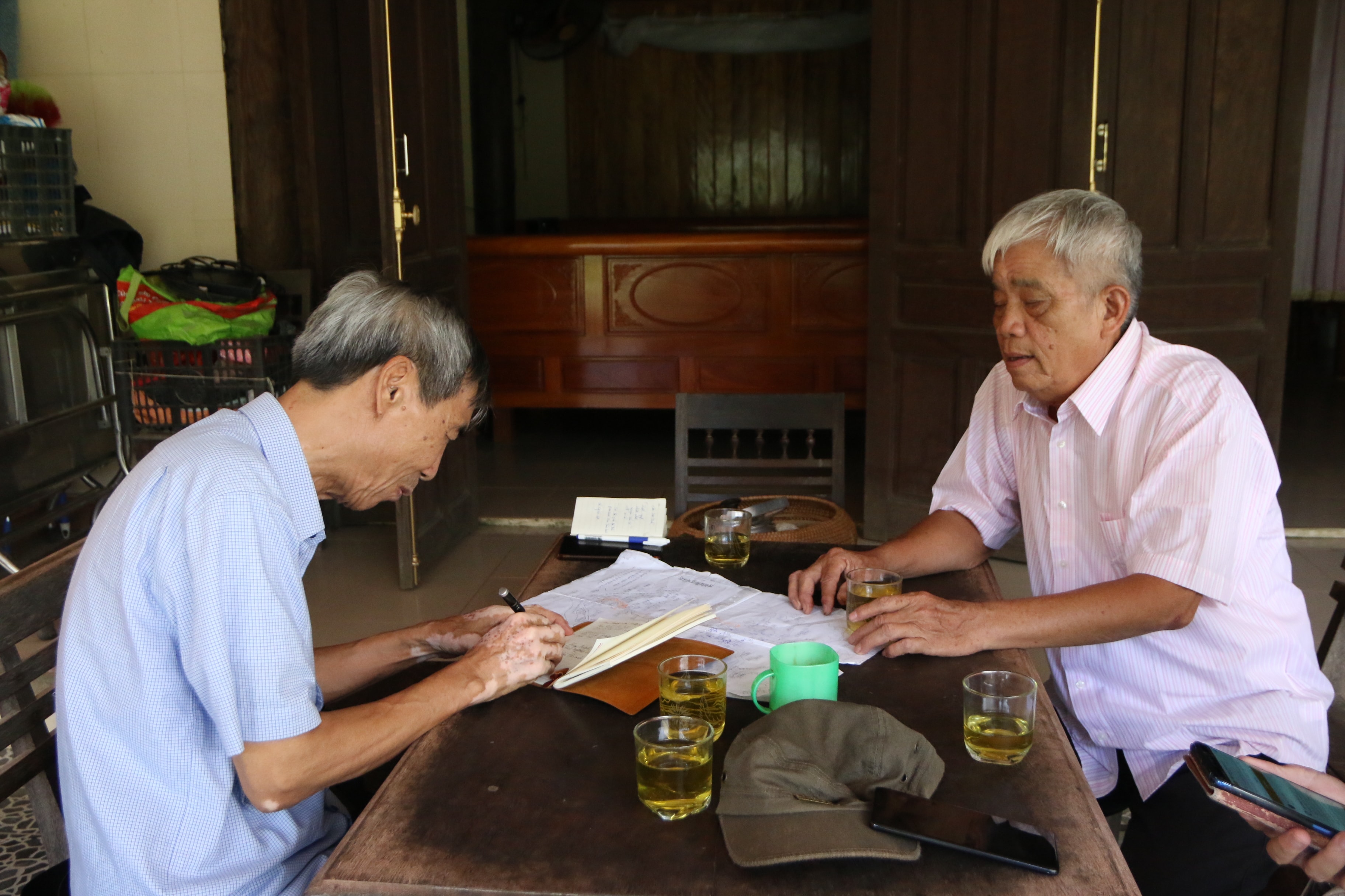 |
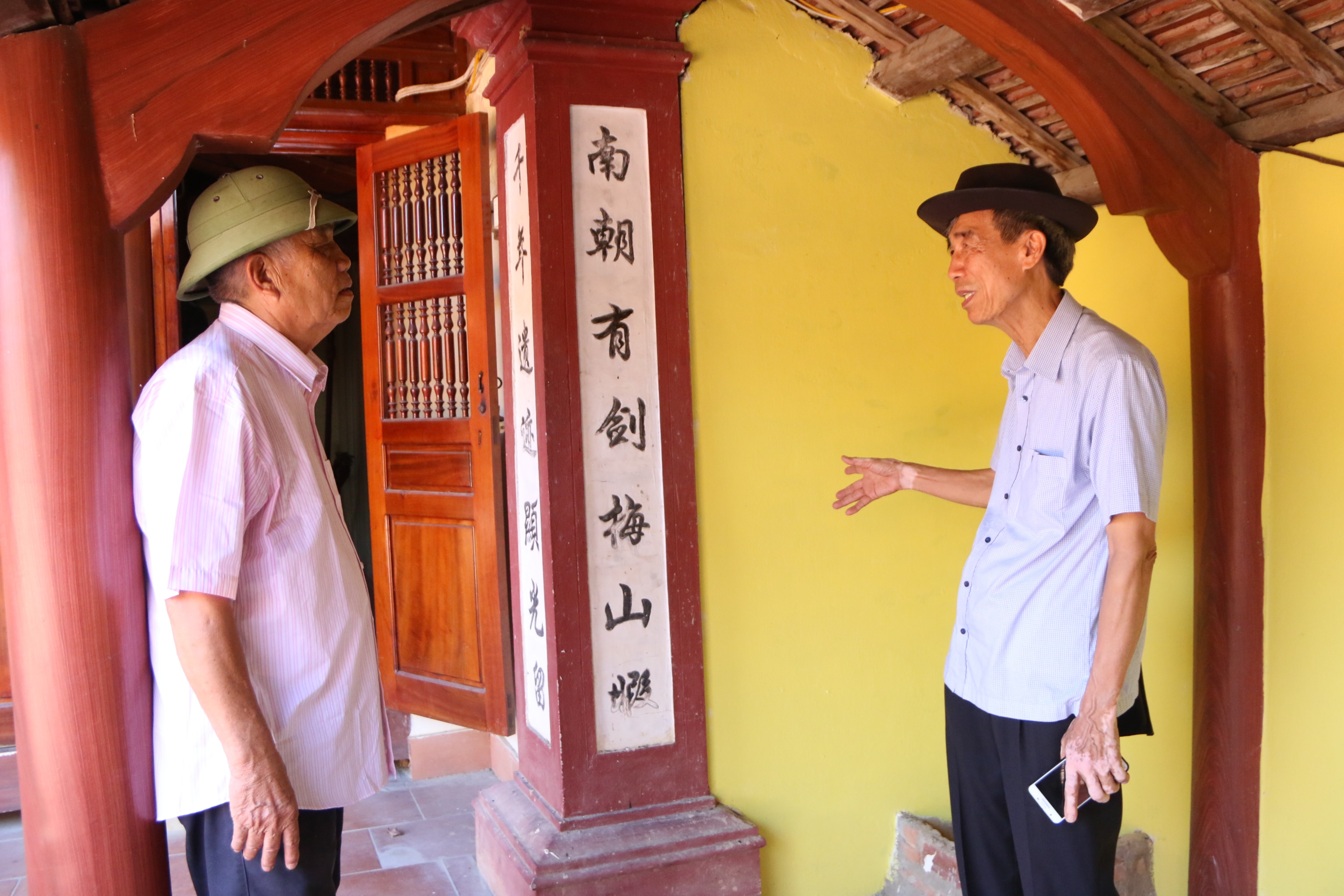
Researcher Thai Huy Bich discusses with Mr. Pham Nghi - former Chairman of the Fatherland Front Committee of Duc Vinh commune (Duc Tho district, Ha Tinh province). Photo: Tien Dong |
Mr. Pham Nghi, former Chairman of the Fatherland Front Committee of Quang Vinh commune, was visibly moved when he learned that we had come to learn about the origins of the villages here. Mr. Nghi explained that Duc Vinh previously consisted of three villages that migrated from Hung Nguyen district: Phu Thach, Vinh Dai, and Hung Phuc. Of these, Vinh Dai and Phu Thach villages boast famous religious architectural structures such as Ghenh Pagoda and Nha Ong Temple… Phu Thach village, in particular, was home to traders from distant lands, primarily of Chinese descent. Currently, many families of Chinese origin, such as the Hong, Ly, and Truong families, still reside here. These families initially came to the area for business and trade, and later established villages and hamlets.
 |
The Chiêu Trưng Temple in Hưng Phúc village, Quang Vĩnh commune today. Photo: Tiến Đông |
 |
Inside the Chieu Trung Temple on the south bank of the Lam River, there are still couplets similar to those in the temple on the north bank. Photo: Tien Dong |
In Hung Phuc village, there is still the Chieu Trung Temple, also known as Vo Muc Temple, dedicated to King Chieu Trung Le Khoi. Previously, this temple, along with the King Le Temple, were two large temples at the foot of Lam Thanh mountain. In the late 19th century, the temple grounds were gradually eroded by the river, forcing the two villages of Quang Du and Hung Phuc in Trieu Khau commune to move to the south bank. Later, the Chieu Trung Temple was also dismantled, and two temples were established: one in Phuc Xuyen village (formerly Hung Khanh, now Hung Thanh commune) on the north bank, and another in Hung Phuc village (Duc Vinh commune) on the south bank. According to elders, the three gates of these two temples are located on the same north-south axis.
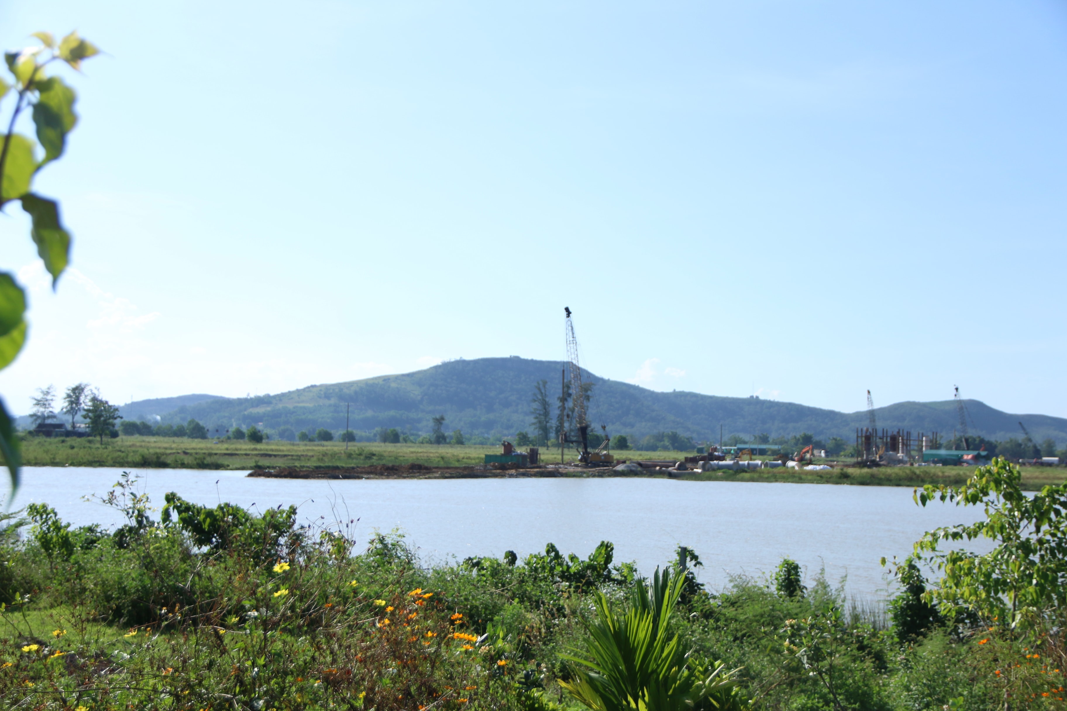 |
This area is believed to be the former Phù Thạch trading town and still features rocky outcrops in the middle of the river. Currently, the Hưng Đức bridge, connecting the two districts of Hưng Nguyên and Đức Thọ on the North-South expressway, is under construction near this area. Photo: Tiến Đông |
In the past, merchant ships flocked to this area for trade, docking near Phu Thach reef. To pray for successful trade, they even built a temple to pray for peace and blessings. Locals still pass down a folk song here."Those who go to Pho Hien to see elephants should go to Vinh Dai village to see Ghenh Pagoda."
Today, with the construction of the North-South Expressway, a bridge abutment connecting Hung Nguyen and Duc Tho districts across the Lam River has been built near the old Phu Thach ferry landing. People feel as if the land on both banks of the Lam River is now closer together. Although it can no longer form villages and hamlets as before, at least they share a common source under the shadow of Lam Thanh...

